1900s (20th Century) Maps of Fulton County, Arkansas
Explore 33 historic maps of Fulton County from the 1900s (20th Century). These maps offer a rare glimpse into what life looked like during the 1900s — showing old roads, neighborhoods, homes, and landmarks that have changed or disappeared over time.
Whether you're researching your family's past, planning a metal detecting trip, or studying how Fulton County's landscape evolved across the 1900s, these high-resolution maps are a powerful tool for exploring the history of this region.
- Focus on a specific era: All maps on this page are from the 1900s, giving you a focused view of this time period.
- See what’s changed: Compare century-old streets, trails, and buildings to today's modern landscape using overlays and satellite layers.
- Research with precision: Use these maps for genealogy, historical research, land use analysis, or educational projects.
- View, download, or print: Maps are fully viewable online in high resolution, and can be downloaded or printed for your own records.
Start exploring Fulton County's history through authentic maps from the 1900s. This is your window into the past.
Fulton County, AR maps
(33)- 1945 Map of Harrison
 1945 Harrison1945 Print · USGSThe Ozark and Boston Mountains straddle the Missouri-Arkansas border during the mid-forties, showing a landscape of forest ridges and river valleys. Genealogists and historians can trace rail-connected towns like Monett and West Plains or early lake developments at Bull Shoals Res and Norfork Lake.
 - 1949 Map of Harrison
 1949 Harrison1949 Print · USGSThe Ozark highlands of northern Arkansas and southern Missouri are shown just after the war, when the White River still followed its original course. Genealogists and historians can trace rail lines like the Missouri & Arkansas RR and locate rural hubs like Harrison, Eureka Springs, and Mountain Home.
 - 1950 Map of Salem, 1973 Print
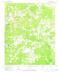
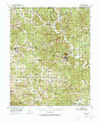 1950 Salem1973 Print · USGSFulton County and the surrounding Ozark borderlands are captured here in the mid-twentieth century, centered on the community of Salem. Local researchers can locate family homesteads near landmarks like Wesley Chapel, Bexar, and the Liberty Hill Ch.2 unique versions available
 - 1951 Map of Salem
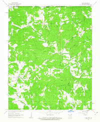
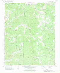
 1951 Salem1951 Print · USGSFulton County settlements and timberlands are mapped here in detail during the early fifties. Genealogists and local historians can trace family roots through numerous sites like Wesley Chapel, Crossroads Sch, and the Hunter Cem.
 - 1954 Map of Harrison
 1954 Harrison1954 Print · USGSThe Ozarks and Boston Mountains meet during a period of massive river engineering in the mid-fifties. Researchers can trace the early shorelines of Bull Shoals Lake and Table Rock Reservoir or locate inland towns like Berryville and Harrison.
 - 1957 Map of Poplar Bluff, 1968 Print
 1957 Poplar Bluff1968 Print · USGSThe Missouri-Arkansas border region is captured here as the timber and rail industries shaped the Ozark foothills. Genealogists and historians can trace the Missouri Pacific Railroad through river towns like Pocahontas, Greenville, and Van Buren.3 unique versions available
 - 1958 Map of Harrison, 1973 Print
 1958 Harrison1973 Print · USGSThe Ozark and Boston Mountains appear in this mid-century survey as the great White River impoundments were reshaping the region. Researchers can trace the rail lines of the St Louis-San Francisco Ry and locate early settlements like Berryville and Gainesville.
 - 1959 Map of Poplar Bluff
 1959 Poplar Bluff1959 Print · USGSThe Missouri Ozarks and Arkansas borderlands meet in this late 1950s study of the region's diverse terrain and rail-fed towns. Researchers can trace the path of the Missouri Pacific Railroad through Poplar Bluff or locate smaller settlements like Birch Tree and Myrtle.
 - 1960 Map of Poplar Bluff
 1960 Poplar Bluff1960 Print · USGSSoutheast Missouri and Northeast Arkansas are captured here during the post-war era, showing the transition from the Ozark highlands to the Delta. Genealogists and historians can trace rail corridors like the St. Louis Southwestern RR and remote settlements such as Birch Tree and Warm Springs.
 - 1962 Map of Stuart, 1963 Print
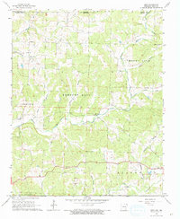
 1962 Stuart1963 Print · USGSFulton and Sharp Counties are captured during the mid-century transformation of the Ozarks into a recreational lake district. Genealogists and local historians can trace family sites like Taylor Cem alongside the emerging planned communities of Cherokee Village and Hidden Valley.4 unique versions available
 - 1962 Map of Agnos, 1963 Print
 1962 Agnos1963 Print · USGSNorthern Arkansas at the start of the 1960s shows a landscape of ridge-top settlements and winding river forks. Genealogists and local historians can locate rural landmarks like Burks Chapel, follow U.S. Route 62 through Agnos, or find family burial plots at Rhoads Cem.3 unique versions available
 - 1962 Map of Mammoth Spring, 1963 Print
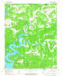
 1962 Mammoth Spring1963 Print · USGSThe Missouri-Arkansas borderlands come alive in the early sixties as the St Louis San Francisco railroad follows the winding Spring River. Trace family history at McLemore Cem, visit Dewey Sch, or explore the springs and hollows near Many Islands.
 - 1962 Map of Camp, 1963 Print
 1962 Camp1963 Print · USGSThe Arkansas-Missouri borderlands come to life in the early sixties, showing a landscape of upland springs and winding creek beds. Researchers can trace rural lineages through Fryatt, Pleasant Valley Ch, and family landmarks like Kerby Cem.2 unique versions available
 - 1964 Map of Harrison
 1964 Harrison1964 Print · USGSThe Ozark and Boston Mountains of Arkansas and Missouri are captured here in the mid-sixties, showing the rugged highlands before extensive modern development. Genealogists and historians can trace family-named peaks like Gaither Mountain and follow the St Louis-San Francisco RR through Monett and Purdy.
 - 1965 Map of Norfork Dam North, 1967 Print
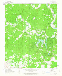
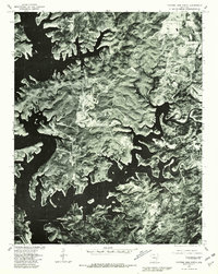
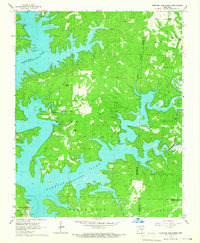 1965 Norfork Dam North1967 Print · USGSNorfork Lake and the Ozark hills are shown here in the mid-sixties, just as recreational development began to transform this Baxter County landscape. Researchers can locate remote airfields like the Kirkview Landing Strip, rural churches such as Wates Ch, and the complex shoreline around Henderson.2 unique versions available
 - 1965 Map of Gamaliel, 1967 Print
 1965 Gamaliel1967 Print · USGSThe northern reaches of the Ozarks meet the waters of the White River basin in the mid-1960s. Researchers can trace the shoreline to Gamaliel Landing, locate family sites at Fluty Cem, and find the rural community of Henderson at the edge of Norfork Lake.2 unique versions available
 - 1966 Map of Gepp, 1967 Print
 1966 Gepp1967 Print · USGSThe Missouri-Arkansas borderlands come alive in the mid-sixties, showing a rural landscape of scattered farmsteads and creek-side settlements. Researchers can trace family roots at Gobbler Trot Cem, visit the Enterprise Ch, or explore the crossroads at Vidette.
 - 1966 Map of Elizabeth, 1967 Print
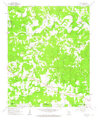
 1966 Elizabeth1967 Print · USGSIn the mid-1960s, the rugged borderlands of Fulton and Izard Counties featured remote settlements and the rising waters of Norfork Lake. Trace family roots at Smith Chapel Cem or locate the old crossroads at Elizabeth and Wild Cherry.
 - 1968 Map of Hardy, 1969 Print
 1968 Hardy1969 Print · USGSThe Spring River valley comes alive in the late sixties as the railroad follows the river through the Ozark foothills. Researchers can trace family history through numerous rural landmarks like Baker Chapel, Richardson Cem, and the old Wagon Trail.2 unique versions available
 - 1968 Map of Wirth, 1969 Print
 1968 Wirth1969 Print · USGSThe borderlands of Sharp and Fulton County come to life in the late 1960s, showing a rural landscape of winding hollows and small family settlements. Genealogists can locate several remote burial grounds and churches, including Ed Collins Cemetery, Bethel Cemetery, and Union Hill Church.2 unique versions available
 - 1976 Map of Salem SW, 1977 Print
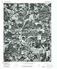
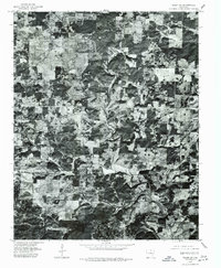 1976 Salem SW1977 Print · USGSMid-seventies Fulton County comes into focus in this detailed orthophotoquad, showing the rural crossroads and river valleys as they were decades ago. Trace the settlement patterns at Bexar and Union, or follow the winding course of the Strawberry River.
 - 1976 Map of Salem SE, 1977 Print
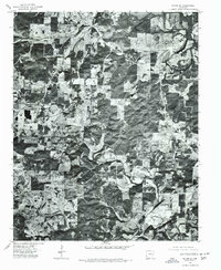 1976 Salem SE1977 Print · USGSThe northern Arkansas landscape comes into focus in the mid-1970s through this aerial orthophotoquad. Local historians can trace the rural layout of Salem and Wheeling or study the natural course of the South Fork Spring River.
 - 1976 Map of Salem NE, 1977 Print
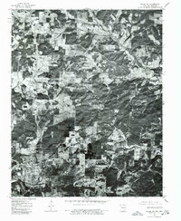
 1976 Salem NE1977 Print · USGSFulton County land patterns and river bends are captured from the air during the mid-seventies. Researchers can trace rural property lines and woodlots near the South Fork Spring River and the settlements of Moko and Salem.
 - 1976 Map of Salem NW, 1977 Print
 1976 Salem NW1977 Print · USGSNear the Arkansas and Missouri border in the mid-seventies, this orthophoto captures the rural homesteads and agricultural layout of Fulton County. Researchers can trace the exact buildings and roads around Viola during this period of Ozark development.
 - 1979 Map of Norfork Dam North, 1981 Print
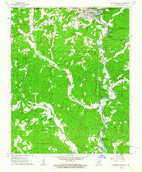
 1979 Norfork Dam North1981 Print · USGSIn the late seventies, the complex shoreline of Norfork Lake and the surrounding Baxter County highlands are captured in sharp detail. Researchers can trace land use patterns near Henderson and Ruth or follow the winding course of Big Creek.
Showing maps 1-25 of 33
Top cities of Fulton County
Frequently asked questions
- What are the different types of historical maps available for Fulton County?
- What is the oldest map of Fulton County?
- Where can I purchase historical maps of Fulton County for my home or office?
- Where can I download high-res historical maps of Fulton County?
- Are there historical topographic maps available for Fulton County?
- Is there historical aerial imagery available for Fulton County?
- Where are historical maps of Fulton County sourced from?