1970s Maps of Garland County, Arkansas
Explore 6 historic maps of Garland County from the 1970s. These maps offer a rare glimpse into what life looked like during the 1970s — showing old roads, neighborhoods, homes, and landmarks that have changed or disappeared over time.
Whether you're researching your family's past, planning a metal detecting trip, or studying how Garland County's landscape evolved across the 1970s, these high-resolution maps are a powerful tool for exploring the history of this region.
- Focus on a specific era: All maps on this page are from the 1970s, giving you a focused view of this time period.
- See what’s changed: Compare century-old streets, trails, and buildings to today's modern landscape using overlays and satellite layers.
- Research with precision: Use these maps for genealogy, historical research, land use analysis, or educational projects.
- View, download, or print: Maps are fully viewable online in high resolution, and can be downloaded or printed for your own records.
Start exploring Garland County's history through authentic maps from the 1970s. This is your window into the past.
Garland County, AR maps
(6)- 1972 Map of Goosepond Mountain, 1974 Print
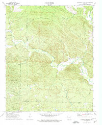 1972 Goosepond Mountain1974 Print · USGSThe borderlands of Saline and Garland Counties are captured in the early 1970s during the early development of Hot Springs Village. Researchers can trace old family sites and local landmarks like Talley Cem, Antioch Ch, and the Lookout Tower on Goosepond Mountain.3 unique versions available
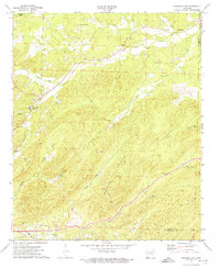
 - 1972 Map of Lonsdale, 1974 Print
 1972 Lonsdale1974 Print · USGSThe Garland and Saline County borderlands in the early seventies reveal a rural landscape defined by the Saline River forks. Researchers can trace family sites at Slate Branch Cem, locate the Rural Dale Sch, or follow the path of the OLD RAILROAD GRADE.4 unique versions available
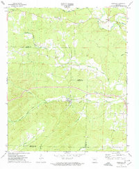
 - 1972 Map of Hamilton, 1974 Print
 1972 Hamilton1974 Print · USGSGarland County's landscape shows the dramatic intersection of forest wilderness and reservoir development in the early seventies. Genealogists and historians can trace the rural roots of Hamilton or locate the Rock Springs Cem and Walnut Grove Ch.2 unique versions available
 - 1972 Map of Fountain Lake, 1974 Print
 1972 Fountain Lake1974 Print · USGSGarland County and the surrounding hills were witnessing the early growth of Hot Springs Village and Fountain Lake in the early 1970s. Researchers can trace historic cemeteries and churches such as McClendon Cem, Rockdale Ch, and the Missouri Pacific rail line.3 unique versions available
 - 1972 Map of Jessieville, 1974 Print
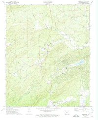 1972 Jessieville1974 Print · USGSNorth of Hot Springs in the early seventies, this area shows the early growth of Hot Springs Village alongside the timbered Ouachita National Forest. Researchers can locate family landmarks like Bethlehem Ch, Cosby Cem, and the rural community at Mountain Valley.2 unique versions available
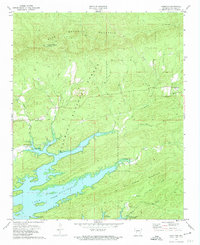
 - 1978 Map of Lake Catherine, 1979 Print
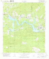 1978 Lake Catherine1979 Print · USGSThe Ouachita River valley comes to life in the late seventies as a hub of hydroelectric power and lakeside recreation. Genealogists and hikers can trace old family sites like Irwin Cem or explore the early development of Lake Catherine State Park and Jones Mills.2 unique versions available
End of results
Showing maps 1-6 of 6
Top cities of Garland County
- Hot Springs historical maps
- Hot Springs Village historical maps
- Mountain Pine historical maps
- Fountain Lake historical maps
- Fountain Lake historical maps
- Lonsdale historical maps
Frequently asked questions
- What are the different types of historical maps available for Garland County?
- What is the oldest map of Garland County?
- Where can I purchase historical maps of Garland County for my home or office?
- Where can I download high-res historical maps of Garland County?
- Are there historical topographic maps available for Garland County?
- Is there historical aerial imagery available for Garland County?
- Where are historical maps of Garland County sourced from?