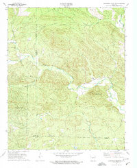
1972 Map of Goosepond Mountain
USGS Topo · Published 1974About this map
The Middle Fork Saline River and its numerous tributaries, including Angling Creek, Brushy Creek, and Cedar Creek, define the complex topography of this region on the border of Saline and Garland Counties. In the early 1970s, the development of Hot Springs Village was just beginning to mark the landscape, positioned south of the rugged Goosepond Mountain. Local history and genealogy interest is anchored by the Antioch Ch and Talley Cem, while industrial activity is represented by a Shale Pit and a major pipeline corridor crossing the northern hills.
Find a feature on this map
16 named features on this map. Tap any name to fly to it.
Don’t see what you’re looking for? This feature index may not catch every label — zoom into the map to look around manually.
Map Details
Editions of this 1972 Goosepond Mountain Map
3 editions found
Other maps of this area

1890 · Benton
USGS Topo · 1:125,000

1890 · Hot Springs
USGS Topo · 1:125,000

1894 · Hot Springs
USGS Topo · 1:125,000

1894 · Benton
USGS Topo · 1:125,000

1955 · Little Rock
USGS Topo · 1:250,000

1956 · Little Rock
USGS Topo · 1:250,000

1960 · Little Rock
USGS Topo · 1:250,000

1963 · Paron SW
USGS Topo · 1:24,000

1963 · Paron
USGS Topo · 1:24,000

1964 · Little Rock
USGS Topo · 1:250,000