Old Maps of Jefferson County, Arkansas for Hiking & Exploration
Hike through history with 167 historic maps of Jefferson County. Explore old trails, ghost towns, and forgotten backroads — perfect for outdoor adventurers and local explorers.
- Rediscover forgotten places: Map out old mining camps, roads, and footpaths that no longer exist on modern maps.
- Layer with modern tools: Combine with LiDAR or satellite views to plan hikes through historical terrain.
- Made for exploration: Popular among hikers, overlanders, and local history lovers.
Use these maps to find adventure and explore the hidden past of Jefferson County.
Jefferson County, AR maps
(167)- 1932 Map of Pastoria, 1965 Print
 1932 Pastoria1965 Print · USGSThe Arkansas River valley comes alive in the mid-1930s, showing a landscape defined by deep river bends and rural institutional life. Genealogists can trace family roots through numerous sites like Haywood College, Pastoria Ch & Cem, and the State Penal Farm.2 unique versions available
 - 1935 Map of Altheimer
 1935 Altheimer1935 Print · USGSJefferson County in the mid-1930s is a landscape of complex waterways and growing rail towns along the St. Louis Southwestern line. Genealogists can trace family roots through numerous sites like St Lukes Ch & Cem, Barrett High Sch, and the Penal Farm.2 unique versions available
 - 1935 Map of Pastoria, 1937 Print
 1935 Pastoria1937 Print · USGSJefferson County's riverfront landscape in the mid-1930s shows a complex network of bayous, schools, and small post offices. Researchers can trace family history at Haywood College, locate the State Penal Farm, or find long-standing community landmarks like Morris Chapel Sch & Ch.2 unique versions available
 - 1935 Map of Varner, 1938 Print
 1935 Varner1938 Print · USGSLower Arkansas River life in the mid-thirties is defined by its winding riverbanks and the expansion of the state penal system. Genealogists can locate family-named landmarks and old rural congregations like Mt Calvary Ch & Cem, Kimbrough, and the Cummins Ferry.3 unique versions available
 - 1935 Map of Noble Lake, 1939 Print
 1935 Noble Lake1939 Print · USGSSoutheast of Pine Bluff in the mid-1930s, the Arkansas River delta was a landscape of fertile bottomlands and vital rail connections. Genealogists can trace rural life through dozens of local landmarks like New Gascony, Yorktown, and Sweet Home Ch.3 unique versions available
 - 1935 Map of Gillett, 1945 Print
 1935 Gillett1945 Print · USGSThe river plains around Gillett were defined by the shifting Arkansas River and the arrival of the railroad in the 1930s. Genealogists can locate family landmarks like Luther Cem, Hostetter Sch, and the remote One Horse Store.2 unique versions available
 - 1941 Map of Goldman, 1944 Print
 1941 Goldman1944 Print · USGSThe Arkansas delta landscape comes alive in this early 1940s record of a river-bound territory. Researchers can trace family history through dozens of rural landmarks, including Flynn Ch & Cem, Goldman School, and the scattered settlements of Ricusskey and Humphrey.2 unique versions available
 - 1948 Map of Helena
 1948 Helena1948 Print · USGSEastern Arkansas and the Mississippi Delta are captured here just after the war, showing a landscape defined by its great rivers and rail lines. Genealogists can trace family locations near Bemis Plantation, Helena, and smaller rail stops like Wheatley and Moro.
 - 1950 Map of Helena
 1950 Helena1950 Print · USGSMid-century Phillips County and the surrounding Delta region are shown at a peak of rail and river commerce. Genealogists and historians can trace family locations through numerous rural communities like Old Austin, Cotton Plant, and West Helena, or follow the routes of the Missouri Pacific RR across Grand Prairie.2 unique versions available
 - 1955 Map of Helena, 1967 Print
 1955 Helena1967 Print · USGSThe Arkansas Delta and Mississippi floodplains are captured here in the mid-fifties, during a period of expanding flood control and rail commerce. Researchers can trace the extensive Chicago Rock Island and Pacific RR lines and locate sites like the Arkansas State College Experimental Rice Farm or Friars Point.2 unique versions available
 - 1955 Map of Little Rock, 1978 Print
 1955 Little Rock1978 Print · USGSCentral Arkansas in the mid-fifties exhibits a landscape of growing cities, massive military installations, and mountain reservoirs. Genealogists and historians can trace the industrial Bauxite Mines, regional rail lines, and local landmarks like Antioch Church.
 - 1956 Map of Little Rock
 1956 Little Rock1956 Print · USGSCentral Arkansas in the mid-fifties shows a landscape defined by burgeoning military bases and the timber-and-mineral wealth of the Ouachitas. Genealogists and researchers can trace old rail lines like the Missouri Pacific and find established communities such as Bauxite, Sheridan, and Mabelvale.
 - 1959 Map of Helena
 1959 Helena1959 Print · USGSThe Arkansas and Mississippi Delta regions are captured here in the late fifties, showing a landscape defined by the Mississippi River and the Grand Prairie. Genealogists and researchers can trace the rail networks of the Illinois Central RR and locate community landmarks like Helena and the White River National Wildlife Refuge.
 - 1960 Map of Little Rock
 1960 Little Rock1960 Print · USGSCentral Arkansas in the late fifties shows a landscape of growing military bases and massive new reservoirs. Local historians can trace the mid-century expansion of Little Rock and Hot Springs alongside the industrial works at Bauxite and the Pine Bluff Arsenal.
 - 1960 Map of Helena
 1960 Helena1960 Print · USGSThe Arkansas and Mississippi Delta regions meet along the great river bends during a period of significant agricultural and rail expansion. Genealogists and historians can trace the paths of the Missouri Pacific railroad through Clarendon or locate landings along the Mississippi River and White River.
 - 1962 Map of Pine Bluff, 1963 Print
 1962 Pine Bluff1963 Print · USGSPine Bluff at the start of the sixties reveals a growing urban center still deeply tied to its bayou landscape and rail lines. Researchers can find numerous local institutions like Merrill High Sch, the Arkansas Industrial Sch, and several old burial grounds including Graceland Cemetery.4 unique versions available
 - 1962 Map of Faith, 1963 Print
 1962 Faith1963 Print · USGSThe Arkansas timberlands near the Jefferson and Cleveland county line are captured here in the early sixties. Researchers can locate family landmarks like Curl Cem and Rose Lawn Memorial Garden or trace the St Louis Southwestern rail route.3 unique versions available
 - 1962 Map of Pine Bluff NW, 1963 Print
 1962 Pine Bluff NW1963 Print · USGSJefferson and Grant counties are captured here in the early sixties, showing a landscape of timbered creek bottoms and quiet rural crossroads. Genealogists and local historians can locate several family landmarks, including Fitzhugh Cem, Lee Cem, and Double Wells Ch.4 unique versions available
 - 1962 Map of Kedron, 1963 Print
 1962 Kedron1963 Print · USGSCleveland and Jefferson Counties are documented here in the early sixties, showing the rail-and-river network of rural Arkansas. Genealogists and local historians can trace family roots through sites like Piney Grove Cem, Mt Carmel Ch, and the settlement of Kedron.3 unique versions available
 - 1963 Map of Sherrill, 1965 Print
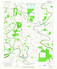 1963 Sherrill1965 Print · USGSThe Arkansas Delta comes to life in the early sixties, showing a landscape defined by the Tucker Prison Farm and the rail-side hamlets of Sherrill and Ferda. Researchers can trace old family burial grounds like Jones Cem and rural spiritual centers such as New Hope Ch along the winding Plum Bayou.2 unique versions available
 - 1964 Map of Little Rock
 1964 Little Rock1964 Print · USGSCentral Arkansas in the mid-sixties is a landscape of mountain ridges, industrial rail lines, and growing military hubs. Researchers can trace the development of Bauxite and Hot Springs or locate rural landmarks like Sparkman and the Pine Bluff Arsenal.
 - 1964 Map of Cades, 1965 Print
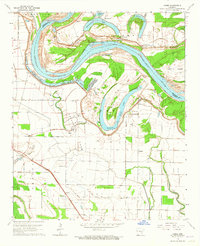 1964 Cades1965 Print · USGSThe Arkansas River bottomlands in the mid-1960s reveal a landscape shaped by the river and the vast Cummins State Prison Farm. Researchers can trace the Missouri Pacific rail line through settlements like Cades and find family landmarks like Union Cem.2 unique versions available
 - 1964 Map of Tarry, 1965 Print
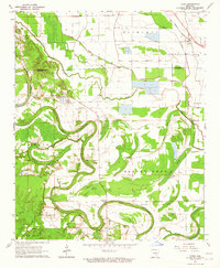 1964 Tarry1965 Print · USGSSoutheast Arkansas in the mid-1960s is defined here by the winding Bartholomew Bayou and a landscape of productive delta farmland. Researchers can locate family landmarks at Yorktown and Tarry, or trace rural church history at Bethlehem Ch and Polk Chapel.
 - 1964 Map of Rob Roy, 1965 Print
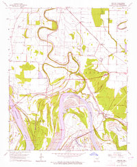 1964 Rob Roy1965 Print · USGSThe Arkansas River delta in the early sixties is captured here in detail, showcasing a region of deep bayous and river-bottom plantations. Researchers can trace family roots through numerous local landmarks like Rob Roy, St Lukes Ch, and the Jefferson County Free Bridge.2 unique versions available
 - 1964 Map of Cornerstone, 1965 Print
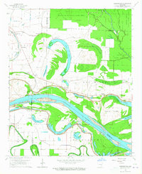 1964 Cornerstone1965 Print · USGSThe river bottoms of Jefferson and Lincoln counties are captured here in the mid-1960s, showing a landscape defined by the Arkansas River and its ancient oxbows. Researchers can locate early rural landmarks like Eudora School and the English Cemetery, alongside small settlements such as Cornerstone and Elmwood.2 unique versions available
Showing maps 1-25 of 167
Top cities of Jefferson County
- Pine Bluff historical maps
- White Hall historical maps
- Redfield historical maps
- Altheimer historical maps
- Wabbaseka historical maps
- Sherrill historical maps
Frequently asked questions
- What are the different types of historical maps available for Jefferson County?
- What is the oldest map of Jefferson County?
- Where can I purchase historical maps of Jefferson County for my home or office?
- Where can I download high-res historical maps of Jefferson County?
- Are there historical topographic maps available for Jefferson County?
- Is there historical aerial imagery available for Jefferson County?
- Where are historical maps of Jefferson County sourced from?