1960s Maps of Morrison Bluff, Arkansas
Explore 3 historic maps of Morrison Bluff from the 1960s. These maps offer a rare glimpse into what life looked like during the 1960s — showing old roads, neighborhoods, homes, and landmarks that have changed or disappeared over time.
Whether you're researching your family's past, planning a metal detecting trip, or studying how Morrison Bluff's landscape evolved across the 1960s, these high-resolution maps are a powerful tool for exploring the history of this region.
- Focus on a specific era: All maps on this page are from the 1960s, giving you a focused view of this time period.
- See what’s changed: Compare century-old streets, trails, and buildings to today's modern landscape using overlays and satellite layers.
- Research with precision: Use these maps for genealogy, historical research, land use analysis, or educational projects.
- View, download, or print: Maps are fully viewable online in high resolution, and can be downloaded or printed for your own records.
Start exploring Morrison Bluff's history through authentic maps from the 1960s. This is your window into the past.
Morrison Bluff, AR maps
(3)- 1961 Map of Hartman, 1962 Print
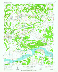 1961 Hartman1962 Print · USGSThe Arkansas River valley at the start of the sixties reveals a landscape of railroad towns and active coal mining. Genealogists and local historians can trace rural roots at Mount Vernon Ch, Kendall Cem, and the community of Sulphur Springs.3 unique versions available
 - 1961 Map of Scranton, 1962 Print
 1961 Scranton1962 Print · USGSLogan County life in the early sixties is centered around Scranton and its surrounding ridge-top communities. Genealogists and historians can trace family locations at Saint Ignatius Ch or numerous burial grounds like Hickory Grove Cem and Ellsworth Cem.3 unique versions available
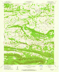
 - 1964 Map of Russellville
 1964 Russellville1964 Print · USGSMid-century Central Arkansas is defined here by the river-valley towns and the surrounding mountain ranges before the full expansion of the interstate system. Genealogists and historians can trace rail-town development along the Missouri Pacific Railroad and locate landmarks like Arkansas Polytechnic College or Petit Jean State Park.
End of results
Showing maps 1-3 of 3
Top cities near Morrison Bluff
- Clarksville historical maps
- Paris historical maps
- Lamar historical maps
- Coal Hill historical maps
- Knoxville historical maps
- Hartman historical maps
See more
Frequently asked questions
- What are the different types of historical maps available for Morrison Bluff?
- What is the oldest map of Morrison Bluff?
- Where can I purchase historical maps of Morrison Bluff for my home or office?
- Where can I download high-res historical maps of Morrison Bluff?
- Are there historical topographic maps available for Morrison Bluff?
- Is there historical aerial imagery available for Morrison Bluff?
- Where are historical maps of Morrison Bluff sourced from?