Old Maps of Purdy, Arkansas for Genealogy
Trace your family roots with 15 historic maps of Purdy. These high-res maps reveal old neighborhoods, homesites, landmarks, and streets — helping you uncover where your ancestors lived and how the area evolved over time.
- Explore historic neighborhoods: Identify where your relatives may have lived in the 1800s or 1900s.
- Compare maps over time: Trace the changes in streets, buildings, and landmarks for multi-generational research.
- Perfect for genealogy & ancestry research: Used by family historians and researchers to map out lineage and migration.
These maps are an incredible resource for exploring your personal connection to Purdy's past.
Purdy, AR maps
(15)- 1900 Map of Eureka Springs, 1954 Print
 1900 Eureka Springs1954 Print · USGSThe Ozark Mountains around the Arkansas and Missouri border are shown here during the turn of the century, when the river-and-rail economy was firmly established. Researchers can locate early family crossings and landmarks like Knox Ferry, Pivot Rock, and the St. Louis & San Francisco R. R.
 - 1901 Map of Eureka Springs
 1901 Eureka Springs1901 Print · USGSThe Arkansas Ozarks at the turn of the century are captured here in a time of river ferries and mountain townships. Genealogists and historians can locate early settlements like Eureka Springs and Berryville, or trace historic crossings such as Knox Ferry and Ellis Ford.3 unique versions available
 - 1945 Map of Harrison
 1945 Harrison1945 Print · USGSThe Ozark and Boston Mountains straddle the Missouri-Arkansas border during the mid-forties, showing a landscape of forest ridges and river valleys. Genealogists and historians can trace rail-connected towns like Monett and West Plains or early lake developments at Bull Shoals Res and Norfork Lake.
 - 1949 Map of Harrison
 1949 Harrison1949 Print · USGSThe Ozark highlands of northern Arkansas and southern Missouri are shown just after the war, when the White River still followed its original course. Genealogists and historians can trace rail lines like the Missouri & Arkansas RR and locate rural hubs like Harrison, Eureka Springs, and Mountain Home.
 - 1954 Map of Harrison
 1954 Harrison1954 Print · USGSThe Ozarks and Boston Mountains meet during a period of massive river engineering in the mid-fifties. Researchers can trace the early shorelines of Bull Shoals Lake and Table Rock Reservoir or locate inland towns like Berryville and Harrison.
 - 1958 Map of Harrison, 1973 Print
 1958 Harrison1973 Print · USGSThe Ozark and Boston Mountains appear in this mid-century survey as the great White River impoundments were reshaping the region. Researchers can trace the rail lines of the St Louis-San Francisco Ry and locate early settlements like Berryville and Gainesville.
 - 1964 Map of Harrison
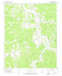
 1964 Harrison1964 Print · USGSThe Ozark and Boston Mountains of Arkansas and Missouri are captured here in the mid-sixties, showing the rugged highlands before extensive modern development. Genealogists and historians can trace family-named peaks like Gaither Mountain and follow the St Louis-San Francisco RR through Monett and Purdy.
 - 1973 Map of Kingston, 1976 Print
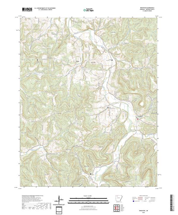
 1973 Kingston1976 Print · USGSThe Kings River valley in the early seventies remains a landscape of high peaks and tight-knit hollows. Genealogists can locate family landmarks like Kingston Cem, Loy Cem, and rural congregations including Big Sandy Ch or Upper Wharton Ch.
 - 1985 Map of Harrison
 1985 Harrison1985 Print · USGSNorthwest Arkansas and southwest Missouri appear in the mid-eighties as a region of deep river valleys and high Ozark ridges. Researchers can trace rural life across several counties, locating the Bear Creek Springs Quarry, the winding Buffalo National River, and hilltop settlements like Alpena.
 - 1985 Map of Harrison
 1985 Harrison1985 Print · USGSThe Ozark highlands and the White River valley are seen here in the mid-1980s, showcasing a region defined by its massive reservoirs and protected wilderness. You can trace the rugged corridors of the Missouri & North Arkansas RR or locate historic settlements like Eureka Springs and Jasper.
 - 2011 Map of Kingston, 2011 Print
 2011 Kingston2011 Print · USGSCovers Purdy, including Kingston, Loy, and other nearby areas
 - 2014 Map of Kingston, 2014 Print
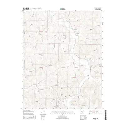 2014 Kingston2014 Print · USGSCovers Purdy, including Kingston, Loy, and other nearby areas
 - 2017 Map of Kingston, 2017 Print
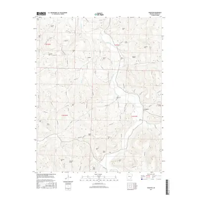 2017 Kingston2017 Print · USGSCovers Purdy, including Kingston, Loy, and other nearby areas
 - 2020 Map of Kingston, 2020 Print
 2020 Kingston2020 Print · USGSCovers Purdy, including Kingston, Loy, and other nearby areas
 - 2024 Map of Kingston, 2024 Print
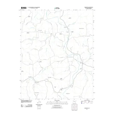
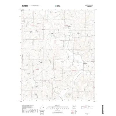
 2024 Kingston2024 Print · USGSMadison County high country comes into focus here, showing the rural settlements and mountain ridges of the Ozarks in the early 2020s. Trace local family history at Kingston Cem and Upper Campground Cem, or locate the isolated settlement of Purdy near the banks of the Kings River.
End of results
Showing maps 1-15 of 15
Top cities near Purdy
Frequently asked questions
- What are the different types of historical maps available for Purdy?
- What is the oldest map of Purdy?
- Where can I purchase historical maps of Purdy for my home or office?
- Where can I download high-res historical maps of Purdy?
- Are there historical topographic maps available for Purdy?
- Is there historical aerial imagery available for Purdy?
- Where are historical maps of Purdy sourced from?