Old Maps of Perryville, Arkansas for Academic Research
Study the evolution of Perryville with 29 high-resolution historic maps. Whether you're teaching, researching, or modeling changes in land use, these maps provide essential visual documentation of urban, environmental, and geographic change.
- Analyze long-term change: Track patterns in development, transportation, and natural features.
- Ideal for environmental or urban studies: Support academic projects with primary historical map data.
- Use in the classroom or lab: Educators and researchers rely on these maps to bring historical context to life.
These maps are a powerful tool for teaching, research, and visualizing how Perryville has changed over the decades.
Perryville, AR maps
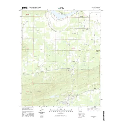
(29)- 1889 Map of Morrilton No. 3
 1889 Morrilton No. 31889 Print · USGSNear the end of the nineteenth century, the Arkansas River valley was defined by the massive plateau of Petit Jean Mountain. Genealogists can trace early homesteads in Atkins or near rural centers like Ada, Divide, and the river lands of Gardens Bottoms.
 - 1890 Map of Benton
 1890 Benton1890 Print · USGSSaline and Pulaski counties are shown here in the late nineteenth century as the rail network began to reshape the river-valley economy. Genealogists and researchers can trace family roots through old settlements like Brazils and Avilla or locate landmarks like Goosepond Mt and Aplin.
 - 1892 Map of Morrillton
 1892 Morrillton1892 Print · USGSThe Arkansas River valley at the end of the nineteenth century was a landscape of vital ferry crossings and early rail expansion. Genealogists and historians can trace the foundations of Morrillton and Perryville or locate river landmarks like Galla Rock Fy. and Stouts Ldg.
 - 1894 Map of Morrillton
 1894 Morrillton1894 Print · USGSThe Arkansas River valley and the Ouachita foothills meet in the 1890s, where river traffic and the rail line define the local economy. Genealogists can trace early homesteads and crossings near Morrillton, Burnetts Ford, and the rugged heights of Cedar Falls Mt.5 unique versions available
 - 1894 Map of Benton
 1894 Benton1894 Print · USGSCentral Arkansas in the late nineteenth century was a landscape of steep ridges and critical river crossings. Genealogists and researchers can trace the early rail corridor of the St. Louis Iron Mountain and Southern R. R. near Benton or locate family roots in Avilla and Brazils.5 unique versions available
 - 1955 Map of Little Rock, 1978 Print
 1955 Little Rock1978 Print · USGSCentral Arkansas in the mid-fifties exhibits a landscape of growing cities, massive military installations, and mountain reservoirs. Genealogists and historians can trace the industrial Bauxite Mines, regional rail lines, and local landmarks like Antioch Church.
 - 1956 Map of Little Rock
 1956 Little Rock1956 Print · USGSCentral Arkansas in the mid-fifties shows a landscape defined by burgeoning military bases and the timber-and-mineral wealth of the Ouachitas. Genealogists and researchers can trace old rail lines like the Missouri Pacific and find established communities such as Bauxite, Sheridan, and Mabelvale.
 - 1956 Map of Russellville
 1956 Russellville1956 Print · USGSThe Arkansas River valley and the surrounding Boston Mountains are captured here in the mid-fifties, showing a landscape of small timber towns and new reservoirs. Genealogists can trace family roots through upland settlements like Pelsor and Witts Springs or locate the campus of Arkansas Polytechnic College.2 unique versions available
 - 1960 Map of Little Rock
 1960 Little Rock1960 Print · USGSCentral Arkansas in the late fifties shows a landscape of growing military bases and massive new reservoirs. Local historians can trace the mid-century expansion of Little Rock and Hot Springs alongside the industrial works at Bauxite and the Pine Bluff Arsenal.
 - 1961 Map of Perryville, 1962 Print
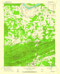 1961 Perryville1962 Print · USGSPerry County and the Arkansas River valley are shown in the early sixties, capturing the area between the river bends and the mountain ridges. Researchers can locate the County Fairground, rural schools like St Elizabeth Sch, and family burial plots including Wolfe Cem and McGhee Cem.3 unique versions available
 - 1963 Map of Thornburg, 1964 Print
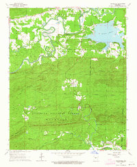 1963 Thornburg1964 Print · USGSCentral Arkansas in the early sixties is defined by the winding Fourche La Fave River and the rural crossroads of Thornburg. Researchers can trace family sites at Tyndall Cem, the community at Antioch, and the Fish Hatchery at Williams Junction.4 unique versions available
 - 1964 Map of Russellville
 1964 Russellville1964 Print · USGSMid-century Central Arkansas is defined here by the river-valley towns and the surrounding mountain ranges before the full expansion of the interstate system. Genealogists and historians can trace rail-town development along the Missouri Pacific Railroad and locate landmarks like Arkansas Polytechnic College or Petit Jean State Park.
 - 1964 Map of Little Rock
 1964 Little Rock1964 Print · USGSCentral Arkansas in the mid-sixties is a landscape of mountain ridges, industrial rail lines, and growing military hubs. Researchers can trace the development of Bauxite and Hot Springs or locate rural landmarks like Sparkman and the Pine Bluff Arsenal.
 - 1977 Map of Russellville
 1977 Russellville1977 Print · USGSThe Arkansas River Valley and surrounding Ozark Mountains are documented here during a period of significant postwar growth and infrastructure development. Genealogists and researchers can locate family landmarks such as Mount Carmel Cem, St Josephs Church, and several remote Coal Mine sites along the Missouri Pacific RR line.
 - 1983 Map of Conway, 1984 Print
 1983 Conway1984 Print · USGSThe Arkansas River valley in the early eighties shows a landscape of river-bend settlements and expanding wildlife areas. Genealogists and historians can trace the Missouri Pacific RR through old river towns like Toad Suck, Morrilton, and Menifee.
 - 1984 Map of Russellville
 1984 Russellville1984 Print · USGSThe Arkansas River valley was undergoing significant change in the 1950s as transportation and water management reshaped the region from Russellville to Conway. Researchers can trace the era's rail networks like the Missouri Pacific RR and explore landmarks like Magazine Mountain and Petit Jean State Park.
 - 1985 Map of Little Rock, 1988 Print
 1985 Little Rock1988 Print · USGSLittle Rock and its surrounding river valley are shown in the mid-eighties as the region balanced urban expansion with its industrial and military roots. Genealogists and historians can locate dozens of institutions and family landmarks, including Mount Holly Cem, the Bauxite Mines, and Central High Sch.
 - 1989 Map of Perryville, 1995 Print
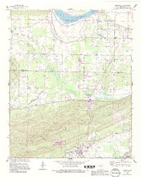 1989 Perryville1995 Print · USGSPerry County and the Arkansas River valley are shown here in the late eighties as timbered ridges give way to fertile bottomlands. Researchers can trace family history through a network of rural sites like St Elizabeth Sch, McGhee Cem, and the riverfront at Riverview.
 - 1992 Map of Russellville, 1993 Print
 1992 Russellville1993 Print · USGSCentral Arkansas in the early nineties shows a landscape defined by the Arkansas River valley and the surrounding national forests. Trace the development of river towns like Russellville and Dardanelle alongside landmarks such as Lake Dardanelle and Magazine Mtn.
 - 2011 Map of Thornburg, 2011 Print
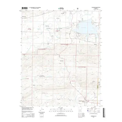
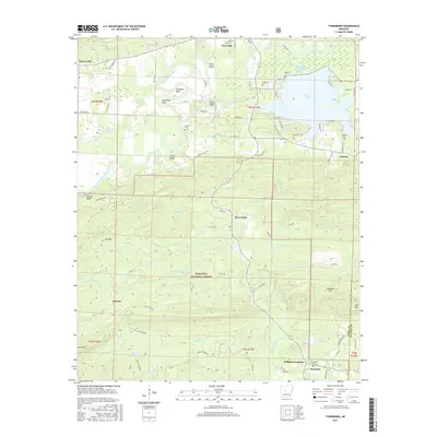
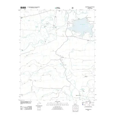 2011 Thornburg2011 Print · USGSCovers Perryville, including Cherry Hill, Williams Junction, and other nearby areas
 - 2011 Map of Perryville, 2011 Print
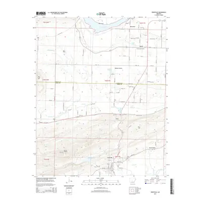
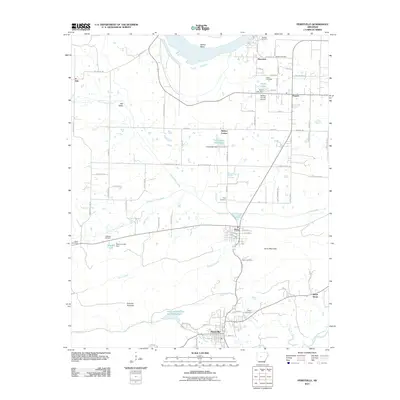 2011 Perryville2011 Print · USGSCovers Perryville, including Oppelo, Perry, and other nearby areas
 - 2014 Map of Perryville, 2014 Print
 2014 Perryville2014 Print · USGSCovers Perryville, including Oppelo, Perry, and other nearby areas
 - 2014 Map of Thornburg, 2014 Print
 2014 Thornburg2014 Print · USGSCovers Perryville, including Cherry Hill, Williams Junction, and other nearby areas
 - 2017 Map of Thornburg, 2017 Print
 2017 Thornburg2017 Print · USGSCovers Perryville, including Cherry Hill, Williams Junction, and other nearby areas
 - 2017 Map of Perryville, 2017 Print
 2017 Perryville2017 Print · USGSCovers Perryville, including Oppelo, Perry, and other nearby areas
Showing maps 1-25 of 29
Top cities near Perryville
- Conway historical maps
- Morrilton historical maps
- Atkins historical maps
- Pottsville historical maps
- Plumerville historical maps
- Oppelo historical maps
See more
Frequently asked questions
- What are the different types of historical maps available for Perryville?
- What is the oldest map of Perryville?
- Where can I purchase historical maps of Perryville for my home or office?
- Where can I download high-res historical maps of Perryville?
- Are there historical topographic maps available for Perryville?
- Is there historical aerial imagery available for Perryville?
- Where are historical maps of Perryville sourced from?