Old Maps of Hazen, Arkansas for Academic Research
Study the evolution of Hazen with 34 high-resolution historic maps. Whether you're teaching, researching, or modeling changes in land use, these maps provide essential visual documentation of urban, environmental, and geographic change.
- Analyze long-term change: Track patterns in development, transportation, and natural features.
- Ideal for environmental or urban studies: Support academic projects with primary historical map data.
- Use in the classroom or lab: Educators and researchers rely on these maps to bring historical context to life.
These maps are a powerful tool for teaching, research, and visualizing how Hazen has changed over the decades.
Hazen, AR maps
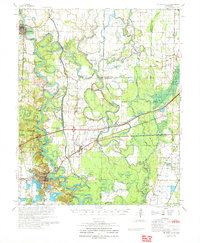
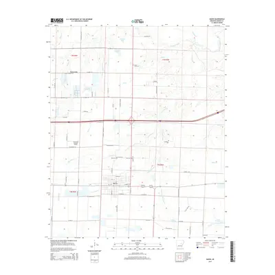
(34)- 1935 Map of Hazen, 1936 Print
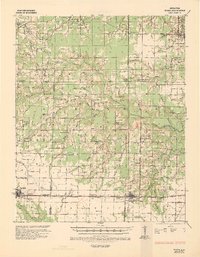 1935 Hazen1936 Print · USGSPrairie and Lonoke Counties come into focus during the mid-thirties, showing the rail-and-road corridor that linked central Arkansas. Genealogists can trace family roots through numerous rural landmarks like Whippoorwill Cem, Hickory Plains Sch, and Morris Chapel.
 - 1941 Map of Hazen, 1942 Print
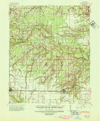 1941 Hazen1942 Print · USGSThe Grand Prairie region of Arkansas is captured here during the early 1940s, showing a landscape defined by the arrival of the Chicago Rock Island and Pacific railroad. Genealogists can locate family sites among numerous rural hubs like Philadelphia Ch, Hazen, and Barrettsville Sch.2 unique versions available
 - 1941 Map of De Valls Bluff, 1943 Print
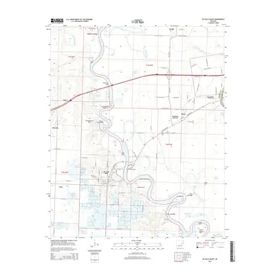
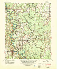 1941 De Valls Bluff1943 Print · USGSThe White River basin in the early 1940s reveals a landscape of complex oxbows and timbered bottomlands. Genealogists and historians can trace family roots through numerous local landmarks like St Johns Cem, Beulah, and the Richland Sch.2 unique versions available
 - 1948 Map of Helena
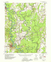
 1948 Helena1948 Print · USGSEastern Arkansas and the Mississippi Delta are captured here just after the war, showing a landscape defined by its great rivers and rail lines. Genealogists can trace family locations near Bemis Plantation, Helena, and smaller rail stops like Wheatley and Moro.
 - 1950 Map of Helena
 1950 Helena1950 Print · USGSMid-century Phillips County and the surrounding Delta region are shown at a peak of rail and river commerce. Genealogists and historians can trace family locations through numerous rural communities like Old Austin, Cotton Plant, and West Helena, or follow the routes of the Missouri Pacific RR across Grand Prairie.2 unique versions available
 - 1955 Map of Helena, 1967 Print
 1955 Helena1967 Print · USGSThe Arkansas Delta and Mississippi floodplains are captured here in the mid-fifties, during a period of expanding flood control and rail commerce. Researchers can trace the extensive Chicago Rock Island and Pacific RR lines and locate sites like the Arkansas State College Experimental Rice Farm or Friars Point.2 unique versions available
 - 1957 Map of De Valls Bluff
 1957 De Valls Bluff1957 Print · USGSThe river bottoms of the White and Cache rivers are captured here in the late fifties, showcasing a complex world of oxbow lakes and rail-line settlements. Genealogists and historians can locate rural landmarks such as St. Johns Cem, Beulah, and Ash Grove Ch & Cem.
 - 1959 Map of Helena
 1959 Helena1959 Print · USGSThe Arkansas and Mississippi Delta regions are captured here in the late fifties, showing a landscape defined by the Mississippi River and the Grand Prairie. Genealogists and researchers can trace the rail networks of the Illinois Central RR and locate community landmarks like Helena and the White River National Wildlife Refuge.
 - 1960 Map of Helena
 1960 Helena1960 Print · USGSThe Arkansas and Mississippi Delta regions meet along the great river bends during a period of significant agricultural and rail expansion. Genealogists and historians can trace the paths of the Missouri Pacific railroad through Clarendon or locate landings along the Mississippi River and White River.
 - 1964 Map of Hazen, 1965 Print
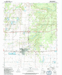
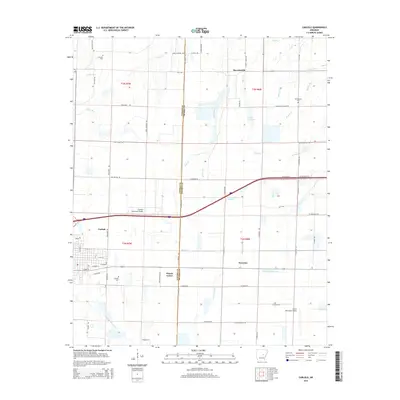
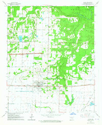 1964 Hazen1965 Print · USGSHazen and the surrounding Prairie County lowlands are captured here in the mid-1960s as a vital rail and agricultural corridor. Researchers can trace the Chicago Rock Island and Pacific line, locate the Old Bethel Cem, or explore the wooded Wattensaw State Game Area.3 unique versions available
 - 1964 Map of Carlisle, 1965 Print
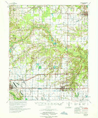
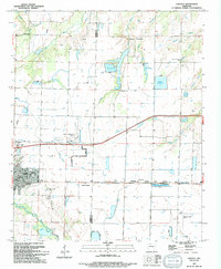
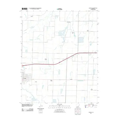
 1964 Carlisle1965 Print · USGSLonoke and Prairie Counties appear here during a period of infrastructure expansion in the mid-1960s. Researchers can trace the Chicago Rock Island and Pacific railroad or locate local landmarks like Mt Zion Cemetery and Screeton.
 - 1967 Map of Hazen
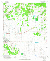
 1967 Hazen1967 Print · USGSPrairie and Lonoke Counties come into focus in the mid-1960s as industrial transport and local agriculture intersect. Genealogists and historians can trace family sites at Tucker Cem, New Bethel Ch, and the rail stops along the Chicago Rock Island and Pacific.
 - 1968 Map of De Valls Bluff, 1970 Print
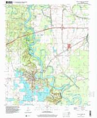
 1968 De Valls Bluff1970 Print · USGSPrairie County in the late sixties reveals a landscape of river-bottom commerce and rail connectivity along the White River. Trace the old rail lines and pioneer burials at Oaklawn Cem or family-named landmarks like Pfennighausen Ridge.3 unique versions available
 - 1971 Map of De Valls Bluff
 1971 De Valls Bluff1971 Print · USGSPrairie County's river-driven landscape is shown here in the early 1970s, as railroads and river landings still defined the region's character. Researchers can locate family landmarks like St Luke Cem, Philadelphia Cem, and the community of Biscoe along the White River.
 - 1986 Map of Brinkley
 1986 Brinkley1986 Print · USGSThe Grand Prairie and White River basin come to life in the mid-1980s, showing the intersection of heavy rail and interstate travel through eastern Arkansas. Genealogists can locate family sites near Sylvania Cem, Oak Grove Ch, and the rural community of De Valls Bluff.
 - 1990 Map of Brinkley, 1991 Print
 1990 Brinkley1991 Print · USGSEastern Arkansas at the start of the 1990s is defined by the agricultural rhythms of the Grand Prairie and the vital White River corridor. Genealogists and historians can trace the rail-linked growth of Brinkley and Des Arc alongside older landmarks like Peckerwood Lake.
 - 1994 Map of Hazen
 1994 Hazen1994 Print · USGSThe Prairie County landscape around Hazen in the mid-1990s reflects a deep connection to the land through its managed waters and wildlife areas. Genealogists and local historians can trace legacy sites like Old Bethel Cemetery and the settlement of Tarnceville.
 - 1994 Map of Carlisle
 1994 Carlisle1994 Print · USGSLonoke and Prairie counties are captured in the mid-1990s as a landscape of established agriculture and managed water resources. Researchers can trace family history through sites like Old Carlisle Cem and rural centers such as Barrettsville and Prairie Center.
 - 1996 Map of De Valls Bluff, 1999 Print
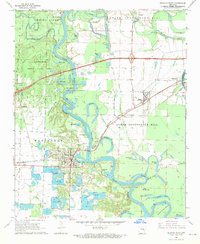
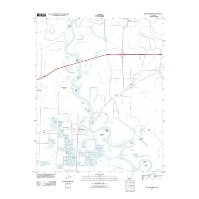
 1996 De Valls Bluff1999 Print · USGSDe Valls Bluff and the White River wetlands are captured in the late 1990s as the modern interstate began to reshape the landscape. Local historians can trace the foundations of riverside life at Bucks Landing or find family history at Oaklawn Cem and Biscoe.
 - 2011 Map of Hazen, 2011 Print
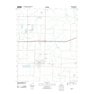 2011 Hazen2011 Print · USGSCovers Hazen, including Tarnceville, Prairie County, and other nearby areas
 - 2011 Map of Carlisle, 2011 Print
 2011 Carlisle2011 Print · USGSCovers Hazen, including Carlisle, Barrettsville, and other nearby areas
 - 2011 Map of De Valls Bluff, 2011 Print
 2011 De Valls Bluff2011 Print · USGSCovers Hazen, including De Valls Bluff, Fredonia (Biscoe), and other nearby areas
 - 2014 Map of Carlisle, 2014 Print
 2014 Carlisle2014 Print · USGSCovers Hazen, including Carlisle, Barrettsville, and other nearby areas
 - 2014 Map of Hazen, 2014 Print
 2014 Hazen2014 Print · USGSCovers Hazen, including Tarnceville, Prairie County, and other nearby areas
 - 2014 Map of De Valls Bluff, 2014 Print
 2014 De Valls Bluff2014 Print · USGSCovers Hazen, including De Valls Bluff, Fredonia (Biscoe), and other nearby areas
Showing maps 1-25 of 34
Top cities near Hazen
- Carlisle historical maps
- Des Arc historical maps
- De Valls Bluff historical maps
- Fredonia (Biscoe) historical maps
- Ulm historical maps
- Roe historical maps
Frequently asked questions
- What are the different types of historical maps available for Hazen?
- What is the oldest map of Hazen?
- Where can I purchase historical maps of Hazen for my home or office?
- Where can I download high-res historical maps of Hazen?
- Are there historical topographic maps available for Hazen?
- Is there historical aerial imagery available for Hazen?
- Where are historical maps of Hazen sourced from?