1990s Maps of Little Rock, Arkansas
Explore 6 historic maps of Little Rock from the 1990s. These maps offer a rare glimpse into what life looked like during the 1990s — showing old roads, neighborhoods, homes, and landmarks that have changed or disappeared over time.
Whether you're researching your family's past, planning a metal detecting trip, or studying how Little Rock's landscape evolved across the 1990s, these high-resolution maps are a powerful tool for exploring the history of this region.
- Focus on a specific era: All maps on this page are from the 1990s, giving you a focused view of this time period.
- See what’s changed: Compare century-old streets, trails, and buildings to today's modern landscape using overlays and satellite layers.
- Research with precision: Use these maps for genealogy, historical research, land use analysis, or educational projects.
- View, download, or print: Maps are fully viewable online in high resolution, and can be downloaded or printed for your own records.
Start exploring Little Rock's history through authentic maps from the 1990s. This is your window into the past.
Little Rock, AR maps
(6)- 1994 Map of Little Rock, 2000 Print
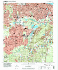 1994 Little Rock2000 Print · USGSLittle Rock in the mid-1990s shows a capital city balancing its historic civic core with significant southward expansion and industrial roots. Researchers can trace neighborhood development from Oak Forest to Wakefield Village, while locating landmarks like Central High Sch and the National Cemetery.
 - 1994 Map of Sweet Home, 2000 Print
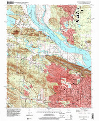
 1994 Sweet Home2000 Print · USGSSoutheast of the state capital in the 1990s, this area shows the intersection of major river commerce and long-standing communities. Genealogists and local historians can locate Cornerstone Cem, College Station, and the historic Harris Ch near the river's edge.
 - 1994 Map of Ferndale, 2000 Print
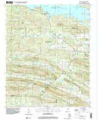 1994 Ferndale2000 Print · USGSWestern Pulaski County in the mid-nineties shows a rural landscape transitioning into the suburban reaches of the state capital. Genealogists and local historians can trace family markers at Walnut Grove Ch Cem or locate the historic Joel T Robinson Sch and Union Chapel.
 - 1994 Map of Pinnacle Mountain, 2000 Print
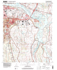
 1994 Pinnacle Mountain2000 Print · USGSGreater Little Rock expanded toward the Arkansas River during the 1990s as suburban growth met the ancient peaks of the Ouachita foothills. Researchers can trace family history at the Old Soldiers Cem, Natural Steps, and the former Maumelle Station.
 - 1994 Map of Alexander, 2000 Print
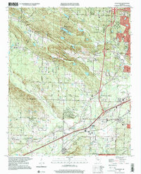 1994 Alexander2000 Print · USGSThe outskirts of Little Rock and the ridges of the Ouachita foothills meet in the mid-1990s as suburban development expands toward the Saline County line. Researchers can trace local heritage through Forest Hills Memorial Park and historic settlements like Mabelvale and Collegeville.
 - 1996 Map of North Little Rock, 1999 Print
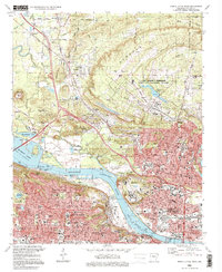 1996 North Little Rock1999 Print · USGSGreater Little Rock at the close of the twentieth century reveals a landscape defined by the Arkansas River and massive military installations. Genealogists and local historians can trace legacy sites like St Josephs Orphanage, Palestine Cem, and Shorter College.
End of results
Showing maps 1-6 of 6
Top cities near Little Rock
- North Little Rock historical maps
- Jacksonville historical maps
- Benton historical maps
- Sherwood historical maps
- Maumelle historical maps
- Bryant historical maps
See more
Top neighborhoods of Little Rock
- Spring Valley historical maps
- Pleasant Valley historical maps
- Pulaski Heights historical maps
- Rock Creek historical maps
- Brittain historical maps
- Pleasant Valley Estates historical maps
See more
Frequently asked questions
- What are the different types of historical maps available for Little Rock?
- What is the oldest map of Little Rock?
- Where can I purchase historical maps of Little Rock for my home or office?
- Where can I download high-res historical maps of Little Rock?
- Are there historical topographic maps available for Little Rock?
- Is there historical aerial imagery available for Little Rock?
- Where are historical maps of Little Rock sourced from?