Old Maps of Maumelle, Arkansas for Metal Detecting
Plan your next treasure hunt with 45 historic maps of Maumelle. Find old homesites, ghost towns, trails, and gathering spots that may be lost to time — perfect for identifying promising metal detecting locations.
- Locate forgotten sites: Uncover places like long-lost settlements, abandoned rail lines, or gathering spots.
- Plan better hunts: Use map overlays combined with LiDAR or satellite views to narrow in on historically rich areas.
- Made for detectorists: Thousands of hobbyists use these maps to discover relics, coins, and hidden history.
Use these historic maps to boost your research and find new opportunities beneath the surface of Maumelle.
Maumelle, AR maps
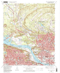
(45)- 1891 Map of Little Rock
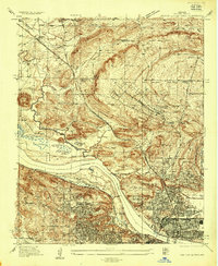
 1891 Little Rock1891 Print · USGSLittle Rock and the central Arkansas river valley are shown in detail during the 1890s, when rail travel and river trade dominated the local economy. Genealogists can trace early homesteads and communities near Argenta, the Indian Mounds at Toltec, and Sweet Home.
 - 1893 Map of Little Rock
 1893 Little Rock1893 Print · USGSLittle Rock and the Arkansas River valley are shown here in the early 1890s, just as the regional rail network was maturing. Genealogists can trace family roots through old settlements like Argenta, Shilcott, and Collegeville, or locate archaeological sites such as the Indian Mounds.5 unique versions available
 - 1935 Map of North Little Rock
 1935 North Little Rock1935 Print · USGSNorth Little Rock and the surrounding Pulaski County hills are captured here in the mid-1930s during a period of significant military and civic expansion. Local historians can trace the grounds of Camp Pike, find the historic St Josephs Orphanage, or locate family sites near Palestine Cem.
 - 1943 Map of Pinnacle Mtn, 1946 Print
 1943 Pinnacle Mtn1946 Print · USGSPulaski County at the end of the war shows a landscape of river-bend settlements and rising ridges. Genealogists can trace family names at the Brimmette Cem and Pankey Cem or locate old school sites like Round Hill Sch.
 - 1953 Map of Cato
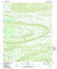
 1953 Cato1953 Print · USGSThe hills of central Arkansas meet heavy military and rural history during the mid-fifties near the Faulkner-Pulaski line. Trace the borders of (Former Camp J T Robinson) and locate local landmarks like Blue Hill School and Cato Pentecostal Church.4 unique versions available
 - 1953 Map of Mayflower, 1957 Print
 1953 Mayflower1957 Print · USGSThe Arkansas River valley at mid-century shows a landscape defined by military reservations and rural settlement patterns. Genealogists and local historians can trace the foundations of Mayflower and find historic sites like White City Church and Mayflower Cemetery.5 unique versions available
 - 1954 Map of Pinnacle Mountain, 1957 Print
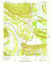
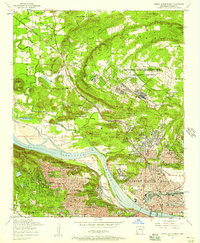
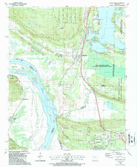
 1954 Pinnacle Mountain1957 Print · USGSThe foothills of the Ouachitas meet the Arkansas River mid-century, where industry and rural life intersect. Genealogists and historians can trace family locations near the Maumelle Ordnance Works, Joe T Robinson School, and Natural Steps.
 - 1954 Map of North Little Rock, 1975 Print
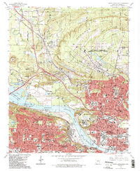
 1954 North Little Rock1975 Print · USGSThe Arkansas state capital and its northern neighbor are captured here in the mid-fifties during a period of steady urban expansion and military activity. Researchers can trace the footprints of St Josephs Orphanage, the Owen pit mines, and the expansive Camp Joseph T Robinson.
 - 1955 Map of Little Rock, 1978 Print
 1955 Little Rock1978 Print · USGSCentral Arkansas in the mid-fifties exhibits a landscape of growing cities, massive military installations, and mountain reservoirs. Genealogists and historians can trace the industrial Bauxite Mines, regional rail lines, and local landmarks like Antioch Church.
 - 1956 Map of Little Rock
 1956 Little Rock1956 Print · USGSCentral Arkansas in the mid-fifties shows a landscape defined by burgeoning military bases and the timber-and-mineral wealth of the Ouachitas. Genealogists and researchers can trace old rail lines like the Missouri Pacific and find established communities such as Bauxite, Sheridan, and Mabelvale.
 - 1960 Map of Little Rock
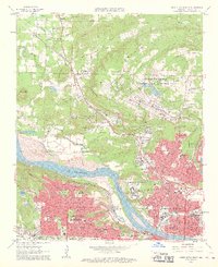
 1960 Little Rock1960 Print · USGSCentral Arkansas in the late fifties shows a landscape of growing military bases and massive new reservoirs. Local historians can trace the mid-century expansion of Little Rock and Hot Springs alongside the industrial works at Bauxite and the Pine Bluff Arsenal.
 - 1961 Map of North Little Rock, 1962 Print
 1961 North Little Rock1962 Print · USGSThe riverfront and uplands of the Little Rock metro area are captured here in the early sixties, as suburban growth began to reach toward the hills. Genealogists and local historians can locate dozens of institutions, from St Josephs Orphanage and Shorter College to Palestine Cem.4 unique versions available
 - 1961 Map of Pinnacle Mountain, 1962 Print
 1961 Pinnacle Mountain1962 Print · USGSThe peaks of the Arkansas River Valley stand tall in the early sixties, as suburban growth reaches toward the river's edge. Researchers can trace family history at the Old Soldiers Cem, visit the County Prison Farm, or locate the Pumping Station near Natural Steps.4 unique versions available
 - 1964 Map of Little Rock
 1964 Little Rock1964 Print · USGSCentral Arkansas in the mid-sixties is a landscape of mountain ridges, industrial rail lines, and growing military hubs. Researchers can trace the development of Bauxite and Hot Springs or locate rural landmarks like Sparkman and the Pine Bluff Arsenal.
 - 1975 Map of Pinnacle Mountain, 1976 Print
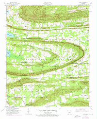
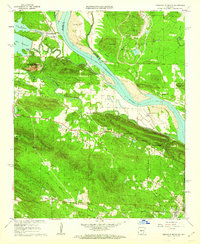
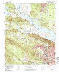
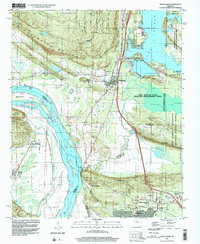
 1975 Pinnacle Mountain1976 Print · USGSCentral Arkansas in the mid-seventies shows a landscape of sharp relief and growing communities along the water. Researchers can trace the development near Pinnacle Mountain and the winding confluence of the Arkansas River and Maumelle River.
 - 1975 Map of North Little Rock, 1976 Print
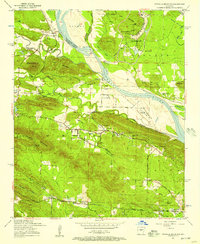
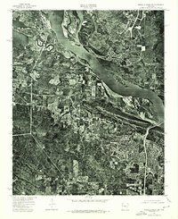
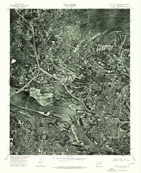 1975 North Little Rock1976 Print · USGSCentral Arkansas comes into sharp focus during the mid-1970s through this aerial-based survey of the riverfront. Researchers can trace the development of North Little Rock and the industrial activity along the Arkansas River.
 - 1985 Map of Little Rock, 1988 Print
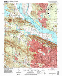
 1985 Little Rock1988 Print · USGSLittle Rock and its surrounding river valley are shown in the mid-eighties as the region balanced urban expansion with its industrial and military roots. Genealogists and historians can locate dozens of institutions and family landmarks, including Mount Holly Cem, the Bauxite Mines, and Central High Sch.
 - 1986 Map of North Little Rock
 1986 North Little Rock1986 Print · USGSThe Arkansas River corridor in the mid-eighties shows a period of significant civic and military development in Pulaski County. Researchers can trace the footprints of Camp Joseph T. Robinson, the historic St Josephs Orphanage, and neighborhood schools like Boone Park Sch.2 unique versions available
 - 1986 Map of Pinnacle Mountain
 1986 Pinnacle Mountain1986 Print · USGSPulaski County at the peak of the 1980s displays a landscape where the suburbs of Little Rock meet the rugged heights of the Fulk Mountains. Genealogists can locate numerous family burial grounds including Old Soldiers Cem, Grimmette Cem, and Ives Cem.
 - 1987 Map of Cato
 1987 Cato1987 Print · USGSThe northern Pulaski County hills meet the Faulkner County line in the late eighties, featuring a landscape defined by military training grounds and rural settlements. Genealogists and local historians can trace family-named sites like Brockington Corner, Mt Psyam Cemetery, and the Immaculate Heart of Mary School.
 - 1987 Map of Mayflower
 1987 Mayflower1987 Print · USGSFaulkner and Pulaski counties are shown in the late 1980s as the suburbs and conservation areas north of Little Rock began to take their modern form. Researchers can trace the development of Mayflower and Maumelle, locate family sites near Mayflower Cem, or explore the riparian landscape of Fletcher Bend and Grassy Lake.2 unique versions available
 - 1994 Map of Mayflower, 2000 Print
 1994 Mayflower2000 Print · USGSThe Arkansas River valley meets the southern shores of Lake Conway in the mid-nineties. Genealogists and local historians can trace the foundations of Mayflower and Maumelle while locating landmarks like Mayflower Cem, Northside Ch, and the sprawling Camp Joseph T Robinson.
 - 1994 Map of Cato, 2000 Print
 1994 Cato2000 Print · USGSFaulkner and Pulaski counties are captured in the mid-1990s, where military reservation land meets growing rural communities. Genealogists and local historians can trace family-named sites like Brockington Corner, the Mt Psyam Cemetery, and the Immaculate Heart of Mary Sch.
 - 1994 Map of Pinnacle Mountain, 2000 Print
 1994 Pinnacle Mountain2000 Print · USGSGreater Little Rock expanded toward the Arkansas River during the 1990s as suburban growth met the ancient peaks of the Ouachita foothills. Researchers can trace family history at the Old Soldiers Cem, Natural Steps, and the former Maumelle Station.
 - 1996 Map of North Little Rock, 1999 Print
 1996 North Little Rock1999 Print · USGSGreater Little Rock at the close of the twentieth century reveals a landscape defined by the Arkansas River and massive military installations. Genealogists and local historians can trace legacy sites like St Josephs Orphanage, Palestine Cem, and Shorter College.
Showing maps 1-25 of 45
Top cities near Maumelle
- Little Rock historical maps
- North Little Rock historical maps
- Conway historical maps
- Jacksonville historical maps
- Benton historical maps
- Sherwood historical maps
See more
Top neighborhoods of Maumelle
Frequently asked questions
- What are the different types of historical maps available for Maumelle?
- What is the oldest map of Maumelle?
- Where can I purchase historical maps of Maumelle for my home or office?
- Where can I download high-res historical maps of Maumelle?
- Are there historical topographic maps available for Maumelle?
- Is there historical aerial imagery available for Maumelle?
- Where are historical maps of Maumelle sourced from?