Old Maps of North Little Rock, Arkansas for Academic Research
Study the evolution of North Little Rock with 91 high-resolution historic maps. Whether you're teaching, researching, or modeling changes in land use, these maps provide essential visual documentation of urban, environmental, and geographic change.
- Analyze long-term change: Track patterns in development, transportation, and natural features.
- Ideal for environmental or urban studies: Support academic projects with primary historical map data.
- Use in the classroom or lab: Educators and researchers rely on these maps to bring historical context to life.
These maps are a powerful tool for teaching, research, and visualizing how North Little Rock has changed over the decades.
North Little Rock, AR maps
(91)- 1891 Map of Little Rock
 1891 Little Rock1891 Print · USGSLittle Rock and the central Arkansas river valley are shown in detail during the 1890s, when rail travel and river trade dominated the local economy. Genealogists can trace early homesteads and communities near Argenta, the Indian Mounds at Toltec, and Sweet Home.
 - 1893 Map of Little Rock
 1893 Little Rock1893 Print · USGSLittle Rock and the Arkansas River valley are shown here in the early 1890s, just as the regional rail network was maturing. Genealogists can trace family roots through old settlements like Argenta, Shilcott, and Collegeville, or locate archaeological sites such as the Indian Mounds.5 unique versions available
 - 1935 Map of Mc Almont
 1935 Mc Almont1935 Print · USGSPulaski County during the mid-1930s is mapped here with a focus on the railroad hubs and river bottomlands northeast of the capital. Genealogists can trace family landmarks like Brushy Cem, St Luke Ch, and the Sylvan Hills Res settlement.
 - 1935 Map of Little Rock
 1935 Little Rock1935 Print · USGSLittle Rock and its southern outskirts are captured in the mid-thirties, showcasing a city defined by its railroads and quarrying industry. Genealogists can trace family footprints near Oakland Cem or the rural community of Geyer Springs, while identifying landmarks like the Old Penitentiary Site and Biddle Shops.
 - 1935 Map of Sweet Home
 1935 Sweet Home1935 Print · USGSSoutheast of Little Rock during the mid-thirties, the river plain was defined by large-scale institutional farms and military camps. Genealogists can trace family connections at All Souls Rest Cem, St Stephens Cem, and the Union Industrial Agricultural College.
 - 1935 Map of North Little Rock
 1935 North Little Rock1935 Print · USGSNorth Little Rock and the surrounding Pulaski County hills are captured here in the mid-1930s during a period of significant military and civic expansion. Local historians can trace the grounds of Camp Pike, find the historic St Josephs Orphanage, or locate family sites near Palestine Cem.
 - 1935 Map of Alexander
 1935 Alexander1935 Print · USGSSaline and Pulaski counties come alive in this mid-1930s survey as the rail-and-creek network shaped local life. Researchers can trace family roots through numerous country landmarks including Sardis Sch, Salem Cem, and the State Girls Indust Home.2 unique versions available
 - 1941 Map of Alexander
 1941 Alexander1941 Print · USGSIn the 1930s, the corridor between Pulaski and Saline County was a bustling landscape of rail lines and rural townships. Genealogists and historians can trace family roots through numerous local landmarks, including the Dawson Sch, Vimy Ridge, and the Industrial Home.2 unique versions available
 - 1941 Map of Olmstead, 1945 Print
 1941 Olmstead1945 Print · USGSNorth of Little Rock in the early 1940s, this area was a network of bayous and ridges punctuated by rural crossroads and family homesteads. Genealogists and local historians can trace legacy sites like Tates Mill, Sumner Cem, and several country meeting houses including Zion Hill Ch and Harmony Ch.
 - 1942 Map of Scott
 1942 Scott1942 Print · USGSThe alluvial plains east of Little Rock come to life in this early 1940s survey of the Arkansas River oxbows. Researchers can pinpoint the Toltec Mounds and trace a dense network of country schools and churches like Banes Chapel Sch and Mt Hope Ch.2 unique versions available
 - 1943 Map of Jacksonville
 1943 Jacksonville1943 Print · USGSJacksonville and the Pulaski-Lonoke county line appear here in the early 1940s, revealing a landscape of rail junctions and rural homesteads. Genealogists can trace early family sites like Mc Graw Cem, the South Bend Sch, and the route of the Old Military Road.2 unique versions available
 - 1943 Map of Pinnacle Mtn, 1946 Print
 1943 Pinnacle Mtn1946 Print · USGSPulaski County at the end of the war shows a landscape of river-bend settlements and rising ridges. Genealogists can trace family names at the Brimmette Cem and Pankey Cem or locate old school sites like Round Hill Sch.
 - 1944 Map of Little Rock, 1946 Print
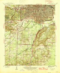 1944 Little Rock1946 Print · USGSMid-century Little Rock and its southern rural outskirts are captured here during a period of industrial and residential expansion. Researchers can trace the legacy of local families through landmarks like Feltons Store, Longley Sch, and rural congregations at Primrose Ch.2 unique versions available
 - 1945 Map of Sweet Home, 1946 Print
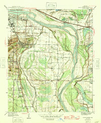 1945 Sweet Home1946 Print · USGSThe southern outskirts of Little Rock and the river bottoms come alive in the mid-forties, showing a landscape of industry and community. Genealogists can trace family roots through College Station, Higgins, and Zion Wheel Ch or locate burials at Cornerstone Cem.3 unique versions available
 - 1954 Map of Sweet Home, 1957 Print
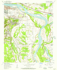 1954 Sweet Home1957 Print · USGSSoutheast of Little Rock in the mid-fifties, this area shows a landscape shaped by the Arkansas River and industrial growth. Researchers can find family-named locations such as College Station, trace the Missouri Pacific rail lines, and locate rural landmarks like Zion Hill Cemetery and Browns Gin.
 - 1954 Map of Little Rock, 1957 Print
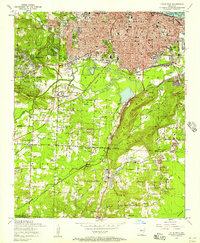 1954 Little Rock1957 Print · USGSLittle Rock and its southern outskirts are captured here during a decade of postwar growth and industrial activity. Genealogists can locate family sites among several country churches like Life Line Church and historic burial grounds including Mt Holly Cemetery.
 - 1954 Map of Pinnacle Mountain, 1957 Print
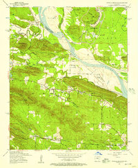 1954 Pinnacle Mountain1957 Print · USGSThe foothills of the Ouachitas meet the Arkansas River mid-century, where industry and rural life intersect. Genealogists and historians can trace family locations near the Maumelle Ordnance Works, Joe T Robinson School, and Natural Steps.
 - 1954 Map of Mc Almont, 1957 Print
 1954 Mc Almont1957 Print · USGSNorth Little Rock and the surrounding Pulaski County countryside are captured in the mid-1950s just as the suburbs began to expand. Genealogists and historians can locate numerous landmarks like Booker Cemetery, the Sylvan Hills School, and the junction at Protho Junction.
 - 1954 Map of Olmstead, 1957 Print
 1954 Olmstead1957 Print · USGSPulaski County at the dawn of the jet age shows a rural landscape of ridges and bayous meeting the new military installations. Genealogists can locate family sites like Mount Valley Cemetery, Tates Mill, and the Bayou Mete School.4 unique versions available
 - 1954 Map of Scott, 1957 Print
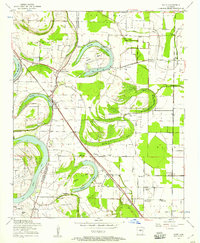 1954 Scott1957 Print · USGSThe oxbows and river bends of the Arkansas lowlands are captured here in the mid-fifties, just as rural communities like Scott and Toltec were evolving. Researchers can trace ancestral footprints at Toltec Mounds, La Grande Cemetery, and old rural hubs like Walkers Corner.3 unique versions available
 - 1954 Map of Jacksonville, 1957 Print
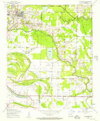 1954 Jacksonville1957 Print · USGSJacksonville and the surrounding wetlands of the Bayou Meto basin are captured here during a period of steady mid-century growth. Researchers can trace historic routes like Old Military Road and locate family landmarks such as Johnson Cemetery and St Joe Church.4 unique versions available
 - 1954 Map of North Little Rock, 1975 Print
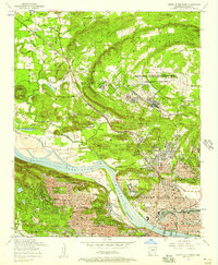 1954 North Little Rock1975 Print · USGSThe Arkansas state capital and its northern neighbor are captured here in the mid-fifties during a period of steady urban expansion and military activity. Researchers can trace the footprints of St Josephs Orphanage, the Owen pit mines, and the expansive Camp Joseph T Robinson.
 - 1955 Map of Little Rock, 1978 Print
 1955 Little Rock1978 Print · USGSCentral Arkansas in the mid-fifties exhibits a landscape of growing cities, massive military installations, and mountain reservoirs. Genealogists and historians can trace the industrial Bauxite Mines, regional rail lines, and local landmarks like Antioch Church.
 - 1956 Map of Little Rock
 1956 Little Rock1956 Print · USGSCentral Arkansas in the mid-fifties shows a landscape defined by burgeoning military bases and the timber-and-mineral wealth of the Ouachitas. Genealogists and researchers can trace old rail lines like the Missouri Pacific and find established communities such as Bauxite, Sheridan, and Mabelvale.
 - 1960 Map of Little Rock
 1960 Little Rock1960 Print · USGSCentral Arkansas in the late fifties shows a landscape of growing military bases and massive new reservoirs. Local historians can trace the mid-century expansion of Little Rock and Hot Springs alongside the industrial works at Bauxite and the Pine Bluff Arsenal.
Showing maps 1-25 of 91
Top cities near North Little Rock
- Little Rock historical maps
- Conway historical maps
- Jacksonville historical maps
- Cabot historical maps
- Sherwood historical maps
- Maumelle historical maps
See more
Top neighborhoods of North Little Rock
- Levy historical maps
- Protho Junction historical maps
- Tanglewood historical maps
- Amboy historical maps
- Timber Creek historical maps
- Galloway historical maps
See more
Frequently asked questions
- What are the different types of historical maps available for North Little Rock?
- What is the oldest map of North Little Rock?
- Where can I purchase historical maps of North Little Rock for my home or office?
- Where can I download high-res historical maps of North Little Rock?
- Are there historical topographic maps available for North Little Rock?
- Is there historical aerial imagery available for North Little Rock?
- Where are historical maps of North Little Rock sourced from?