1980s Maps of Sebastian County, Arkansas
Explore 17 historic maps of Sebastian County from the 1980s. These maps offer a rare glimpse into what life looked like during the 1980s — showing old roads, neighborhoods, homes, and landmarks that have changed or disappeared over time.
Whether you're researching your family's past, planning a metal detecting trip, or studying how Sebastian County's landscape evolved across the 1980s, these high-resolution maps are a powerful tool for exploring the history of this region.
- Focus on a specific era: All maps on this page are from the 1980s, giving you a focused view of this time period.
- See what’s changed: Compare century-old streets, trails, and buildings to today's modern landscape using overlays and satellite layers.
- Research with precision: Use these maps for genealogy, historical research, land use analysis, or educational projects.
- View, download, or print: Maps are fully viewable online in high resolution, and can be downloaded or printed for your own records.
Start exploring Sebastian County's history through authentic maps from the 1980s. This is your window into the past.
Sebastian County, AR maps
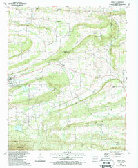
(17)- 1983 Map of Hon, 1984 Print
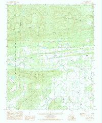 1983 Hon1984 Print · USGSThe Poteau River valley in the early eighties was defined by the ridges of the Ouachita range and the KANSAS CITY SOUTHERN rail line. Genealogists and local historians can trace family-named sites and small settlements like Hon, Winfield, and Evening Shade.
 - 1987 Map of Van Buren, 1988 Print
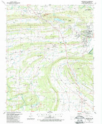
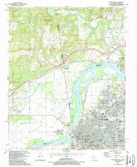
 1987 Van Buren1988 Print · USGSVan Buren and northern Fort Smith are captured in the late 1980s as the riverfront and rail lines continued to shape local industry. Genealogists can locate family landmarks like Antioch Cem, Old Concord Cem, and the Westark Com College campus.2 unique versions available
 - 1987 Map of Burnville, 1988 Print
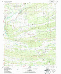 1987 Burnville1988 Print · USGSSebastian and Logan counties appear during the late eighties as a landscape of ridgelines and rural settlements. Researchers can locate family landmarks like Dawson Mem Cem and Clarks Chapel or trace the early energy footprint of numerous Gas Wells.
 - 1987 Map of Barber, 1988 Print
 1987 Barber1988 Print · USGSIn the late 1980s, this portion of the Arkansas Ozark foothills shows the expansion of the natural gas industry alongside traditional rural settlements. Genealogists can locate several local burial sites including Washburn Cem and Mannis Cem, or trace the Old RR Grade near Barber.
 - 1987 Map of Abbott, 1988 Print
 1987 Abbott1988 Print · USGSThe borderlands of Sebastian, Scott, and Logan counties are captured in the late eighties, showing a landscape defined by natural gas extraction and wooded wilderness. Researchers can trace an Old Railroad Grade and locate numerous family burial sites, including Union Ridge Cem and Sorrels Cem.
 - 1987 Map of Greenwood, 1988 Print
 1987 Greenwood1988 Print · USGSSebastian County during the late eighties reveals a landscape of industrial persistence and rural memory. Researchers can trace the legacy of local coal and gas extraction near Old Jenny Lind or locate ancestral sites like Stroud Cem and Palestine Ch.
 - 1987 Map of Hackett, 1988 Print
 1987 Hackett1988 Print · USGSThe borderlands of Arkansas and Oklahoma were defined by intensive mining and ridge-top terrain in the late eighties. Researchers can trace historic family burial sites at Old Union Cem and Macedonia Cem or follow the old Railroad corridors.
 - 1987 Map of Alma, 1988 Print
 1987 Alma1988 Print · USGSCrawford County settlements and river bottomlands are captured here in the late 1980s during a period of steady growth. Researchers can trace family names and rural landmarks from Yoestown and Cross Lanes to the Twelve Corner Cem and St Mathew Ch.
 - 1987 Map of South Fort Smith, 1988 Print
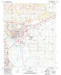
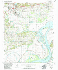
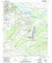
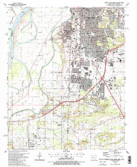 1987 South Fort Smith1988 Print · USGSThe borderlands of Arkansas and Oklahoma come alive in the late eighties, documenting the expansion of FORT SMITH and its satellite communities. Genealogists and local historians can trace family ties at Woodland Cem, find the site of St Scholastica Academy, or explore the industrial landscape of Arkoma and Pocola.2 unique versions available
 - 1987 Map of Charleston, 1988 Print
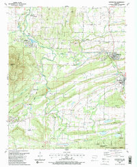
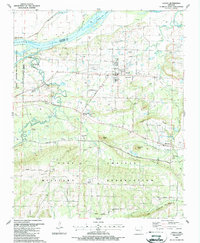
 1987 Charleston1988 Print · USGSFranklin and Sebastian Counties are captured here in the late eighties, showing the growth of Charleston alongside active energy extraction. Researchers can locate numerous family burial grounds like Morrow Cem and Nixon Cem or trace the northern limits of the Fort Chaffee Military Reservation.
 - 1987 Map of Huntington, 1988 Print
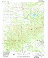
 1987 Huntington1988 Print · USGSSebastian County during the late 1980s reveals a transition from the coal-mining corridors of the north to the wilderness of the south. Researchers can trace historic industrial footprints and community roots through Midland, Frog Town, and the Huntington Cem.2 unique versions available
 - 1987 Map of Mulberry, 1988 Print
 1987 Mulberry1988 Print · USGSThe river valleys of Crawford and Franklin Counties come into focus in the late 1980s as gas extraction and rural life intersect. Researchers can locate family landmarks like Tate Cem, the Hall school, and community centers at Pleasant View and Vesta.2 unique versions available
 - 1987 Map of Barling, 1988 Print
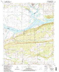
 1987 Barling1988 Print · USGSThe Arkansas River valley during the late eighties shows the expansion of Fort Smith and the massive infrastructure of Fort Chaffee. Researchers can trace family roots through several local burial sites like Barling Cem or locate the rural Rye Hill Ch and Howard Hill Ch.2 unique versions available
 - 1987 Map of Hartford, 1988 Print
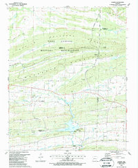
 1987 Hartford1988 Print · USGSThe Arkansas-Oklahoma borderlands in the late eighties show a landscape shaped by coal-era rail lines and the rise of Sugar Loaf Lake. Trace family roots at Red Yard Cem or Clark Cem, and locate the old railroad grade near Hartford.
 - 1987 Map of Lavaca, 1988 Print
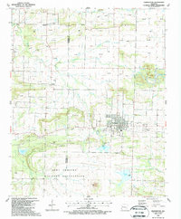
 1987 Lavaca1988 Print · USGSSebastian County in the late eighties shows a landscape of military training grounds and rural energy development. Genealogists can locate several small burial grounds like William Teague Cem and Indian Cem near the town of Lavaca.
 - 1987 Map of Fort Smith, 1988 Print
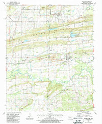
 1987 Fort Smith1988 Print · USGSThe riverfront communities of Arkansas and Oklahoma meet in the late eighties as urban growth expands across the valley. Researchers can trace historic church sites like Wyatt Mem Ch, legacy schools, and the industry of the Moffett Bottom gas fields.2 unique versions available
 - 1989 Map of Mena, 1991 Print
 1989 Mena1991 Print · USGSThe Ouachita and Kiamichi mountains define this borderland region in the late 1980s. Local historians can trace the Kansas City Southern RR corridor from Mena through settlements like Heavener and past the waters of Wister Lake.
End of results
Showing maps 1-17 of 17
Top cities of Sebastian County
- Fort Smith historical maps
- Greenwood historical maps
- Barling historical maps
- Lavaca historical maps
- Hackett historical maps
- Hartford historical maps
See more
Frequently asked questions
- What are the different types of historical maps available for Sebastian County?
- What is the oldest map of Sebastian County?
- Where can I purchase historical maps of Sebastian County for my home or office?
- Where can I download high-res historical maps of Sebastian County?
- Are there historical topographic maps available for Sebastian County?
- Is there historical aerial imagery available for Sebastian County?
- Where are historical maps of Sebastian County sourced from?