1970s Maps of Union County, Arkansas
Explore 5 historic maps of Union County from the 1970s. These maps offer a rare glimpse into what life looked like during the 1970s — showing old roads, neighborhoods, homes, and landmarks that have changed or disappeared over time.
Whether you're researching your family's past, planning a metal detecting trip, or studying how Union County's landscape evolved across the 1970s, these high-resolution maps are a powerful tool for exploring the history of this region.
- Focus on a specific era: All maps on this page are from the 1970s, giving you a focused view of this time period.
- See what’s changed: Compare century-old streets, trails, and buildings to today's modern landscape using overlays and satellite layers.
- Research with precision: Use these maps for genealogy, historical research, land use analysis, or educational projects.
- View, download, or print: Maps are fully viewable online in high resolution, and can be downloaded or printed for your own records.
Start exploring Union County's history through authentic maps from the 1970s. This is your window into the past.
Union County, AR maps
(5)- 1971 Map of Wesson, 1973 Print
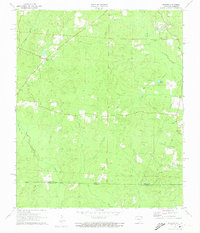 1971 Wesson1973 Print · USGSThe Arkansas-Louisiana state line south of Wesson comes to life in the early 1970s, showing a landscape of timber and creek-side communities. Researchers can trace family history at Three Creeks Cem or follow the path of an Old Railroad Grade.2 unique versions available
 - 1971 Map of Wesson SW, 1973 Print
 1971 Wesson SW1973 Print · USGSThe Arkansas-Louisiana state line comes alive in the early seventies, showing a landscape of bayous and rising energy production. Trace family roots and rural life at Dodge City, Salem Ch, and the winding banks of Cornie Bayou.
 - 1971 Map of Newell, 1973 Print
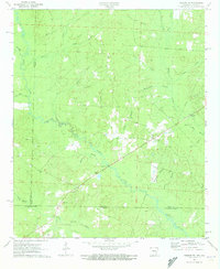
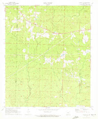
 1971 Newell1973 Print · USGSUnion County during the 1970s was a landscape defined by the intersection of rural life and a burgeoning energy economy. Researchers can trace historic family burial sites like Mt Willie Ch Cem and the extensive industrial infrastructure of the Shuler Oil and Gas Field.3 unique versions available
 - 1971 Map of Marsden, 1973 Print
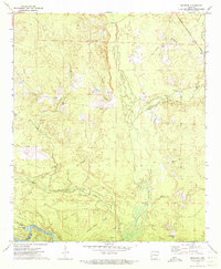 1971 Marsden1973 Print · USGSIn the early 1970s, this portion of Bradley County was a landscape of timbered ridges and river bottomlands. Genealogists and local historians can trace family locations near Marsden, Crossroads Ch, and the Cem Wearied Rest Ch.2 unique versions available
 - 1971 Map of Marysville, 1973 Print
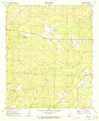
 1971 Marysville1973 Print · USGSThe borderlands of Union and Columbia County come to life in the early seventies, showing a rural landscape shaped by the petroleum industry. Genealogists and local historians can locate many rural landmarks, including Marysville Cemetery, Union Hill, and the expansive Shuler Oil and Gas Field.2 unique versions available
End of results
Showing maps 1-5 of 5
Top cities of Union County
- El Dorado historical maps
- Smackover historical maps
- Norphlet historical maps
- Huttig historical maps
- Strong historical maps
- Junction City historical maps
See more
Frequently asked questions
- What are the different types of historical maps available for Union County?
- What is the oldest map of Union County?
- Where can I purchase historical maps of Union County for my home or office?
- Where can I download high-res historical maps of Union County?
- Are there historical topographic maps available for Union County?
- Is there historical aerial imagery available for Union County?
- Where are historical maps of Union County sourced from?