1980s Maps of Union County, Arkansas
Explore 16 historic maps of Union County from the 1980s. These maps offer a rare glimpse into what life looked like during the 1980s — showing old roads, neighborhoods, homes, and landmarks that have changed or disappeared over time.
Whether you're researching your family's past, planning a metal detecting trip, or studying how Union County's landscape evolved across the 1980s, these high-resolution maps are a powerful tool for exploring the history of this region.
- Focus on a specific era: All maps on this page are from the 1980s, giving you a focused view of this time period.
- See what’s changed: Compare century-old streets, trails, and buildings to today's modern landscape using overlays and satellite layers.
- Research with precision: Use these maps for genealogy, historical research, land use analysis, or educational projects.
- View, download, or print: Maps are fully viewable online in high resolution, and can be downloaded or printed for your own records.
Start exploring Union County's history through authentic maps from the 1980s. This is your window into the past.
Union County, AR maps
(16)- 1981 Map of New Union
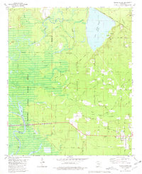
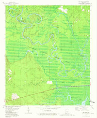 1981 New Union1981 Print · USGSThe river bottomlands of southern Arkansas are captured here in the early eighties, showcasing the intersection of the Ouachita River and Saline River. Genealogists and researchers can trace the vicinity of New Union or locate specific river landmarks like Prairie Island Landing and Fishtrap Lake.2 unique versions available
 - 1981 Map of Urbana
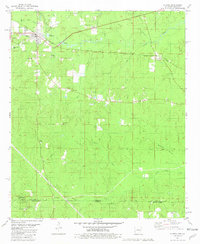
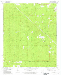
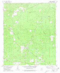 1981 Urbana1981 Print · USGSUnion County, Arkansas, during the early eighties shows a productive landscape of timber and petroleum interests. Genealogists and local historians can trace family locations through numerous sites like Urbana Cem, Liberty Ch, and the Missouri Pacific railroad corridor.
 - 1981 Map of Lockhart
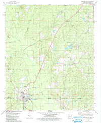
 1981 Lockhart1981 Print · USGSThe Arkansas-Louisiana borderlands in the early eighties were defined by petroleum extraction and quiet rural parishes. Genealogists can trace the location of community centers like Lockhart and family-named sites such as Hillsboro Cem and Olive Branch Ch.
 - 1981 Map of El Dorado West
 1981 El Dorado West1981 Print · USGSEl Dorado was a thriving center of the Arkansas oil industry during the late twentieth century. Genealogists and historians can trace local landmarks like Old Parkers Chapel Cem, Hickory Grove Chapel, and the South El Dorado Oil Field.2 unique versions available
 - 1981 Map of Marais Saline
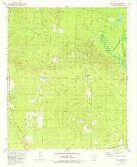
 1981 Marais Saline1981 Print · USGSLower Arkansas river country is captured here in the early eighties as the Felsenthal wetlands meet industrial lake development. Genealogists and local historians can trace family-named routes like J D Pippen Road or locate the Arkadelphia Cem and Godfrey Landing.
 - 1981 Map of Strong
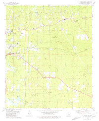
 1981 Strong1981 Print · USGSThe Arkansas-Louisiana borderlands come into focus in the early eighties, centered on the rail-driven town of Strong. Researchers can trace old family burial sites and rural communities like Victoria or locate landmarks such as Batts Chapel and the Strong Oil Field.
 - 1981 Map of Junction City
 1981 Junction City1981 Print · USGSJunction City sits squarely on the Arkansas-Louisiana border in the early eighties, surrounded by oil fields and bayou country. Trace family roots at Graceland Cem and Caledonia Ch, or locate old homesites near Upland and Lamberton.
 - 1981 Map of Harrell Brake
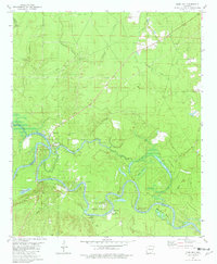
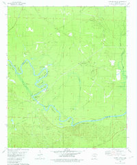 1981 Harrell Brake1981 Print · USGSThe riverfront of the late 1970s is preserved here as the Ouachita River snakes through the bottomlands of Calhoun and Union counties. Genealogists and researchers can trace the locations of Bangs Landing, Wilmington Landing, and the settlement of Lawson.
 - 1981 Map of Gardner
 1981 Gardner1981 Print · USGSUnion County and Union Parish sit at the state line in the early eighties, where timber and oil intersect with small-town life. Genealogists and historians can trace numerous rural sites like Pleasant Grove Cem, the settlement of Aurelle, and the Missouri Pacific line.
 - 1981 Map of Moro Bay
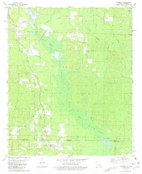
 1981 Moro Bay1981 Print · USGSIn the river bottoms of southern Arkansas during the early eighties, the landscape was a mix of quiet wetlands and active oil production. Genealogists and historians can trace family locations near the Hilo Cem, explore the early footprint of Moro Bay State Park, and locate the historic Careyville Landing river access.
 - 1981 Map of El Dorado East
 1981 El Dorado East1981 Print · USGSThe oil-rich landscape east of El Dorado is captured here in the early eighties, showing a complex network of wells and refineries. Local historians can trace established communities like Old Union and locate rural landmarks such as Union High Sch and Shady Grove Cem.
 - 1981 Map of Huttig
 1981 Huttig1981 Print · USGSThe Ouachita River borderlands near the Arkansas-Louisiana line come into focus during this early 1980s survey. Researchers can trace the timber and rail roots of Huttig or find local landmarks like the Old Lapile Cem and the Huttig Lookout Tower.
 - 1981 Map of New London
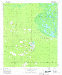
 1981 New London1981 Print · USGSUnion County, Arkansas, is captured here in the late seventies as an active center of oil production and rural community life. Researchers can locate specific family landmarks and vanished industrial footprints like McLendon Mill, Wallace Cem, and the Old Railroad Grade.
 - 1981 Map of Felsenthal Dam
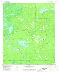 1981 Felsenthal Dam1981 Print · USGSThe Ouachita River bottomlands are captured here in the early eighties as new infrastructure began to reshape the landscape. Local historians can trace the transition from the Old Railroad Grade to modern works like the Felsenthal Lock and Dam and the Macedonia Cem.
 - 1985 Map of El Dorado, 1986 Print
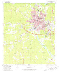
 1985 El Dorado1986 Print · USGSSouth-central Arkansas and the Louisiana borderlands appear here in the mid-1980s, defined by the energy industry and river bottomlands. Genealogists and historians can locate rural landmarks like Old Parkers Chapel Cem, the Smackover Gas Field, and the El Dorado & Wesson RR.2 unique versions available
 - 1989 Map of El Dorado, 1990 Print
 1989 El Dorado1990 Print · USGSThe Arkansas-Louisiana borderlands in the late eighties show a landscape of heavy industry and wildlife conservation centered on the Ouachita River. Researchers can trace the legacy of timber and transport via the Missouri Pacific RR, Poison Springs State Forest, and the vast Felsenthal Pool.
End of results
Showing maps 1-16 of 16
Top cities of Union County
- El Dorado historical maps
- Smackover historical maps
- Norphlet historical maps
- Huttig historical maps
- Strong historical maps
- Junction City historical maps
See more
Frequently asked questions
- What are the different types of historical maps available for Union County?
- What is the oldest map of Union County?
- Where can I purchase historical maps of Union County for my home or office?
- Where can I download high-res historical maps of Union County?
- Are there historical topographic maps available for Union County?
- Is there historical aerial imagery available for Union County?
- Where are historical maps of Union County sourced from?