1990s Maps of Van Buren County, Arkansas
Explore 8 historic maps of Van Buren County from the 1990s. These maps offer a rare glimpse into what life looked like during the 1990s — showing old roads, neighborhoods, homes, and landmarks that have changed or disappeared over time.
Whether you're researching your family's past, planning a metal detecting trip, or studying how Van Buren County's landscape evolved across the 1990s, these high-resolution maps are a powerful tool for exploring the history of this region.
- Focus on a specific era: All maps on this page are from the 1990s, giving you a focused view of this time period.
- See what’s changed: Compare century-old streets, trails, and buildings to today's modern landscape using overlays and satellite layers.
- Research with precision: Use these maps for genealogy, historical research, land use analysis, or educational projects.
- View, download, or print: Maps are fully viewable online in high resolution, and can be downloaded or printed for your own records.
Start exploring Van Buren County's history through authentic maps from the 1990s. This is your window into the past.
Van Buren County, AR maps
(8)- 1990 Map of Jerusalem, 1995 Print
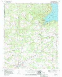
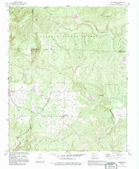 1990 Jerusalem1995 Print · USGSThe Arkansas Ozark foothills are captured here in the 1990s as the community of Jerusalem borders the national forest. Genealogists can trace family roots through numerous upland landmarks including Thompson Chapel, Cato Cem, and the high-altitude settlement of Stumptoe.
 - 1990 Map of Cleveland, 1995 Print
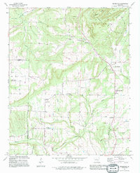
 1990 Cleveland1995 Print · USGSCentral Arkansas rural life in the 1990s is captured here along the Van Buren and Conway County line. Genealogists can trace family roots at Upchurch Cem, Moores Chapel, and the old Center School near the community of Cleveland.
 - 1991 Map of Bee Branch, 1995 Print
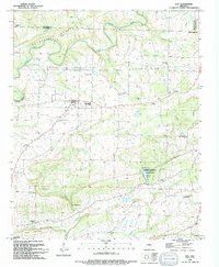
 1991 Bee Branch1995 Print · USGSBee Branch and the Southside community are documented during the early nineties as they expanded along the ridges of Van Buren County. Researchers can pinpoint historic rural landmarks like Soldier Memorial Cem, Southside Schools, and Pleasant Valley Ch.
 - 1991 Map of Formosa, 1995 Print
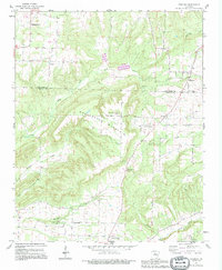 1991 Formosa1995 Print · USGSThe hills of Van Buren and Conway counties come alive in the early 1990s as this map traces the family-named settlements of the Arkansas highlands. Researchers can locate remote burial sites and rural steeples like Woolverton Mountain Cem, Halbrooks Cem, and Union Hill Ch.
 - 1991 Map of Quitman, 1995 Print
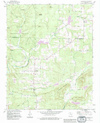
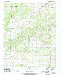
 1991 Quitman1995 Print · USGSQuitman and the surrounding Cleburne County hills are shown during a period of transition as rural homesteads met the growing recreation of the lake. Researchers can locate family landmarks like Aldridge Cem, Wesley Chapel, and the historic site of Goff Ferry.
 - 1992 Map of Russellville, 1993 Print
 1992 Russellville1993 Print · USGSCentral Arkansas in the early nineties shows a landscape defined by the Arkansas River valley and the surrounding national forests. Trace the development of river towns like Russellville and Dardanelle alongside landmarks such as Lake Dardanelle and Magazine Mtn.
 - 1994 Map of Damascus
 1994 Damascus1994 Print · USGSThe hill country of Faulkner and Van Buren counties comes to life in the mid-1990s as a landscape of small settlements and creek-bottom farms. Researchers can trace family history through several burial sites like Spires Cem or locate the Old Indian Reservation Boundary.
 - 1994 Map of Guy
 1994 Guy1994 Print · USGSThe northern reaches of Faulkner County are shown here in the mid-1990s, centering on the small community of Guy. Genealogists and local historians can trace family roots through several legacy sites like Copperas Springs Cem, G W Perkins School, and New Home Ch.
End of results
Showing maps 1-8 of 8
Top cities of Van Buren County
Frequently asked questions
- What are the different types of historical maps available for Van Buren County?
- What is the oldest map of Van Buren County?
- Where can I purchase historical maps of Van Buren County for my home or office?
- Where can I download high-res historical maps of Van Buren County?
- Are there historical topographic maps available for Van Buren County?
- Is there historical aerial imagery available for Van Buren County?
- Where are historical maps of Van Buren County sourced from?