2000s (21st Century) Maps of Peaceful Pines, California
Explore 5 historic maps of Peaceful Pines from the 2000s (21st Century). These maps offer a rare glimpse into what life looked like during the 2000s — showing old roads, neighborhoods, homes, and landmarks that have changed or disappeared over time.
Whether you're researching your family's past, planning a metal detecting trip, or studying how Peaceful Pines's landscape evolved across the 2000s, these high-resolution maps are a powerful tool for exploring the history of this region.
- Focus on a specific era: All maps on this page are from the 2000s, giving you a focused view of this time period.
- See what’s changed: Compare century-old streets, trails, and buildings to today's modern landscape using overlays and satellite layers.
- Research with precision: Use these maps for genealogy, historical research, land use analysis, or educational projects.
- View, download, or print: Maps are fully viewable online in high resolution, and can be downloaded or printed for your own records.
Start exploring Peaceful Pines's history through authentic maps from the 2000s. This is your window into the past.
Peaceful Pines, CA maps
(5)- 2001 Map of Dardanelles Cone, 2004 Print
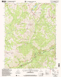 2001 Dardanelles Cone2004 Print · USGSThe high Sierra Nevada backcountry of Alpine and Tuolumne counties is captured here at the turn of the century. Trace the high-altitude route of the Pacific Crest National Scenic Trail past peaks like Dardanelles Cone and the Highland Lakes.
 - 2012 Map of Dardanelles Cone, 2012 Print
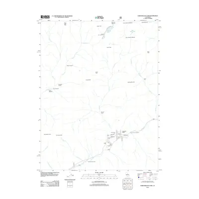 2012 Dardanelles Cone2012 Print · USGSCovers Peaceful Pines, including Tuolumne County, Alpine County, and other nearby areas
 - 2015 Map of Dardanelles Cone, 2015 Print
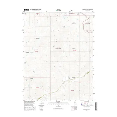 2015 Dardanelles Cone2015 Print · USGSCovers Peaceful Pines, including Tuolumne County, Alpine County, and other nearby areas
 - 2018 Map of Dardanelles Cone, 2018 Print
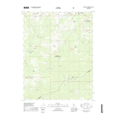 2018 Dardanelles Cone2018 Print · USGSCovers Peaceful Pines, including Tuolumne County, Alpine County, and other nearby areas
 - 2021 Map of Dardanelles Cone, 2021 Print
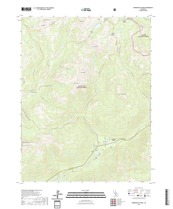 2021 Dardanelles Cone2021 Print · USGSThe high Sierra peaks and forest boundaries of Alpine and Tuolumne counties are shown here as they appeared in the early 2020s. Hikers and researchers can trace the Pacific Crest National Scenic Trl past Wolf Creek Pass and identify landmarks like Dardanelles Cone.
End of results
Showing maps 1-5 of 5
Frequently asked questions
- What are the different types of historical maps available for Peaceful Pines?
- What is the oldest map of Peaceful Pines?
- Where can I purchase historical maps of Peaceful Pines for my home or office?
- Where can I download high-res historical maps of Peaceful Pines?
- Are there historical topographic maps available for Peaceful Pines?
- Is there historical aerial imagery available for Peaceful Pines?
- Where are historical maps of Peaceful Pines sourced from?