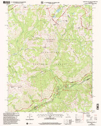
2001 Map of Dardanelles Cone
USGS Topo · Published 2004About this map
Dardanelles Cone and The Dardanelles dominate the southwestern skyline of this high-altitude landscape within the Stanislaus National Forest. At the turn of the millennium, this terrain remained a preserved wilderness, defined by the Carson-Iceberg Wilderness boundary and the path of the Pacific Crest National Scenic Trail as it crosses through the Arnot Ranger District. The drainage patterns of Clark Fork and Highland Creek dictate the local geography, leading toward established recreational outposts like the Clark Fork Horse Camp and Lianona Camp. Numerous peaks including Arnot Peak, Hiram Peak, and Airola Peak provide a dramatic vertical profile to the area. For those studying the borderlands of the Sierra, the map clearly delineates the Alpine and Tuolumne County line as it cuts through the glaciated valleys and high meadows like Upper Gardner Meadow.
Find a feature on this map
57 named features on this map. Tap any name to fly to it.
Don’t see what you’re looking for? This feature index may not catch every label — zoom into the map to look around manually.
Map Details
Editions of this 2001 Dardanelles Cone Map
This is the sole edition of this map. No revisions or reprints were ever made.
Other maps of this area

1889 · Markleeville
USGS Topo · 1:125,000

1891 · Markleeville
USGS Topo · 1:125,000

1893 · Markleeville
USGS Topo · 1:125,000

1896 · Dardanelles
USGS Topo · 1:125,000

1898 · Dardanelles
USGS Topo · 1:125,000

1948 · Walker Lake
USGS Topo · 1:250,000

1956 · Topaz Lake
USGS Topo · 1:62,500

1956 · Markleeville
USGS Topo · 1:62,500

1956 · Dardanelles Cone
USGS Topo · 1:62,500

1956 · Sonora Pass
USGS Topo · 1:62,500