2020s Maps of Oakley, California
Explore 6 historic maps of Oakley from the 2020s. These maps offer a rare glimpse into what life looked like during the 2020s — showing old roads, neighborhoods, homes, and landmarks that have changed or disappeared over time.
Whether you're researching your family's past, planning a metal detecting trip, or studying how Oakley's landscape evolved across the 2020s, these high-resolution maps are a powerful tool for exploring the history of this region.
- Focus on a specific era: All maps on this page are from the 2020s, giving you a focused view of this time period.
- See what’s changed: Compare century-old streets, trails, and buildings to today's modern landscape using overlays and satellite layers.
- Research with precision: Use these maps for genealogy, historical research, land use analysis, or educational projects.
- View, download, or print: Maps are fully viewable online in high resolution, and can be downloaded or printed for your own records.
Start exploring Oakley's history through authentic maps from the 2020s. This is your window into the past.
Oakley, CA maps
(6)- 2021 Map of Antioch South, 2021 Print
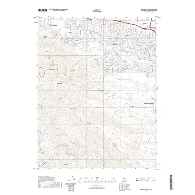 2021 Antioch South2021 Print · USGSCovers Oakley, including Antioch, Pittsburg, and other nearby areas
 - 2021 Map of Brentwood, 2021 Print
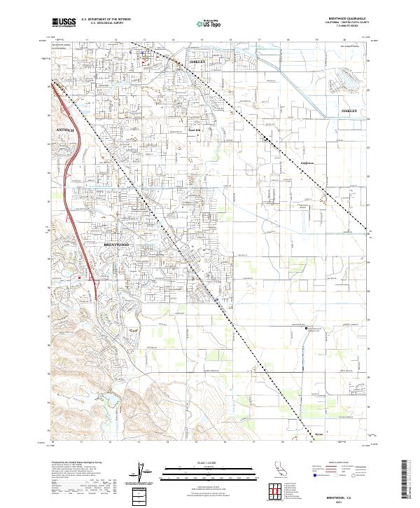 2021 Brentwood2021 Print · USGSBrentwood and Oakley are shown at a peak of modern growth in this 2021 survey of the California Delta's edge. Genealogists and local historians can trace the community's evolution through landmarks like the Byron Brentwood Knightsen Cem, Liberty High Sch, and the winding Marsh Creek Regional Trl.
 - 2021 Map of Woodward Island, 2021 Print
 2021 Woodward Island2021 Print · USGSThe Sacramento-San Joaquin River Delta comes alive in this contemporary view of its intricate waterways and reclaimed islands. Trace the residential canals of Discovery Bay and the industrial path of the Mokelumne Aqueduct past Orwood.
 - 2021 Map of Antioch North, 2021 Print
 2021 Antioch North2021 Print · USGSThe Sacramento-San Joaquin Delta comes into focus in this recent survey, showcasing the meeting of industrial cities and marshland islands. Trace local history through Collinsville Cem, the hilltop roads of Montezuma Hills, and the waterfronts of Antioch and Pittsburg.
 - 2021 Map of Jersey Island, 2021 Print
 2021 Jersey Island2021 Print · USGSThe California Delta's intricate network of islands and channels is captured here in the early 2020s. Researchers can trace the levee-lined borders of Jersey Island, the residential waterways of Bethel Island, and historic transit points like the Twitchell Island Ferry Rd.
 - 2023 Map of Antioch South, 2023 Print
 2023 Antioch South2023 Print · USGSContra Costa County in the 2020s shows the convergence of modern suburban development and deep-rooted industrial history. Trace the legacy of early coal mining and ranching through Rose Hill Cem, Stewartville, and the extensive trail system of Oil Canyon TRL.
End of results
Showing maps 1-6 of 6
Top cities near Oakley
- Fairfield historical maps
- Antioch historical maps
- Tracy historical maps
- San Ramon historical maps
- Pittsburg historical maps
- Brentwood historical maps
See more
Top neighborhoods of Oakley
Frequently asked questions
- What are the different types of historical maps available for Oakley?
- What is the oldest map of Oakley?
- Where can I purchase historical maps of Oakley for my home or office?
- Where can I download high-res historical maps of Oakley?
- Are there historical topographic maps available for Oakley?
- Is there historical aerial imagery available for Oakley?
- Where are historical maps of Oakley sourced from?