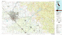
Old Maps of Calwa, Fresno County for Metal Detecting
Plan your next treasure hunt with 17 historic maps of Calwa. Find old homesites, ghost towns, trails, and gathering spots that may be lost to time — perfect for identifying promising metal detecting locations.
- Locate forgotten sites: Uncover places like long-lost settlements, abandoned rail lines, or gathering spots.
- Plan better hunts: Use map overlays combined with LiDAR or satellite views to narrow in on historically rich areas.
- Made for detectorists: Thousands of hobbyists use these maps to discover relics, coins, and hidden history.
Use these historic maps to boost your research and find new opportunities beneath the surface of Calwa.
Calwa, Fresno County maps
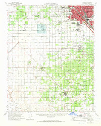
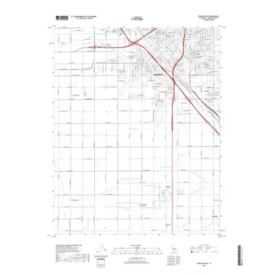
(17)- 1923 Map of Fresno
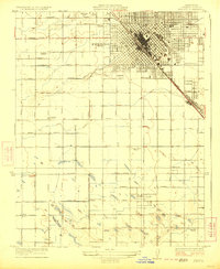 1923 Fresno1923 Print · USGSFresno was rapidly expanding into its surrounding agricultural colonies during the early twenties as a major Central Valley rail hub. Researchers can trace the development of local school districts and rural settlements like Calwa, Covell, and the American Colony School.2 unique versions available
 - 1946 Map of Fresno South, 1947 Print
 1946 Fresno South1947 Print · USGSThe Central Valley hub of Fresno is captured just after the war, showing the city's transition from a rail-dependent center to a modern agricultural and aviation base. Genealogists can trace family roots through neighborhood schools like Edison Technical Sch and sites such as Ararat Cemetery.
 - 1947 Map of Fresno South
 1947 Fresno South1947 Print · USGSPost-war Fresno and its agricultural outskirts come to life just as the Central Valley's irrigation network reached its peak. Genealogists and local historians can trace family roots through numerous country schools like Orange Center Sch and mapped cemeteries including Ararat Cemetery.
 - 1948 Map of Fresno
 1948 Fresno1948 Print · USGSThe San Joaquin Valley and the High Sierra met during a period of rapid post-war growth and industrial expansion. Genealogists and researchers can trace family lines through small rail towns like Calwa City, find early aviation sites at Fresno-Chandler, or locate the Fresno Copper Mine.
 - 1955 Map of Fresno
 1955 Fresno1955 Print · USGSThe Central Valley and High Sierra meet in this mid-fifties study of California’s agricultural and wilderness heart. Researchers can trace the rail-side growth of Sanger, Selma, and Reedley or locate high-altitude landmarks like Mt Whitney and Hume Lake.
 - 1956 Map of Fresno
 1956 Fresno1956 Print · USGSThe Central Valley and High Sierra meet in this mid-fifties survey of a rapidly developing California interior. Researchers can trace the rail-and-water networks of Visalia, the footprint of Tulare Lake, and the remote heights of Sequoia National Park.
 - 1958 Map of Fresno
 1958 Fresno1958 Print · USGSThe Central Valley and High Sierra meet in this mid-century survey of the California heartland. Researchers can trace the rail-and-road network connecting Fresno and Visalia or locate high-country landmarks like Mt Whitney and Sequoia National Park.
 - 1960 Map of Fresno
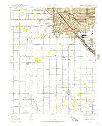
 1960 Fresno1960 Print · USGSThe San Joaquin Valley's mid-century agricultural boom meets the high peaks of the Sierra Nevada in this detailed survey. Genealogists and historians can trace the rail-driven growth of Fresno, Tulare, and Visalia or locate family roots in smaller towns like Raisin City and Calwa City.2 unique versions available
 - 1962 Map of Fresno, 1968 Print
 1962 Fresno1968 Print · USGSThe Central Valley and High Sierra meet in this mid-century survey, capturing the region's massive irrigation systems and mountain wilderness. Researchers can trace the rail corridors of the Southern Pacific and locate landmarks like the Tulare Lake Bed and Mount Whitney.3 unique versions available
 - 1963 Map of Fresno South, 1964 Print
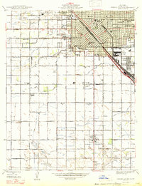
 1963 Fresno South1964 Print · USGSSouthern Fresno and the surrounding agricultural tracts are seen here in the early sixties as urban growth began to edge into the surrounding farm colonies. Researchers can trace family roots through numerous local landmarks, including Easton, Washington Colony Cem, and Oleander.4 unique versions available
 - 1963 Map of Fresno, 1966 Print
 1963 Fresno1966 Print · USGSFresno and its surrounding agricultural colonies are captured here during a period of significant mid-century development. Genealogists and researchers can trace family landmarks and rural roots at Raisin City, Caruthers, and the Fresno Memorial Gardens.
 - 1966 Map of Fresno
 1966 Fresno1966 Print · USGSCentral California in the mid-1960s showcases a high-production agricultural valley rising into the granite peaks of the High Sierra. Researchers can trace irrigation networks, rail spurs like the Southern Pacific, and landmarks from Mount Whitney to the Lemoore Naval Air Station.
 - 1982 Map of Fresno, 1983 Print
 1982 Fresno1983 Print · USGSThe San Joaquin Valley's agricultural and urban landscape is captured here in the early eighties as Fresno expanded northward. Researchers can trace the rail lines of the Southern Pacific RR and identify landmarks like Raisin City and Kingsburg.2 unique versions available
 - 2012 Map of Fresno South, 2012 Print
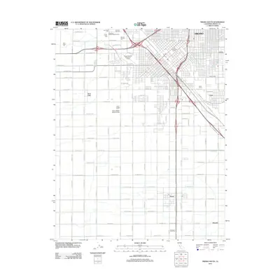 2012 Fresno South2012 Print · USGSCovers Calwa, including Fresno, Oleander, and other nearby areas
 - 2015 Map of Fresno South, 2015 Print
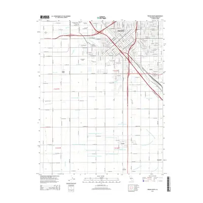 2015 Fresno South2015 Print · USGSCovers Calwa, including Fresno, Oleander, and other nearby areas
 - 2018 Map of Fresno South, 2018 Print
 2018 Fresno South2018 Print · USGSCovers Calwa, including Fresno, Oleander, and other nearby areas
 - 2021 Map of Fresno South, 2021 Print
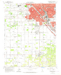
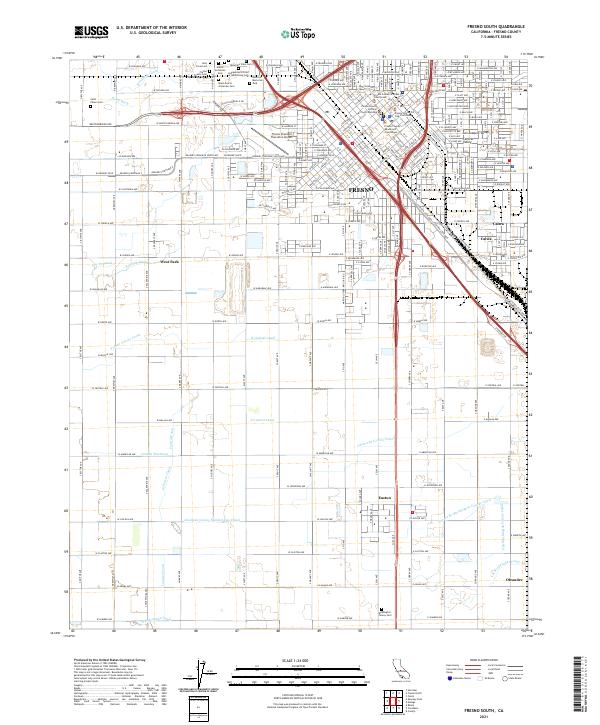 2021 Fresno South2021 Print · USGSFresno and its southern agricultural suburbs are captured here in the early 2020s, showcasing the intersection of urban justice centers and irrigation-dependent farmland. Researchers can trace local history through numerous burial sites like Ararat Armenian Cem and irrigation landmarks like the Houghton Canal.
End of results
Showing maps 1-17 of 17
Frequently asked questions
- What are the different types of historical maps available for Calwa?
- What is the oldest map of Calwa?
- Where can I purchase historical maps of Calwa for my home or office?
- Where can I download high-res historical maps of Calwa?
- Are there historical topographic maps available for Calwa?
- Is there historical aerial imagery available for Calwa?
- Where are historical maps of Calwa sourced from?