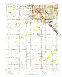
1946 Map of Fresno South
USGS Topo · Published 1947About this map
Fresno serves as the focal point of this 1946 culture revision, revealing a post-war landscape where urban density gives way to a highly organized network of agricultural irrigation. The city's growth is anchored by key institutions like the Theodore Roosevelt High Sch and the Fresno County General Hospital, while the industrial and logistics corridor follows the Southern Pacific and A T & S F rail lines through Calwa City.
Find a feature on this map
62 named features on this map. Tap any name to fly to it.
Don’t see what you’re looking for? This feature index may not catch every label — zoom into the map to look around manually.
Map Details
Editions of this 1946 Fresno South Map
This is the sole edition of this map. No revisions or reprints were ever made.
Other maps of this area

1921 · Bullard
USGS Topo · 1:31,680

1923 · Kearney Park
USGS Topo · 1:31,680

1923 · Malaga
USGS Topo · 1:31,680

1923 · Herndon
USGS Topo · 1:31,680

1923 · Fresno
USGS Topo · 1:31,680

1923 · Clovis
USGS Topo · 1:31,680

1923 · Bullard
USGS Topo · 1:31,680

1924 · Conejo
USGS Topo · 1:31,680

1925 · Raisin
USGS Topo · 1:31,680

1925 · Caruthers
USGS Topo · 1:31,680