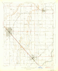
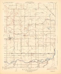
1924 Map of Conejo
USGS Topo · Published 1924About this map
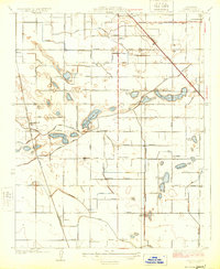
The agricultural landscape of Fresno County unfolds across this 1922 survey, defined by a meticulously engineered network of irrigation canals and drainage ditches. The settlement at Conejo sits at the intersection of early 20th-century transit, where the Southern Pacific and Atchison Topeka and Santa Fe rail lines cut through the valley. This era reveals a transition from natural surface water to a managed system, as seen in the collection of ponds such as Rockwell Pond and Willow Lake interspersed with man-made works like South Ditch and Chicago Ditch.
Find a feature on this map
44 named features on this map. Tap any name to fly to it.
Don’t see what you’re looking for? This feature index may not catch every label — zoom into the map to look around manually.
Map Details
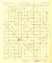
Editions of this 1924 Conejo Map
This is the sole edition of this map. No revisions or reprints were ever made.
Other maps of this area

1923 · Malaga
USGS Topo · 1:31,680
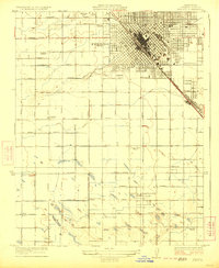
1923 · Fresno
USGS Topo · 1:31,680
1923 · Sanger
USGS Topo · 1:31,680
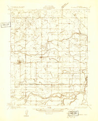
1924 · Riverdale
USGS Topo · 1:31,680
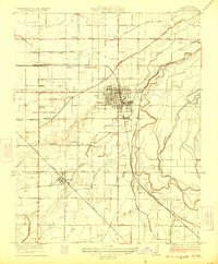
1924 · Selma
USGS Topo · 1:31,680
1925 · Caruthers
USGS Topo · 1:31,680
1926 · Burris Park
USGS Topo · 1:31,680
1927 · Laton
USGS Topo · 1:31,680
1927 · Riverdale
USGS Topo · 1:31,680
1946 · Malaga
USGS Topo · 1:24,000