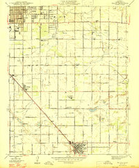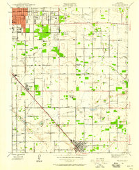
1946 Map of Malaga
USGS Topo · Published 1946About this map
Fresno serves as the urban anchor for this post-war landscape, where established grid-patterned streets meet the surrounding agricultural heartland. The southeastern expansion of the city is evident, bordered by the County Hospital and the sprawling Fair Grounds. This era marks a peak in the region's viticulture and agricultural research, highlighted by the presence of the Alta Vineyards Mattei Plant and the nearby U S Experimental Station. The layout reveals an intricate web of irrigation through the Fresno Canal and Southern Pacific Canal, which sustained the many small settlements and family farms along the rail lines.
Find a feature on this map
62 named features on this map. Tap any name to fly to it.
Don’t see what you’re looking for? This feature index may not catch every label — zoom into the map to look around manually.
Map Details
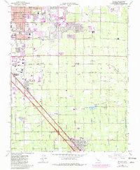
Editions of this 1946 Malaga Map
This is the sole edition of this map. No revisions or reprints were ever made.
Historical Maps of Fresno Through Time
8 maps found