
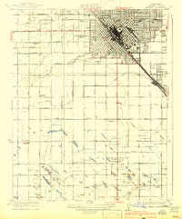
1923 Map of Fresno
USGS Topo · Published 1923About this map
The growing city of Fresno radiates from a dense diagonal grid at the intersection of the Southern Pacific and Atchison Topeka and Santa Fe railroads. This 1923 survey reveals a landscape transitioning from the urban core to the surrounding agricultural colonies that defined the Central Valley's development. Outside the city limits, the terrain is structured by an intensive network of named roads like Whites Bridge Road and Kearney Boulevard, serving a constellation of rural education centers including the American Colony School, West Park School, and Oleander School. To the northwest, Roeding Park provides a managed green space at the city's edge, while the southeast is anchored by the industrial and rail siding at Calwa. The prevalence of schools and the precise irrigation-driven grid illustrate the organized nature of early 20th-century settlement in Fresno County.
Find a feature on this map
44 named features on this map. Tap any name to fly to it.
Don’t see what you’re looking for? This feature index may not catch every label — zoom into the map to look around manually.
Map Details
Editions of this 1923 Fresno Map
2 editions found
Other maps of this area

1921 · Bullard
USGS Topo · 1:31,680

1923 · Kearney Park
USGS Topo · 1:31,680

1923 · Malaga
USGS Topo · 1:31,680

1923 · Herndon
USGS Topo · 1:31,680

1923 · Clovis
USGS Topo · 1:31,680

1923 · Bullard
USGS Topo · 1:31,680

1924 · Conejo
USGS Topo · 1:31,680

1925 · Raisin
USGS Topo · 1:31,680

1925 · Caruthers
USGS Topo · 1:31,680
1946 · Malaga
USGS Topo · 1:24,000