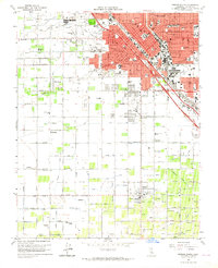
1963 Map of Fresno South
USGS Topo · Published 1964About this map
The southern grid of Fresno and its surrounding agricultural colonies define this 1960s landscape, where urban development meets a dense network of irrigation infrastructure. Industrial corridors and residential expansion push south along the Southern Pacific and Atchison Topeka and Santa Fe railroads, particularly around the rail junction at Calwa. The map reveals the intricate water management system essential to the San Joaquin Valley, featuring a web of namesake canals like the Washington Canal and specialized colony lines such as Colony No 1 Canal.
Find a feature on this map
113 named features on this map. Tap any name to fly to it.
Don’t see what you’re looking for? This feature index may not catch every label — zoom into the map to look around manually.
Map Details
Editions of this 1963 Fresno South Map
4 editions found
Other maps of this area

1921 · Bullard
USGS Topo · 1:31,680

1923 · Kearney Park
USGS Topo · 1:31,680

1923 · Malaga
USGS Topo · 1:31,680

1923 · Herndon
USGS Topo · 1:31,680

1923 · Fresno
USGS Topo · 1:31,680

1923 · Clovis
USGS Topo · 1:31,680

1923 · Bullard
USGS Topo · 1:31,680

1924 · Conejo
USGS Topo · 1:31,680

1925 · Raisin
USGS Topo · 1:31,680

1925 · Caruthers
USGS Topo · 1:31,680