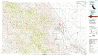
Old Maps of Polvadero Ranch, California for Academic Research
Study the evolution of Polvadero Ranch with 17 high-resolution historic maps. Whether you're teaching, researching, or modeling changes in land use, these maps provide essential visual documentation of urban, environmental, and geographic change.
- Analyze long-term change: Track patterns in development, transportation, and natural features.
- Ideal for environmental or urban studies: Support academic projects with primary historical map data.
- Use in the classroom or lab: Educators and researchers rely on these maps to bring historical context to life.
These maps are a powerful tool for teaching, research, and visualizing how Polvadero Ranch has changed over the decades.
Polvadero Ranch, CA maps
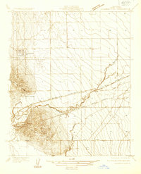
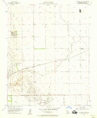
(17)- 1912 Map of Coalinga
 1912 Coalinga1912 Print · USGSThe western San Joaquin Valley comes into focus in the early twentieth century as oil and rail transform the landscape. Genealogists and historians can trace the industrial roots of Oilfields and Coalinga or locate the San Joaquin Valley Coal Mine.4 unique versions available
 - 1933 Map of Guijarral Hills
 1933 Guijarral Hills1933 Print · USGSFresno County's western oil and ranching lands are captured here in the early thirties. Local historians can trace the industrial footprint of the Oil Tank Farm and the rail-side settlement at Turk along the Southern Pacific line.
 - 1936 Map of Guijarral Hills, 1947 Print
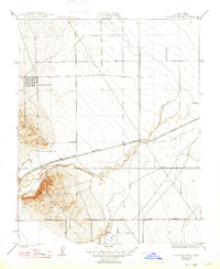 1936 Guijarral Hills1947 Print · USGSFresno County's western edge was a hub of energy and ranching in the 1930s. Researchers can trace early oil infrastructure at the Oil Tank Farm and Caliola Pumping Sta, or locate the historic Pleasant Valley Ranch near the Southern Pacific line.
 - 1937 Map of Guijarral Hills
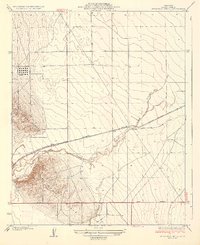 1937 Guijarral Hills1937 Print · USGSFresno County ranching and the early oil industry collide in this 1930s survey of the Central Valley. Trace the Southern Pacific rail line and identify family-held lands like Pleasant Valley Ranch and the industrial Oil Tank Farm.2 unique versions available
 - 1942 Map of Polvadero Gap
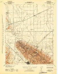 1942 Polvadero Gap1942 Print · USGSCentral California ranching and early rail corridors appear in high detail during the early war years. Genealogists and local historians can locate early family holdings like Kreyenhagen Ranch, the town of Huron, and the Southern Pacific line.2 unique versions available
 - 1948 Map of Santa Cruz
 1948 Santa Cruz1948 Print · USGSThe Central Coast and San Joaquin Valley meet in this mid-century look at the region's agricultural and military geography. Genealogists and historians can trace the paths of El Camino Real, locate family farms near Hollister, or study the footprint of the Fort Ord Military Reservation.2 unique versions available
 - 1955 Map of Santa Cruz
 1955 Santa Cruz1955 Print · USGSCoastal Monterey Bay and the fertile Salinas Valley are captured here during the post-war expansion of the mid-fifties. Researchers can trace the era's rail-and-road network via the Southern Pacific lines and find landmarks like Fort Ord or the Lonoak School.
 - 1956 Map of Guijarral Hills, 1957 Print
 1956 Guijarral Hills1957 Print · USGSThe Central Valley oil boom was in full swing during the late fifties, transforming this landscape near Guijarral Hills. Genealogists and historians can trace industrial footprints at Turk, the Caliola Pumping Station, and the Labor Camp.3 unique versions available
 - 1957 Map of Santa Cruz
 1957 Santa Cruz1957 Print · USGSCentral California comes into sharp focus during the late fifties, from the fog-swept Monterey Bay to the sun-drenched San Joaquin Valley. Genealogists and historians can trace the mid-century footprints of Fort Ord Military Reservation, the Southern Pacific line, and the historic streets of San Juan Bautista.
 - 1958 Map of Santa Cruz
 1958 Santa Cruz1958 Print · USGSCoastal California and the central valleys are shown during the mid-fifties, capturing a landscape of massive military reserves and vital rail arteries. Genealogists and historians can trace the Southern Pacific line through Salinas or explore the early footprints of the Fort Ord Military Reservation and San Juan Bautista.2 unique versions available
 - 1965 Map of Santa Cruz, 1968 Print
 1965 Santa Cruz1968 Print · USGSThe Central Coast and San Joaquin Valley meet here during the mid-sixties, capturing the growth of agricultural and coastal hubs. Trace the historic Southern Pacific RR lines and locate sites like the Presidio of Monterey or Pinnacles National Monument.
 - 1974 Map of Monterey, 1977 Print
 1974 Monterey1977 Print · USGSThe Central Coast and San Joaquin Valley meet in this mid-seventies survey of the Monterey region. Genealogists and historians can locate Spanish-era sites like the San Antonio de Padua Mission, early industrial markers such as the New Idria Mine, and coastal landmarks like the Point Sur Lighthouse.
 - 1987 Map of Coalinga
 1987 Coalinga1987 Print · USGSCentral California's rugged interior and industrial valleys come into focus in the late eighties. Researchers can trace the massive Coalinga Oil Field, follow the Southern Pacific rail lines, and locate remote outposts like Idria and Lonoak.
 - 2012 Map of Guijarral Hills, 2012 Print
 2012 Guijarral Hills2012 Print · USGSCovers Polvadero Ranch, including Coalinga, Turk, and other nearby areas
 - 2015 Map of Guijarral Hills, 2015 Print
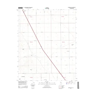 2015 Guijarral Hills2015 Print · USGSCovers Polvadero Ranch, including Coalinga, Turk, and other nearby areas
 - 2018 Map of Guijarral Hills, 2018 Print
 2018 Guijarral Hills2018 Print · USGSCovers Polvadero Ranch, including Coalinga, Turk, and other nearby areas
 - 2021 Map of Guijarral Hills, 2021 Print
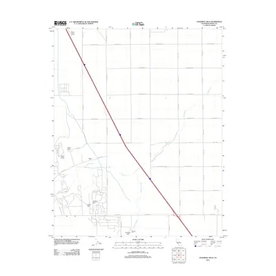
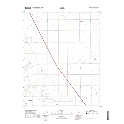
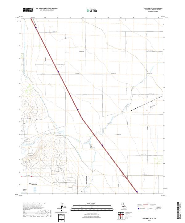 2021 Guijarral Hills2021 Print · USGSThe arid foothills northeast of Coalinga come into focus during the early 2020s, showing a landscape defined by the Guijarral Hills and Anticline Ridge. Researchers can trace the path of the Coalinga Canal or locate local landmarks like Turk and Polvadero Gap.
End of results
Showing maps 1-17 of 17
Top cities near Polvadero Ranch
Frequently asked questions
- What are the different types of historical maps available for Polvadero Ranch?
- What is the oldest map of Polvadero Ranch?
- Where can I purchase historical maps of Polvadero Ranch for my home or office?
- Where can I download high-res historical maps of Polvadero Ranch?
- Are there historical topographic maps available for Polvadero Ranch?
- Is there historical aerial imagery available for Polvadero Ranch?
- Where are historical maps of Polvadero Ranch sourced from?