Old Maps of Avenal, California
Explore 52 old maps of Avenal, spanning from 1912 to today. These high-resolution historic maps reveal how streets, neighborhoods, landmarks, and natural features evolved over time — perfect for genealogy, metal detecting, research, and local history exploration.
What you can do with these maps:
- See how Avenal changed over time: Compare historical maps to modern-day views to trace roads, homesites, rail lines & more.
- View detailed metadata: Each map includes creators, publishers, year, scale, and archive source.
- Overlay maps with satellite & LiDAR: Visualize the past alongside modern tools to explore terrain & human change.
- Trusted historical sources: Maps sourced from the USGS, Library of Congress, and other archives.
- Access maps your way: View online, download high-res files, or order prints for personal or research use.
Start exploring old maps of Avenal to uncover forgotten places, hidden landmarks, and the deep history beneath your feet.
Avenal, CA maps
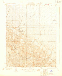
(52)- 1912 Map of Coalinga
 1912 Coalinga1912 Print · USGSThe western San Joaquin Valley comes into focus in the early twentieth century as oil and rail transform the landscape. Genealogists and historians can trace the industrial roots of Oilfields and Coalinga or locate the San Joaquin Valley Coal Mine.4 unique versions available
 - 1914 Map of Cholame
 1914 Cholame1914 Print · USGSCentral California ranching and rugged topography meet at the turn of the century across the Temblor Range. Genealogists and historians can trace early outposts like Devils Den, Dudley, and Carter's Ranch.
 - 1915 Map of Cholame, 1956 Print
 1915 Cholame1956 Print · USGSThe ranchlands of the Central Coast and western San Joaquin Valley were still largely defined by mining and cattle during the early 1900s. Genealogists and researchers can trace family-run operations at Cholame Ranch or find vanished rural schoolhouses like Eagle School and Alliance School.
 - 1917 Map of Cholame
 1917 Cholame1917 Print · USGSSan Luis Obispo and Monterey counties in the early twentieth century reveal a landscape of remote quicksilver mines and isolated ranching outposts. Genealogists and researchers can trace family-named landmarks like Carter's Ranch and early rural education at Eagle School or Choice Valley School.4 unique versions available
 - 1930 Map of Discovery Well
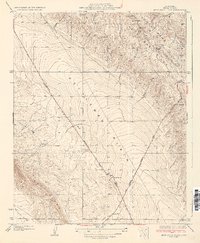
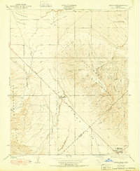
 1930 Discovery Well1930 Print · USGSOil exploration on the Kettleman North Hills Dome was just beginning when this 1930 survey was conducted along the Fresno and Kings county line. Researchers can trace the early industrial footprint of the region through the Discovery Well, Standard Oil Camp, and Milham City.2 unique versions available
 - 1930 Map of Canoas Creek
 1930 Canoas Creek1930 Print · USGSThe Fresno and Kings county line area is captured here during the 1930s oil boom. Researchers can trace early industrial landmarks like the Discovery Well near Avenal and follow the route of the Coalinga and Bakersfield Road.
 - 1930 Map of Kettleman Plain
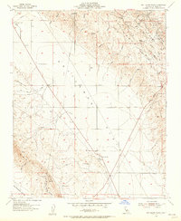
 1930 Kettleman Plain1930 Print · USGSKings County at the height of the early oil boom is captured in this detailed 1930 survey of the Kettleman North Dome. Researchers can trace the early industrial footprint of the region through the Oil Pumping Sta and various Oil Wells along the Coalinga Bakersfield Road.
 - 1933 Map of Kettleman Plain
 1933 Kettleman Plain1933 Print · USGSKings County's oil frontier is captured here in the early 1930s as industrial development reshaped the Central Valley. Researchers can trace early infrastructure like the Oil Pumping Sta and local terrain including Bullwheel Ridge and Little Tar Canyon.2 unique versions available
 - 1934 Map of Reef Ridge
 1934 Reef Ridge1934 Print · USGSThe Fresno and Kings County line ran through a landscape of ranching and early oil work in the 1930s. Genealogists and historians can trace family-named sites like the Ernest Kreyenhagen Ranch or the Vones Ranch Adobe Ruins.
 - 1934 Map of La Cima
 1934 La Cima1934 Print · USGSThe Kettleman Hills oil boom is in full swing on this early 1930s survey of the San Joaquin Valley’s western edge. Researchers can locate specific industrial landmarks like the Discovery Well, the Standard Oil Camp, and the vanished settlement of Milham City.2 unique versions available
 - 1934 Map of Canoas Creek
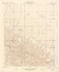
 1934 Canoas Creek1934 Print · USGSThe foothills of Fresno County appear in the early 1930s just as the oil and ranching economies were shaping the region. Researchers can trace the early street layout of Avenal and the natural paths of Canoas Creek and Zapato Creek before modern irrigation changed the land.2 unique versions available
 - 1937 Map of Reef Ridge
 1937 Reef Ridge1937 Print · USGSKings and Monterey counties were defined by isolated ranching and early oil infrastructure in the mid-1930s. Researchers can trace family history at the Ernest Kreyenhagen Ranch or locate industrial sites like the Avenal Canyon Mine and the Union Oil Co Pumping Sta.2 unique versions available
 - 1942 Map of Polvadero Gap
 1942 Polvadero Gap1942 Print · USGSCentral California ranching and early rail corridors appear in high detail during the early war years. Genealogists and local historians can locate early family holdings like Kreyenhagen Ranch, the town of Huron, and the Southern Pacific line.2 unique versions available
 - 1947 Map of San Luis Obispo, 1948 Print
 1947 San Luis Obispo1948 Print · USGSCoastal California at the dawn of the Cold War reveals a landscape of massive military reservations and quiet seaside towns. Genealogists and researchers can trace the Southern Pacific rail line, old mining sites like Los Burros Mine, and local landmarks from Point Buchon to the Carrizo Plain.
 - 1948 Map of Santa Cruz
 1948 Santa Cruz1948 Print · USGSThe Central Coast and San Joaquin Valley meet in this mid-century look at the region's agricultural and military geography. Genealogists and historians can trace the paths of El Camino Real, locate family farms near Hollister, or study the footprint of the Fort Ord Military Reservation.2 unique versions available
 - 1948 Map of San Luis Obispo
 1948 San Luis Obispo1948 Print · USGSCentral Coast life in the late 1940s is centered on the Southern Pacific rail line and expanding military bases. Genealogists can trace early rural life through Union School and local operations like the Klau Mine or Buena Vista Mine.
 - 1950 Map of Kettleman Plain
 1950 Kettleman Plain1950 Print · USGSThe oil fields of Kings County are captured here at mid-century, showcasing a landscape of industrial development and arid ridges. Researchers can trace the early petroleum infrastructure near North Dome and the remote Oil Pumping Sta.
 - 1950 Map of Reef Ridge
 1950 Reef Ridge1950 Print · USGSThe northern Kettleman Plain and Diablo Range transition into a landscape of remote ranching and early industry during the 1930s. Genealogists and historians can locate the Ernest Kreyenhagen Ranch, the Avenal Canyon Mine, and the Union Oil Co Pumping Sta.
 - 1950 Map of Canoas Creek
 1950 Canoas Creek1950 Print · USGSMid-century oil production and the development of the Kettleman Hills dominate this landscape along the Fresno-Kings county line. Researchers can trace the early layout of Avenal and the industrial footprint of the Associated Oil Pumping Sta.
 - 1953 Map of Kettleman Plain, 1956 Print
 1953 Kettleman Plain1956 Print · USGSMid-century oil exploration and high-desert infrastructure define this corner of Kings County in the early 1950s. Researchers can trace the network of pipelines and oil wells surrounding Reef Station, El Mirador, and the high ridges of North Dome.4 unique versions available
 - 1953 Map of Garza Peak, 1957 Print
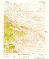 1953 Garza Peak1957 Print · USGSThe rugged ranch lands of Kings County are captured here in the early 1950s as oil exploration and traditional cattle operations coexisted. You can trace family holdings like Kreyenhagen Ranch and locate early industrial sites such as the Avenal Canyon Mine and Dawson Mine.3 unique versions available
 - 1954 Map of Avenal, 1957 Print
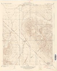
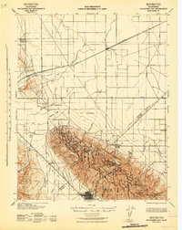
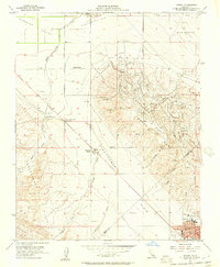 1954 Avenal1957 Print · USGSThe oil-rich ridges of the Kettleman Hills meet the floor of the San Joaquin Valley during a peak era of petroleum production. Researchers can trace early energy infrastructure at the Oil Refinery and Kettleman Station or locate ranch holdings like the Weeth Ranch.6 unique versions available
 - 1954 Map of La Cima, 1957 Print
 1954 La Cima1957 Print · USGSThe Kettleman Hills oil fields are captured mid-production in the 1950s, showing the complex industrial footprint of the North Dome. Researchers can trace the layout of the PG&E Compressor Station, the town of Murray, and several labor camps.
 - 1955 Map of Santa Cruz
 1955 Santa Cruz1955 Print · USGSCoastal Monterey Bay and the fertile Salinas Valley are captured here during the post-war expansion of the mid-fifties. Researchers can trace the era's rail-and-road network via the Southern Pacific lines and find landmarks like Fort Ord or the Lonoak School.
 - 1956 Map of San Luis Obispo, 1963 Print
 1956 San Luis Obispo1963 Print · USGSCentral California coastal and valley life unfolds in the mid-fifties, from the shoreline of Pismo Beach to the arid Carrizo Plain. Trace early travel routes along the Southern Pacific RR or locate family sites near the Templeton Cemetery and Paso Robles County Cemetery.5 unique versions available
Showing maps 1-25 of 52
Top cities near Avenal
Frequently asked questions
- What are the different types of historical maps available for Avenal?
- What is the oldest map of Avenal?
- Where can I purchase historical maps of Avenal for my home or office?
- Where can I download high-res historical maps of Avenal?
- Are there historical topographic maps available for Avenal?
- Is there historical aerial imagery available for Avenal?
- Where are historical maps of Avenal sourced from?