Old Maps of Kings County, California
Explore 290 old maps of Kings County, spanning from 1912 to today. These high-resolution historic maps reveal how streets, neighborhoods, landmarks, and natural features evolved over time — perfect for genealogy, metal detecting, research, and local history exploration.
What you can do with these maps:
- See how Kings County changed over time: Compare historical maps to modern-day views to trace roads, homesites, rail lines & more.
- View detailed metadata: Each map includes creators, publishers, year, scale, and archive source.
- Overlay maps with satellite & LiDAR: Visualize the past alongside modern tools to explore terrain & human change.
- Trusted historical sources: Maps sourced from the USGS, Library of Congress, and other archives.
- Access maps your way: View online, download high-res files, or order prints for personal or research use.
Start exploring old maps of Kings County to uncover forgotten places, hidden landmarks, and the deep history beneath your feet.
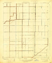
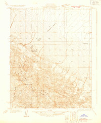
Kings County, CA maps
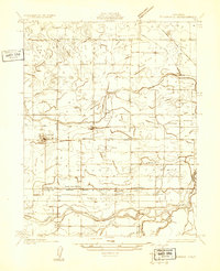
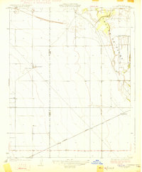
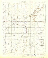
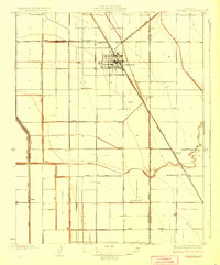
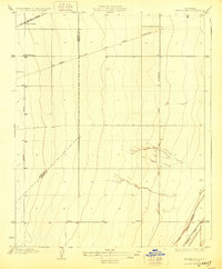
(290)- 1912 Map of Coalinga
 1912 Coalinga1912 Print · USGSThe western San Joaquin Valley comes into focus in the early twentieth century as oil and rail transform the landscape. Genealogists and historians can trace the industrial roots of Oilfields and Coalinga or locate the San Joaquin Valley Coal Mine.4 unique versions available
 - 1914 Map of Lost Hills
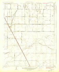
 1914 Lost Hills1914 Print · USGSThe western San Joaquin Valley appears here as an arid ranching frontier during the early years of oil exploration. Researchers can trace historic travel routes like the Dudley-Lemoore Road and locate isolated landmarks such as McDonalds Ranch, Emigrant Hill, and Alamo Solo Spr.4 unique versions available
 - 1914 Map of Cholame
 1914 Cholame1914 Print · USGSCentral California ranching and rugged topography meet at the turn of the century across the Temblor Range. Genealogists and historians can trace early outposts like Devils Den, Dudley, and Carter's Ranch.
 - 1915 Map of Cholame, 1956 Print
 1915 Cholame1956 Print · USGSThe ranchlands of the Central Coast and western San Joaquin Valley were still largely defined by mining and cattle during the early 1900s. Genealogists and researchers can trace family-run operations at Cholame Ranch or find vanished rural schoolhouses like Eagle School and Alliance School.
 - 1917 Map of Cholame
 1917 Cholame1917 Print · USGSSan Luis Obispo and Monterey counties in the early twentieth century reveal a landscape of remote quicksilver mines and isolated ranching outposts. Genealogists and researchers can trace family-named landmarks like Carter's Ranch and early rural education at Eagle School or Choice Valley School.4 unique versions available
 - 1924 Map of Riverdale
 1924 Riverdale1924 Print · USGSCentral California agricultural life thrives in the mid-1920s as rail lines and irrigation canals reshape the valley floor. Genealogists and historians can trace old stops like Gepford and Camden, alongside rural landmarks like North Fork School.
 - 1926 Map of Goshen
 1926 Goshen1926 Print · USGSThe San Joaquin Valley was a landscape defined by rail and irrigation in the mid-1920s. Genealogists can locate rural schoolhouses like Packwood School and Manzanillo School while tracing the Southern Pacific tracks near Goshen.3 unique versions available
 - 1926 Map of Hanford
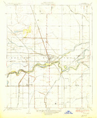
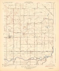
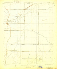
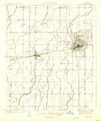 1926 Hanford1926 Print · USGSKings County's agricultural heartland is captured here during the mid-twenties, when irrigation and rail transport defined the Central Valley. Genealogists can locate family landmarks like Union High School, Youd School, and the small siding at Kimble.2 unique versions available
 - 1926 Map of Burris Park
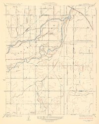 1926 Burris Park1926 Print · USGSCentral Valley farmland and the meandering Kings River define this 1920s landscape at the meeting of Kings, Fresno, and Tulare counties. Genealogists can locate rural schoolhouses like Oakvale School and trace early irrigation via the Peoples Ditch.3 unique versions available
 - 1926 Map of Lethent
 1926 Lethent1926 Print · USGSKings County in the mid-twenties shows a landscape of river forks and early industrial infrastructure. Trace the Southern Pacific railroad through Lethent and locate rural landmarks like the Lethent School and the Oil Pumping Sta.3 unique versions available
 - 1927 Map of Traver
 1927 Traver1927 Print · USGSThe rail-driven landscape of the southern San Joaquin Valley comes into focus here in the mid-1920s. Genealogists and researchers can trace rural school districts like Kennedy School and early infrastructure along the Southern Pacific through Traver.2 unique versions available
 - 1927 Map of Laton
 1927 Laton1927 Print · USGSThe fertile plains of the San Joaquin Valley come alive in this 1920s study of the Laguna de Tache region along the Fresno-Kings county line. Researchers can trace the early irrigation networks of the Last Chance Ditch and find rail-side settlements like Laton, Hardwick, and Lillis.3 unique versions available
 - 1927 Map of Burrel
 1927 Burrel1927 Print · USGSThe agricultural heart of the San Joaquin Valley comes alive in the mid-1920s, showing a landscape defined by irrigation and rail expansion. Genealogists can trace rural communities through family-named sites like West Lake Ranch and a high density of local schoolhouses including Glendora School and Crescent School.3 unique versions available
 - 1927 Map of Remnoy
 1927 Remnoy1927 Print · USGSKings County farming and irrigation networks are shown here in the mid-twenties as the valley's water systems were being formalized. Genealogists and local historians can locate several rural landmarks including Wayne School, King School, and the Southern Pacific stop at Remnoy.2 unique versions available
 - 1927 Map of Riverdale
 1927 Riverdale1927 Print · USGSAgricultural life in the Central Valley centered on the river and rail in the mid-1920s. Genealogists can trace family footprints near rural landmarks like Liberty School or follow the vanished sidings of Gepford and Cornwell along the Southern Pacific.2 unique versions available
 - 1927 Map of Lemoore
 1927 Lemoore1927 Print · USGSThe San Joaquin Valley comes into focus during the mid-1920s as irrigation ditches and rail lines reshaped the land around Lemoore. Genealogists and historians can trace rural life through the Island Church and early schoolhouses like Mussel Slough School.2 unique versions available
 - 1928 Map of Waukena
 1928 Waukena1928 Print · USGSThe agricultural landscape of the southern Central Valley is revealed in the mid-twenties, centered on the settlement of Waukena. Researchers can trace the early irrigation network and rural infrastructure including the Lakeside School, Aurora School, and the Sweet Canal.2 unique versions available
 - 1928 Map of Corcoran
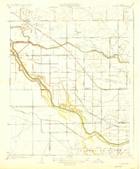
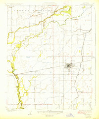
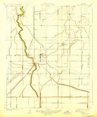
 1928 Corcoran1928 Print · USGSThe San Joaquin Valley's agricultural transformation is on full display here during the late 1920s as irrigation projects reshaped the land. Trace the early growth of Corcoran and vanished points like Turnbull alongside rural landmarks like Riverdale School and the Tule River.3 unique versions available
 - 1929 Map of Hacienda Ranch
 1929 Hacienda Ranch1929 Print · USGSThe southern San Joaquin Valley landscape was defined by large-scale ranching and early irrigation canals during the late 1920s. Genealogists and historians can trace the footprints of Bent Ranch, Fowler Ranch, and the Westlake Gun Club near the shared borders of Kings, Kern, and Tulare counties.2 unique versions available
 - 1929 Map of Guernsey
 1929 Guernsey1929 Print · USGSKings County in the late 1920s reveals an engineered landscape of irrigation and rail transport. Researchers can trace rural school locations like New Home Sch and the rail-side settlement of Guernsey along the Atchison Topeka and Santa Fe line.2 unique versions available
 - 1929 Map of Stratford
 1929 Stratford1929 Print · USGSKings County farming and irrigation are at their peak in the late 1920s as Stratford thrives along the rail line. Researchers can trace the extensive canal system from the Upper Stratford Weir to local landmarks like Empire Sch and Rancheria Santa Rosa.3 unique versions available
 - 1929 Map of Westhaven
 1929 Westhaven1929 Print · USGSThe San Joaquin Valley landscape near the Fresno and Kings county line appears here in the late twenties, defined by early utility corridors and rail transport. Researchers can trace the Southern Pacific route through Westhaven Sta and the irrigation paths of the Empire Canal.2 unique versions available
 - 1929 Map of West Alpaugh
 1929 West Alpaugh1929 Print · USGSThe southern San Joaquin Valley of the late twenties shows a landscape defined by industrial irrigation and rail. Researchers can trace the path of the Shore R R and the early footprints of West Alpaugh and the Hacienda Ranch.2 unique versions available
 - 1930 Map of Discovery Well
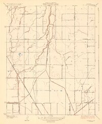
 1930 Discovery Well1930 Print · USGSOil exploration on the Kettleman North Hills Dome was just beginning when this 1930 survey was conducted along the Fresno and Kings county line. Researchers can trace the early industrial footprint of the region through the Discovery Well, Standard Oil Camp, and Milham City.2 unique versions available
 - 1930 Map of Avenal Gap
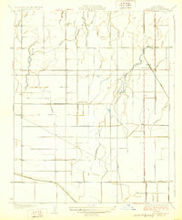
 1930 Avenal Gap1930 Print · USGSThe San Joaquin Valley oil country comes into focus in the early 1930s, showing the intersection of Kings and Kern Counties. Researchers can locate the community of Devils Den, its local Devils Den Sch, and the winding Coalinga Bakersfield Road.
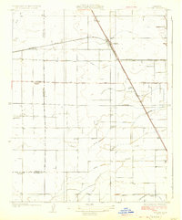
Showing maps 1-25 of 290
Top cities of Kings County
- Hanford historical maps
- Corcoran historical maps
- Lemoore historical maps
- Avenal historical maps
- Armona historical maps
- Home Garden historical maps
See more
Frequently asked questions
- What are the different types of historical maps available for Kings County?
- What is the oldest map of Kings County?
- Where can I purchase historical maps of Kings County for my home or office?
- Where can I download high-res historical maps of Kings County?
- Are there historical topographic maps available for Kings County?
- Is there historical aerial imagery available for Kings County?
- Where are historical maps of Kings County sourced from?