1950s Maps of Kings County, California
Explore 55 historic maps of Kings County from the 1950s. These maps offer a rare glimpse into what life looked like during the 1950s — showing old roads, neighborhoods, homes, and landmarks that have changed or disappeared over time.
Whether you're researching your family's past, planning a metal detecting trip, or studying how Kings County's landscape evolved across the 1950s, these high-resolution maps are a powerful tool for exploring the history of this region.
- Focus on a specific era: All maps on this page are from the 1950s, giving you a focused view of this time period.
- See what’s changed: Compare century-old streets, trails, and buildings to today's modern landscape using overlays and satellite layers.
- Research with precision: Use these maps for genealogy, historical research, land use analysis, or educational projects.
- View, download, or print: Maps are fully viewable online in high resolution, and can be downloaded or printed for your own records.
Start exploring Kings County's history through authentic maps from the 1950s. This is your window into the past.
Kings County, CA maps
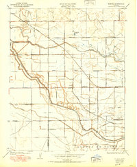
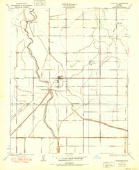
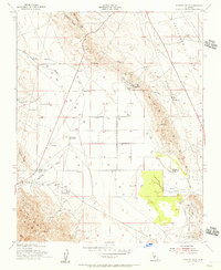
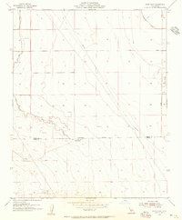
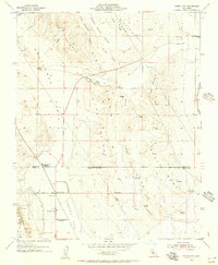
(55)- 1950 Map of Kettleman Plain
 1950 Kettleman Plain1950 Print · USGSThe oil fields of Kings County are captured here at mid-century, showcasing a landscape of industrial development and arid ridges. Researchers can trace the early petroleum infrastructure near North Dome and the remote Oil Pumping Sta.
 - 1950 Map of Burrel
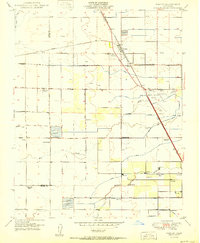
 1950 Burrel1950 Print · USGSThe San Joaquin Valley landscape at mid-century reveals a complex irrigation network and rail-dependent economy. Genealogists and historians can trace old rural school districts like Elkhorn School and family-named landmarks such as Burrel Ranch.
 - 1950 Map of Waukena
 1950 Waukena1950 Print · USGSThe rural stretch between Kings and Tulare Counties comes into focus in this mid-century edition, based on earlier surveys of the valley's irrigation. Genealogists and historians can trace the foundations of the Waukena community and locate old landmarks like Lakeside School and Aurora School.
 - 1950 Map of Burris Park
 1950 Burris Park1950 Print · USGSMid-century Kings and Tulare counties come alive in this survey of the irrigated San Joaquin Valley. Researchers can trace ancestral property near River Bend School, follow the Southern Pacific Railroad, or locate the historic Burris Park.
 - 1950 Map of Avenal Gap
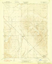
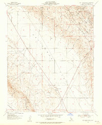
 1950 Avenal Gap1950 Print · USGSThe Kings and Kern County line crosses the southern San Joaquin Valley here at mid-century. Researchers can trace early road routes and locate the Devils Den settlement and Devils Den Sch near the Antelope Plain.
 - 1950 Map of Reef Ridge
 1950 Reef Ridge1950 Print · USGSThe northern Kettleman Plain and Diablo Range transition into a landscape of remote ranching and early industry during the 1930s. Genealogists and historians can locate the Ernest Kreyenhagen Ranch, the Avenal Canyon Mine, and the Union Oil Co Pumping Sta.
 - 1950 Map of Canoas Creek
 1950 Canoas Creek1950 Print · USGSMid-century oil production and the development of the Kettleman Hills dominate this landscape along the Fresno-Kings county line. Researchers can trace the early layout of Avenal and the industrial footprint of the Associated Oil Pumping Sta.
 - 1950 Map of Lethent
 1950 Lethent1950 Print · USGSThe Central Valley river system and agricultural rail lines are preserved here as they appeared in the 1920s and 1950s. Trace the rural landscape along the Kings River to find the Lethent School and the Southern Pacific rail corridor.
 - 1950 Map of Chatom Ranch
 1950 Chatom Ranch1950 Print · USGSKings County was defined by massive water reclamation projects during the mid-twentieth century as the lake basin was converted to farmland. You can trace the complex network of dikes and channels including Cohn Levee and Wilbur Ditch alongside Chatom Ranch.
 - 1950 Map of Traver
 1950 Traver1950 Print · USGSMid-century Tulare County is defined here by its intricate irrigation network and the railroad spine of the San Joaquin Valley. Genealogists and local historians can trace the early footprints of Traver and London, or locate rural landmarks like the Tulare Duck Club and Wilson Sch.
 - 1950 Map of Stratford
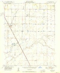
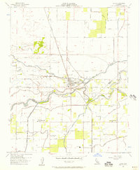
 1950 Stratford1950 Print · USGSKings County irrigation and rail networks are in full view around the middle of the century. Genealogists and historians can trace family-named sites like Cuneo, find the Rancheria Santa Rosa, or locate the Empire Sch and Jacobs Sch.
 - 1950 Map of Goshen
 1950 Goshen1950 Print · USGSCentral California agricultural life is centered on the Goshen rail hub and the surrounding ranch lands at mid-century. Genealogists can locate family-named landmarks like Colpien Ranch and several rural schoolhouses, including Tagus Ranch School and Delta View School.
 - 1950 Map of The Dark Hole
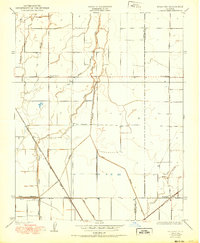
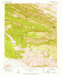
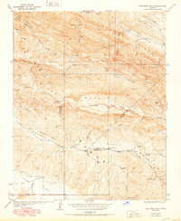 1950 The Dark Hole1950 Print · USGSThe remote interior where Fresno, Monterey, and Kings counties meet is captured here in the mid-twentieth century, showcasing a landscape of high ridges and isolated cabins. Genealogists and historians can locate specific sites like Kings Mine, Twentysix Camp, and Pinoso House (Ruins).
 - 1953 Map of Kettleman Plain, 1956 Print
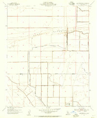
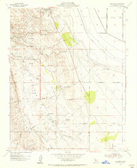
 1953 Kettleman Plain1956 Print · USGSMid-century oil exploration and high-desert infrastructure define this corner of Kings County in the early 1950s. Researchers can trace the network of pipelines and oil wells surrounding Reef Station, El Mirador, and the high ridges of North Dome.4 unique versions available
 - 1953 Map of Pyramid Hills, 1956 Print
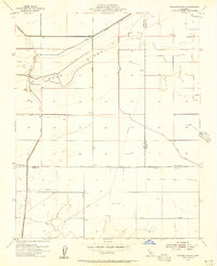
 1953 Pyramid Hills1956 Print · USGSThe Kettleman Plain and the foothills of the Diablo Range are captured here during the peak of mid-century industrial expansion. Researchers can trace the footprint of the petroleum and mineral industries through Oil Wells, the Dudley Pumping Sta, and Gypsum Quarries.3 unique versions available
 - 1953 Map of Laton, 1957 Print
 1953 Laton1957 Print · USGSThe San Joaquin Valley comes into focus in the 1950s as a complex landscape of irrigation canals and historic land grants. Genealogists can trace family footprints near Laton, the Kings River Cemetery, and the site of the Mussel Slough Tragedy Historical Marker.3 unique versions available
 - 1953 Map of The Dark Hole, 1957 Print
 1953 The Dark Hole1957 Print · USGSHigh in the California Coast Ranges during the 1950s, this area shows a landscape of remote ranching outposts and rugged ridges. Genealogists and historians can locate specific family sites like Taylor Ranch, Moore Cabin, and the remnants of Pinoso House.
 - 1953 Map of Garza Peak, 1957 Print
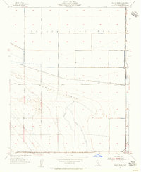
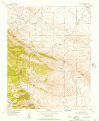 1953 Garza Peak1957 Print · USGSThe rugged ranch lands of Kings County are captured here in the early 1950s as oil exploration and traditional cattle operations coexisted. You can trace family holdings like Kreyenhagen Ranch and locate early industrial sites such as the Avenal Canyon Mine and Dawson Mine.3 unique versions available
 - 1954 Map of West Camp, 1956 Print
 1954 West Camp1956 Print · USGSThe arid borderlands of Kings and Kern counties come into focus during the mid-fifties as the local oil and water infrastructure expands. Researchers can trace the development of West Camp and Espy, along with industrial markers like an Oil Well and a prominent Sand Ridge.3 unique versions available
 - 1954 Map of Lone Tree Well, 1956 Print
 1954 Lone Tree Well1956 Print · USGSThe Central Valley landscape at the mid-century shows an intricate system of water control and ranching. Genealogists and historians can trace local landmarks like Burhans Ranch, Lone Tree Well, and the course of the Kern River Channel.2 unique versions available
 - 1954 Map of Hacienda Ranch, 1956 Print
 1954 Hacienda Ranch1956 Print · USGSThe San Joaquin Valley at the height of the post-war energy boom reveals a landscape of industrial development and rural ranching. Trace the early layout of the Trico Gas Field and family-held land like Hacienda Ranch and Bent Ranch.3 unique versions available
 - 1954 Map of Dudley Ridge, 1956 Print
 1954 Dudley Ridge1956 Print · USGSKings County in the mid-1950s shows a landscape of reclamation as the Tulare Lake Bed is segmented by levees and canals. Genealogists and researchers can trace local work sites like Houser Camp and infrastructure including the Blakeley Canal.3 unique versions available
 - 1954 Map of Avenal Gap, 1956 Print
 1954 Avenal Gap1956 Print · USGSThe Kettleman and Antelope Plains meet here in the mid-1950s, showing a landscape defined by resource extraction and seasonal agriculture. Researchers can trace the layout of Devils Den, find the old Farm Labor Camp, and locate industrial sites like the Cotton Gin and Gypsum Quarries.3 unique versions available
 - 1954 Map of Hacienda Ranch NW, 1956 Print
 1954 Hacienda Ranch NW1956 Print · USGSThe reclaimed Tulare Lake basin in the early 1950s is captured here as a massive grid of canals and ranching infrastructure. You can trace the development of this basin through the Homeland Canal, the isolated Pelican Island, and local landmarks like South Lake Farms.3 unique versions available
 - 1954 Map of Los Viejos, 1956 Print
 1954 Los Viejos1956 Print · USGSKings County in the mid-fifties is captured here as a landscape of oil exploration and dry lake beds. You can trace the industrial outposts of Kettleman Station and Los Medanos or follow the intricate drainage of Arroyo Culebrino.3 unique versions available
Showing maps 1-25 of 55
Top cities of Kings County
- Hanford historical maps
- Corcoran historical maps
- Lemoore historical maps
- Avenal historical maps
- Armona historical maps
- Home Garden historical maps
See more
Frequently asked questions
- What are the different types of historical maps available for Kings County?
- What is the oldest map of Kings County?
- Where can I purchase historical maps of Kings County for my home or office?
- Where can I download high-res historical maps of Kings County?
- Are there historical topographic maps available for Kings County?
- Is there historical aerial imagery available for Kings County?
- Where are historical maps of Kings County sourced from?