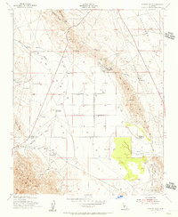
1953 Map of Pyramid Hills
USGS Topo · Published 1956About this map
Pyramid Hills and the surrounding Kettleman Plain define this mid-century portrait of California's energy and mineral landscape. Located along the border of Kings and Kern Counties, the region shows a dense concentration of Oil Wells and infrastructure including the Dudley Pumping Sta and the Pyramid Hills Microwave Relay Sta. The presence of Gypsum Quarries in the north and the Cottonwood Pumping Sta near the southern ridge highlights the diverse industrial activity of the era.
Find a feature on this map
31 named features on this map. Tap any name to fly to it.
Don’t see what you’re looking for? This feature index may not catch every label — zoom into the map to look around manually.
Map Details
Editions of this 1953 Pyramid Hills Map
3 editions found
Other maps of this area

1914 · Lost Hills
USGS Topo · 1:125,000

1914 · Cholame
USGS Topo · 1:125,000

1915 · Cholame
USGS Topo · 1:125,000

1917 · Cholame
USGS Topo · 1:125,000

1930 · Avenal Gap
USGS Topo · 1:31,680

1930 · Kettleman Plain
USGS Topo · 1:31,680

1930 · Middle Dome
USGS Topo · 1:31,680

1933 · Avenal Gap
USGS Topo · 1:31,680

1933 · Kettleman Plain
USGS Topo · 1:31,680

1934 · Reef Ridge
USGS Topo · 1:31,680