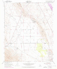
1953 Map of Pyramid Hills
USGS Topo · Published 1976About this map
The Devils Den Oil Field anchor the southeastern portion of this landscape, illustrating the industrial character of the Diablo Range foothills during the mid-20th century. Scattered across the Pyramid Hills and the adjacent Kettleman Plain, a dense network of Oil Wells and a prominent Pipeline trace the region's energy development. This 1953 survey, with revisions into the early 1970s, captures the transition of the land from large-scale ranching, evidenced by Orchard Ranch, to a site of modern infrastructure like the Pyramid Hills Microwave Relay Sta. The terrain is defined by dramatic geological breaks such as Deadman Gap and Dagany Gap, which serve as natural corridors between Sunflower Valley and the plains. Water management and transport are central to the map's details, from the winding path of Avenal Creek to the industrial utility of the Cottonwood Pumping Sta.
Find a feature on this map
23 named features on this map. Tap any name to fly to it.
Don’t see what you’re looking for? This feature index may not catch every label — zoom into the map to look around manually.
Map Details
Editions of this 1953 Pyramid Hills Map
3 editions found
Other maps of this area

1914 · Lost Hills
USGS Topo · 1:125,000

1914 · Cholame
USGS Topo · 1:125,000

1915 · Cholame
USGS Topo · 1:125,000

1917 · Cholame
USGS Topo · 1:125,000

1930 · Avenal Gap
USGS Topo · 1:31,680

1930 · Kettleman Plain
USGS Topo · 1:31,680

1930 · Middle Dome
USGS Topo · 1:31,680

1933 · Avenal Gap
USGS Topo · 1:31,680

1933 · Kettleman Plain
USGS Topo · 1:31,680

1934 · Reef Ridge
USGS Topo · 1:31,680