1930s Maps of Kings County, California
Explore 30 historic maps of Kings County from the 1930s. These maps offer a rare glimpse into what life looked like during the 1930s — showing old roads, neighborhoods, homes, and landmarks that have changed or disappeared over time.
Whether you're researching your family's past, planning a metal detecting trip, or studying how Kings County's landscape evolved across the 1930s, these high-resolution maps are a powerful tool for exploring the history of this region.
- Focus on a specific era: All maps on this page are from the 1930s, giving you a focused view of this time period.
- See what’s changed: Compare century-old streets, trails, and buildings to today's modern landscape using overlays and satellite layers.
- Research with precision: Use these maps for genealogy, historical research, land use analysis, or educational projects.
- View, download, or print: Maps are fully viewable online in high resolution, and can be downloaded or printed for your own records.
Start exploring Kings County's history through authentic maps from the 1930s. This is your window into the past.
Kings County, CA maps
(30)- 1930 Map of Discovery Well
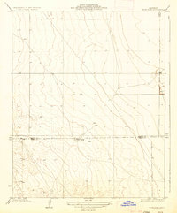
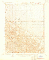 1930 Discovery Well1930 Print · USGSOil exploration on the Kettleman North Hills Dome was just beginning when this 1930 survey was conducted along the Fresno and Kings county line. Researchers can trace the early industrial footprint of the region through the Discovery Well, Standard Oil Camp, and Milham City.2 unique versions available
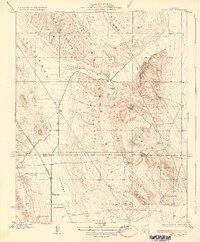
 - 1930 Map of Avenal Gap
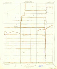
 1930 Avenal Gap1930 Print · USGSThe San Joaquin Valley oil country comes into focus in the early 1930s, showing the intersection of Kings and Kern Counties. Researchers can locate the community of Devils Den, its local Devils Den Sch, and the winding Coalinga Bakersfield Road.
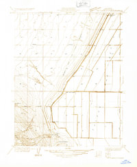
 - 1930 Map of Canoas Creek
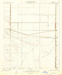
 1930 Canoas Creek1930 Print · USGSThe Fresno and Kings county line area is captured here during the 1930s oil boom. Researchers can trace early industrial landmarks like the Discovery Well near Avenal and follow the route of the Coalinga and Bakersfield Road.
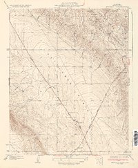
 - 1930 Map of Kettleman Plain
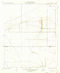
 1930 Kettleman Plain1930 Print · USGSKings County at the height of the early oil boom is captured in this detailed 1930 survey of the Kettleman North Dome. Researchers can trace the early industrial footprint of the region through the Oil Pumping Sta and various Oil Wells along the Coalinga Bakersfield Road.
 - 1930 Map of Middle Dome
 1930 Middle Dome1930 Print · USGSKings County oil country comes into focus in 1930, capturing the landscape during the development of the West Side fields. Researchers can trace the early petroleum industry at the Discovery Well and follow the route of the Paso Robles Hanford Road across the Kettleman Hills.
 - 1931 Map of Harvester
 1931 Harvester1931 Print · USGSKings County ranching and reclamation efforts are meticulously detailed in the early 1930s as the lake basin was being engineered for agriculture. Researchers can trace historic water rights and land holdings through the Tulare Lake Water Company Canal and family-named sites like Baldwin Ranch or Liberty Farms Ranch.
 - 1932 Map of El Rico Ranch
 1932 El Rico Ranch1932 Print · USGSKings County farming and irrigation systems are shown in great detail during the early thirties. Genealogists and historians can trace family landholdings and water infrastructure like Peterson Ranch, Lovelace, and the Dallas Canal.
 - 1932 Map of Dudley Ridge
 1932 Dudley Ridge1932 Print · USGSKings County's agricultural and industrial transformation is captured here in the early 1930s as water management reshaped the valley. Researchers can trace early petroleum sites like Pacific Oil and follow the precise paths of the Goth Levee and Wilbur Ditch.
 - 1932 Map of West Camp
 1932 West Camp1932 Print · USGSThe borderlands of Kings and Kern Counties are captured here in the early thirties, showing the region before modern expansion. Genealogists and researchers can trace the early footprint of West Camp and locate water sources like Lone Tree Well and Mirage.
 - 1932 Map of Lone Tree Well
 1932 Lone Tree Well1932 Print · USGSKings and Kern Counties appear here in the early 1930s as a developing network of irrigation and land boundaries. Genealogists and historians can trace the precise county line and early infrastructure like the Homeland Canal and a remote Water Well.
 - 1933 Map of Avenal Gap
 1933 Avenal Gap1933 Print · USGSThe Kettleman Hills oil country comes into focus in the early thirties as petroleum exploration shaped the Central Valley. Trace the early settlement of Devils Den, locate the Devils Den Sch, and follow the drainages of Arroyo Poso.2 unique versions available
 - 1933 Map of Kettleman City
 1933 Kettleman City1933 Print · USGSKings County in the early 1930s is a landscape of emergent oil fields and vast agricultural tracts at the edge of the Tulare Lake Bed. Researchers can trace the early layout of Kettleman City, early oil well sites in the Kettleman Hills, and family-named landmarks like Blakeley Ranch.
 - 1933 Map of Huron
 1933 Huron1933 Print · USGSThe San Joaquin Valley's agricultural grid is on full display during the early 1930s. Researchers can trace the development of Huron along the Southern Pacific rail line and locate landmarks like the Huron Tank and Jayne Avenue.
 - 1933 Map of Kettleman Plain
 1933 Kettleman Plain1933 Print · USGSKings County's oil frontier is captured here in the early 1930s as industrial development reshaped the Central Valley. Researchers can trace early infrastructure like the Oil Pumping Sta and local terrain including Bullwheel Ridge and Little Tar Canyon.2 unique versions available
 - 1933 Map of Chatom Ranch
 1933 Chatom Ranch1933 Print · USGSReclaimed agricultural land in Kings County is documented during the 1930s as the former lake basin was converted into a network of managed ranches. Researchers can trace early water engineering through the Goldberg Levee and Wilbur Ditch, or locate the historic Chatom Ranch.
 - 1934 Map of The Dark Hole
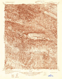 1934 The Dark Hole1934 Print · USGSThe Fresno and Monterey county lines meet in this 1930s survey of the rugged interior Coast Ranges. Genealogists can trace family outposts like Radcliff Cabin and Moore Cabin alongside the King Mine and the distinctive Dark Hole.
 - 1934 Map of Reef Ridge
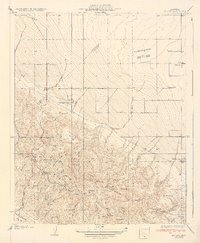
 1934 Reef Ridge1934 Print · USGSThe Fresno and Kings County line ran through a landscape of ranching and early oil work in the 1930s. Genealogists and historians can trace family-named sites like the Ernest Kreyenhagen Ranch or the Vones Ranch Adobe Ruins.
 - 1934 Map of La Cima
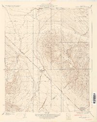
 1934 La Cima1934 Print · USGSThe Kettleman Hills oil boom is in full swing on this early 1930s survey of the San Joaquin Valley’s western edge. Researchers can locate specific industrial landmarks like the Discovery Well, the Standard Oil Camp, and the vanished settlement of Milham City.2 unique versions available
 - 1934 Map of Canoas Creek
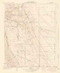
 1934 Canoas Creek1934 Print · USGSThe foothills of Fresno County appear in the early 1930s just as the oil and ranching economies were shaping the region. Researchers can trace the early street layout of Avenal and the natural paths of Canoas Creek and Zapato Creek before modern irrigation changed the land.2 unique versions available
 - 1934 Map of Los Viejos Hills
 1934 Los Viejos Hills1934 Print · USGSKings County terrain and the burgeoning infrastructure of the oil fields come into focus in this mid-1930s survey. Researchers can trace the early path of the Paso Robles Highway and locate vanished sites like Los Medanos and La Esquadilla.3 unique versions available
 - 1935 Map of West Camp
 1935 West Camp1935 Print · USGSThe arid borderlands of the San Joaquin Valley appear in the mid-1930s as a landscape defined by isolation and essential water sources. Genealogists and local researchers can trace the footprint of West Camp and locate scattered landmarks like Lone Tree Well and Antelope Plain.2 unique versions available
 - 1935 Map of Chatom Ranch
 1935 Chatom Ranch1935 Print · USGSKings County was undergoing a massive agricultural transformation in the 1930s as the Tulare Lake Bed was reclaimed. Researchers can trace the early infrastructure of this basin through the Lovelace Levee and isolated outposts like Chatom Ranch.
 - 1935 Map of Harvester
 1935 Harvester1935 Print · USGSKings County's engineered agricultural landscape is captured here in the mid-1930s, showing the systematic conversion of the old lake basin. Researchers can trace early infrastructure like the Kings Lake Shore RR, the settlement at Harvester, and the grounds of Liberty Farms.2 unique versions available
 - 1936 Map of Dudley Ridge
 1936 Dudley Ridge1936 Print · USGSKings County irrigation and land reclamation efforts are at the forefront of this mid-1930s survey of the San Joaquin Valley. Researchers can trace early water management systems through features like the Cohn Levee, Wilbur Ditch, and the isolated Houser Camp.2 unique versions available
 - 1936 Map of Lone Tree Well
 1936 Lone Tree Well1936 Print · USGSThe southern San Joaquin Valley comes into focus in the early 1930s, showing a landscape shaped by water engineering and early agricultural development. Researchers can trace the path of the Homeland Canal and locate the eponymous Lone Tree Well near the Kings Co Kern Co boundary line.2 unique versions available
Showing maps 1-25 of 30
Top cities of Kings County
- Hanford historical maps
- Corcoran historical maps
- Lemoore historical maps
- Avenal historical maps
- Armona historical maps
- Home Garden historical maps
See more
Frequently asked questions
- What are the different types of historical maps available for Kings County?
- What is the oldest map of Kings County?
- Where can I purchase historical maps of Kings County for my home or office?
- Where can I download high-res historical maps of Kings County?
- Are there historical topographic maps available for Kings County?
- Is there historical aerial imagery available for Kings County?
- Where are historical maps of Kings County sourced from?