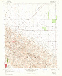
1960s Maps of Kings County, California
Explore 12 historic maps of Kings County from the 1960s. These maps offer a rare glimpse into what life looked like during the 1960s — showing old roads, neighborhoods, homes, and landmarks that have changed or disappeared over time.
Whether you're researching your family's past, planning a metal detecting trip, or studying how Kings County's landscape evolved across the 1960s, these high-resolution maps are a powerful tool for exploring the history of this region.
- Focus on a specific era: All maps on this page are from the 1960s, giving you a focused view of this time period.
- See what’s changed: Compare century-old streets, trails, and buildings to today's modern landscape using overlays and satellite layers.
- Research with precision: Use these maps for genealogy, historical research, land use analysis, or educational projects.
- View, download, or print: Maps are fully viewable online in high resolution, and can be downloaded or printed for your own records.
Start exploring Kings County's history through authentic maps from the 1960s. This is your window into the past.
Kings County, CA maps
(12)- 1960 Map of Fresno
 1960 Fresno1960 Print · USGSThe San Joaquin Valley's mid-century agricultural boom meets the high peaks of the Sierra Nevada in this detailed survey. Genealogists and historians can trace the rail-driven growth of Fresno, Tulare, and Visalia or locate family roots in smaller towns like Raisin City and Calwa City.2 unique versions available
 - 1960 Map of Bakersfield
 1960 Bakersfield1960 Print · USGSThe Southern San Joaquin Valley at mid-century reveals a complex landscape of petroleum development and massive irrigation projects. Researchers can trace the rail lines of the Southern Pacific, explore oil-era landmarks like Oil City, and locate early settlements including Allensworth and Pixley.2 unique versions available
 - 1961 Map of Cholame Valley, 1962 Print
 1961 Cholame Valley1962 Print · USGSThe Monterey and San Luis Obispo county borders come together in the early 1960s across this ranching landscape. Genealogists and historians can locate remote landmarks like the Cholame Ranch, identify water sources at Kerr Lake, and trace the terrain of Turkey Flat.3 unique versions available
 - 1961 Map of Parkfield, 1962 Print
 1961 Parkfield1962 Print · USGSParkfield and the Cholame Valley are captured here in the early sixties, a time of isolated ranching and mineral exploration along the San Andreas fault line. Researchers can trace family history through the Parkfield Cemetery or locate old operations like the Patriquin Mine and White Mine.2 unique versions available
 - 1961 Map of The Dark Hole, 1962 Print
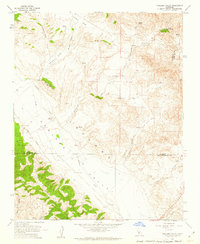
 1961 The Dark Hole1962 Print · USGSThe remote High Desert borderlands of Central California come alive in the early sixties, showing a landscape of mining claims and rugged cattle ranching. Genealogists and historians can trace family outposts like Taylor Ranch or search for the sites of Kings Mine and the Riley Cabin.4 unique versions available
 - 1962 Map of Fresno, 1968 Print
 1962 Fresno1968 Print · USGSThe Central Valley and High Sierra meet in this mid-century survey, capturing the region's massive irrigation systems and mountain wilderness. Researchers can trace the rail corridors of the Southern Pacific and locate landmarks like the Tulare Lake Bed and Mount Whitney.3 unique versions available
 - 1962 Map of Bakersfield, 1969 Print
 1962 Bakersfield1969 Print · USGSThe Southern San Joaquin Valley is shown in the 1960s as a bustling intersection of petroleum production, irrigation agriculture, and mountain recreation. Researchers can trace the rail lines of the Southern Pacific through the valley or locate early desert developments like California City and Tehachapi.4 unique versions available
 - 1963 Map of Kettleman City, 1965 Print
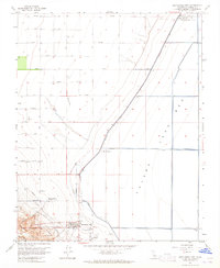 1963 Kettleman City1965 Print · USGSKettleman City and the edge of the Kettleman Hills are captured here in the early 1960s, showing a landscape defined by water engineering. Researchers can trace infrastructure like the Blakeley Canal and industrial sites such as the Compressor Station.4 unique versions available
 - 1963 Map of La Cima, 1965 Print
 1963 La Cima1965 Print · USGSThe Kettleman Hills were a hub of California petroleum production in the early sixties. Researchers can trace the industrial footprint of the Kettleman North Dome Oil and Gas Field and find small settlements like Murray and Hydril.3 unique versions available
 - 1965 Map of Santa Cruz, 1968 Print
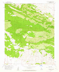
 1965 Santa Cruz1968 Print · USGSThe Central Coast and San Joaquin Valley meet here during the mid-sixties, capturing the growth of agricultural and coastal hubs. Trace the historic Southern Pacific RR lines and locate sites like the Presidio of Monterey or Pinnacles National Monument.
 - 1966 Map of Bakersfield
 1966 Bakersfield1966 Print · USGSThe southern San Joaquin Valley in the mid-sixties reveals a massive industrial and agricultural landscape shaped by water and oil. Genealogists and historians can trace the growth of Bakersfield and Oildale, or locate remote airfields like Minter Field and Mojave-Kern County No. 7 Airport.
 - 1966 Map of Fresno
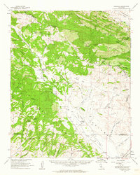
 1966 Fresno1966 Print · USGSCentral California in the mid-1960s showcases a high-production agricultural valley rising into the granite peaks of the High Sierra. Researchers can trace irrigation networks, rail spurs like the Southern Pacific, and landmarks from Mount Whitney to the Lemoore Naval Air Station.
End of results
Showing maps 1-12 of 12
Top cities of Kings County
- Hanford historical maps
- Corcoran historical maps
- Lemoore historical maps
- Avenal historical maps
- Armona historical maps
- Home Garden historical maps
See more
Frequently asked questions
- What are the different types of historical maps available for Kings County?
- What is the oldest map of Kings County?
- Where can I purchase historical maps of Kings County for my home or office?
- Where can I download high-res historical maps of Kings County?
- Are there historical topographic maps available for Kings County?
- Is there historical aerial imagery available for Kings County?
- Where are historical maps of Kings County sourced from?