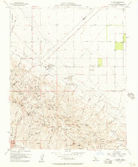
1954 Map of La Cima
USGS Topo · Published 1957About this map
Oil wells and industrial infrastructure dominate this mid-century look at the Kettleman Hills oil fields in Kings County. The landscape is a network of pipelines, tank farms, and compressor stations supporting the extraction from the North Dome. Significant industrial sites like the PG&E Compressor Station, TWA Plant, and the Western States Plant are mapped alongside specialized worker settlements, including several labor camps and named quarters like 2P Camp and 18Q Camp.
Find a feature on this map
72 named features on this map. Tap any name to fly to it.
Don’t see what you’re looking for? This feature index may not catch every label — zoom into the map to look around manually.
Map Details
Editions of this 1954 La Cima Map
This is the sole edition of this map. No revisions or reprints were ever made.
Other maps of this area

1912 · Coalinga
USGS Topo · 1:125,000

1914 · Lost Hills
USGS Topo · 1:125,000

1914 · Cholame
USGS Topo · 1:125,000

1915 · Cholame
USGS Topo · 1:125,000

1917 · Cholame
USGS Topo · 1:125,000

1929 · Westhaven
USGS Topo · 1:31,680

1930 · Discovery Well
USGS Topo · 1:31,680

1930 · Canoas Creek
USGS Topo · 1:31,680

1930 · Kettleman Plain
USGS Topo · 1:31,680

1930 · Middle Dome
USGS Topo · 1:31,680