
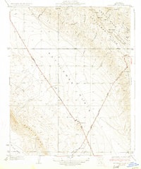
1933 Map of Kettleman Plain
USGS Topo · Published 1933About this map
An industrializing landscape emerges across the Kettleman Plain in this early 1930s survey, dominated by the vital Oil Pumping Sta along the highway. The map illustrates the region's transition into a major energy hub, with complex topography spanning from Reef Ridge to the Kettleman Hills. Numerous drainage features like Arroyo de las Panochas and Arroyo El Paso cut through the foothills, indicating the seasonal water patterns of the Central Valley. The layout of the State Highway No. 138 reveals the early infrastructure connecting these oil fields to Bakersfield and Lemoore. Prominent landmarks such as Bullwheel Ridge and Block Hill provide vertical context to the vast flatlands of the Mc Lure Valley, which extends into the southwestern corner of the quadrangle.
Find a feature on this map
30 named features on this map. Tap any name to fly to it.
Don’t see what you’re looking for? This feature index may not catch every label — zoom into the map to look around manually.
Map Details
Editions of this 1933 Kettleman Plain Map
2 editions found
Other maps of this area

1912 · Coalinga
USGS Topo · 1:125,000

1914 · Lost Hills
USGS Topo · 1:125,000

1914 · Cholame
USGS Topo · 1:125,000

1915 · Cholame
USGS Topo · 1:125,000

1917 · Cholame
USGS Topo · 1:125,000

1930 · Discovery Well
USGS Topo · 1:31,680

1930 · Avenal Gap
USGS Topo · 1:31,680

1930 · Canoas Creek
USGS Topo · 1:31,680

1930 · Kettleman Plain
USGS Topo · 1:31,680

1930 · Middle Dome
USGS Topo · 1:31,680