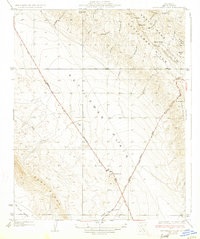
1933 Map of Kettleman Plain
USGS Topo · Published 1933About this map
The Kettleman Plain appears here in the early 1930s as a high-desert landscape defined by the intersection of industrial development and geological isolation. The survey, conducted by topographic engineers including E. P. Davis, reveals a terrain shaped by the search for oil, most notably marked by the Oil Pumping Sta at the junction of two major regional arteries. These routes, the Coalinga Bakersfield State Highway No 138 and the Paso Robles Lemoore State Highway No 125, slice diagonally across the basin, providing the primary link between the Kettleman Hills and Mc Lure Valley.
Find a feature on this map
31 named features on this map. Tap any name to fly to it.
Don’t see what you’re looking for? This feature index may not catch every label — zoom into the map to look around manually.
Map Details
Editions of this 1933 Kettleman Plain Map
2 editions found

Other maps of this area

1912 · Coalinga
USGS Topo · 1:125,000

1914 · Lost Hills
USGS Topo · 1:125,000

1914 · Cholame
USGS Topo · 1:125,000

1915 · Cholame
USGS Topo · 1:125,000

1917 · Cholame
USGS Topo · 1:125,000

1930 · Discovery Well
USGS Topo · 1:31,680

1930 · Avenal Gap
USGS Topo · 1:31,680

1930 · Canoas Creek
USGS Topo · 1:31,680

1930 · Kettleman Plain
USGS Topo · 1:31,680

1930 · Middle Dome
USGS Topo · 1:31,680