
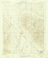
1934 Map of Canoas Creek
USGS Topo · Published 1934About this map
Avenal sits at the base of the foothills in this 1930s survey, a time when the community was emerging as a vital node for the Central Valley's expanding infrastructure. The landscape is defined by the seasonal watercourses of Canoas Creek and Zapato Creek, which carve through the terrain as they flow toward the plains. Surveyed by M.J. Harden and J.L. Buckmaster, the map records the early grid development of the townsite and the prominent transportation lines connecting the oil fields and agricultural regions. The detailed topography reflects the transition from the steep, eroded slopes of the Kettleman Hills down to the flat expanse where development began to take root during the administration of Governor James Rolph, Jr.
Find a feature on this map
3 named features on this map. Tap any name to fly to it.
Don’t see what you’re looking for? This feature index may not catch every label — zoom into the map to look around manually.
Map Details
Editions of this 1934 Canoas Creek Map
2 editions found
Other maps of this area

1912 · Coalinga
USGS Topo · 1:125,000

1914 · Cholame
USGS Topo · 1:125,000

1915 · Cholame
USGS Topo · 1:125,000

1917 · Cholame
USGS Topo · 1:125,000

1930 · Discovery Well
USGS Topo · 1:31,680

1930 · Canoas Creek
USGS Topo · 1:31,680

1930 · Kettleman Plain
USGS Topo · 1:31,680

1933 · Huron
USGS Topo · 1:31,680

1933 · Guijarral Hills
USGS Topo · 1:31,680

1933 · Kettleman Plain
USGS Topo · 1:31,680