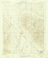
1934 Map of Canoas Creek
USGS Topo · Published 1934About this map
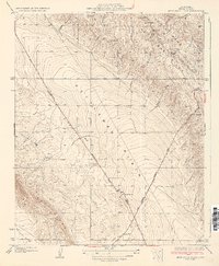
The industrial development of the California oil fields is evident along the Coalinga Bakersfield Highway No 138, where the Associated Oil Pumping Sta sits as a lonely outpost on the Kettleman Plain. This 1930s survey captures the region during a period of significant petroleum extraction, centered on the geological formations of the North Dome and Kettleman Hills. The terrain is characterized by a series of dry washes and arroyos, such as Arroyo El Hocico and Arroyo Seco, which descend from the high ridges toward the valley floor.
Find a feature on this map
26 named features on this map. Tap any name to fly to it.
Don’t see what you’re looking for? This feature index may not catch every label — zoom into the map to look around manually.
Map Details
Editions of this 1934 Canoas Creek Map
2 editions found
Other maps of this area

1912 · Coalinga
USGS Topo · 1:125,000

1914 · Cholame
USGS Topo · 1:125,000

1915 · Cholame
USGS Topo · 1:125,000

1917 · Cholame
USGS Topo · 1:125,000
1930 · Discovery Well
USGS Topo · 1:31,680

1930 · Canoas Creek
USGS Topo · 1:31,680

1930 · Kettleman Plain
USGS Topo · 1:31,680

1933 · Huron
USGS Topo · 1:31,680
1933 · Guijarral Hills
USGS Topo · 1:31,680
1933 · Kettleman Plain
USGS Topo · 1:31,680