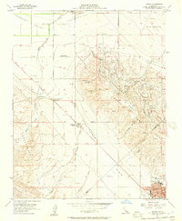
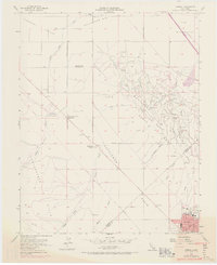
1954 Map of Avenal
USGS Topo · Published 1957About this map
The town of Avenal and the industrial activity of the North Dome oil field anchor this mid-century survey of the Central Valley transition. Situated at the edge of the Kettleman Hills, the landscape is defined by a dense network of energy infrastructure, including an Oil Refinery, Kettleman Station, and numerous pipelines cutting across the ridges. Beyond the industrial hub, the map documents a ranching and agricultural presence with the Weeth Ranch and Starkey and Erwin Ranch positioned along the alluvial fans. The terrain transitions from the alluvial Pleasant Valley and Polvadera Gap into the dissected uplands of the Kreyenhagen Hills. This map captures a period of intensive petroleum development, evidenced by the named arroyos like Arroyo Simada and Arroyo El Perro that drain the prominent topographic features of Elephant Hill and La Luneta.
Find a feature on this map
33 named features on this map. Tap any name to fly to it.
Don’t see what you’re looking for? This feature index may not catch every label — zoom into the map to look around manually.
Map Details
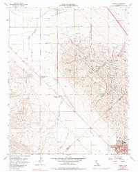
Editions of this 1954 Avenal Map
6 editions found
Other maps of this area

1912 · Coalinga
USGS Topo · 1:125,000

1914 · Cholame
USGS Topo · 1:125,000

1915 · Cholame
USGS Topo · 1:125,000

1917 · Cholame
USGS Topo · 1:125,000

1930 · Discovery Well
USGS Topo · 1:31,680

1930 · Canoas Creek
USGS Topo · 1:31,680

1930 · Kettleman Plain
USGS Topo · 1:31,680

1933 · Huron
USGS Topo · 1:31,680

1933 · Guijarral Hills
USGS Topo · 1:31,680

1933 · Kettleman Plain
USGS Topo · 1:31,680