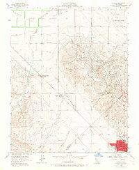
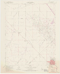
1954 Map of Avenal
USGS Topo · Published 1967About this map
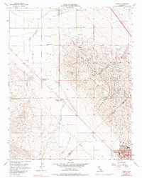
The industrial and agricultural character of the western San Joaquin Valley is evident in this mid-century survey of the Kettleman North Dome. An extensive network of pipelines, oil sumps, and a central Oil Refinery underscore the region's importance as an energy hub, while local commerce and community life center on the town of Avenal. The transition from the flat Kettleman Plain to the uplifted Kreyenhagen Hills is marked by watercourses like Zapato Chino Creek and Canoas Creek, which carve through the arid terrain.
Find a feature on this map
27 named features on this map. Tap any name to fly to it.
Don’t see what you’re looking for? This feature index may not catch every label — zoom into the map to look around manually.
Map Details
Editions of this 1954 Avenal Map
6 editions found
Other maps of this area

1912 · Coalinga
USGS Topo · 1:125,000

1914 · Cholame
USGS Topo · 1:125,000

1915 · Cholame
USGS Topo · 1:125,000

1917 · Cholame
USGS Topo · 1:125,000

1930 · Discovery Well
USGS Topo · 1:31,680

1930 · Canoas Creek
USGS Topo · 1:31,680

1930 · Kettleman Plain
USGS Topo · 1:31,680

1933 · Huron
USGS Topo · 1:31,680

1933 · Guijarral Hills
USGS Topo · 1:31,680

1933 · Kettleman Plain
USGS Topo · 1:31,680