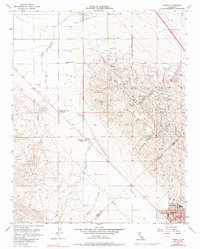
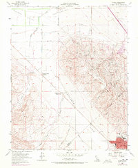
1954 Map of Avenal
USGS Topo · Published 1985About this map
The Kettleman Hills oil fields dominate this mid-century landscape at the boundary of Fresno and Kings Counties. Centered on the industrial topography of North Dome, the map reveals a complex network of oil infrastructure including an Oil Refinery, numerous Oil Sumps, and multiple Booster Stations. The town of Avenal sits in the southeast corner, serving as a hub for the surrounding energy operations and providing essential services such as a Hospital and Airport.
Find a feature on this map
35 named features on this map. Tap any name to fly to it.
Don’t see what you’re looking for? This feature index may not catch every label — zoom into the map to look around manually.
Map Details
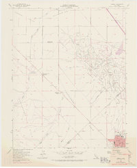
Editions of this 1954 Avenal Map
6 editions found
Other maps of this area

1912 · Coalinga
USGS Topo · 1:125,000

1914 · Cholame
USGS Topo · 1:125,000

1915 · Cholame
USGS Topo · 1:125,000

1917 · Cholame
USGS Topo · 1:125,000

1930 · Discovery Well
USGS Topo · 1:31,680

1930 · Canoas Creek
USGS Topo · 1:31,680

1930 · Kettleman Plain
USGS Topo · 1:31,680

1933 · Huron
USGS Topo · 1:31,680

1933 · Guijarral Hills
USGS Topo · 1:31,680

1933 · Kettleman Plain
USGS Topo · 1:31,680