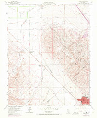
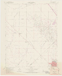
1954 Map of Avenal
USGS Topo · Published 1972About this map
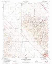
Avenal sits at the base of the prominent Kettleman Hills, where the agricultural plains of the Central Valley meet the rising terrain of the Kettleman North Dome. This landscape is defined by the tension between industrial infrastructure and the natural drainage patterns of Canoas Creek and Garza Creek. The presence of the Kettleman Station and the Airport near the town center reflects the region's mid-century development, while sprawling agricultural properties like Weeth Ranch and the Starkey and Erwin Ranch occupy the flatter terrain of Pleasant Valley. To the north, the Polvadero Country Club marks a distinct recreational island near Polvadero Gap, highlighting the social layers of this oil-rich and ranching landscape. The intricate network of arroyos, including Arroyo Hondo and Arroyo Salado, carves through the hills, illustrating the erosion patterns characteristic of the Kettleman range.
Find a feature on this map
33 named features on this map. Tap any name to fly to it.
Don’t see what you’re looking for? This feature index may not catch every label — zoom into the map to look around manually.
Map Details
Editions of this 1954 Avenal Map
6 editions found
Other maps of this area

1912 · Coalinga
USGS Topo · 1:125,000

1914 · Cholame
USGS Topo · 1:125,000

1915 · Cholame
USGS Topo · 1:125,000

1917 · Cholame
USGS Topo · 1:125,000

1930 · Discovery Well
USGS Topo · 1:31,680

1930 · Canoas Creek
USGS Topo · 1:31,680

1930 · Kettleman Plain
USGS Topo · 1:31,680

1933 · Huron
USGS Topo · 1:31,680

1933 · Guijarral Hills
USGS Topo · 1:31,680

1933 · Kettleman Plain
USGS Topo · 1:31,680