2020s Maps of Avenal, California
Explore 4 historic maps of Avenal from the 2020s. These maps offer a rare glimpse into what life looked like during the 2020s — showing old roads, neighborhoods, homes, and landmarks that have changed or disappeared over time.
Whether you're researching your family's past, planning a metal detecting trip, or studying how Avenal's landscape evolved across the 2020s, these high-resolution maps are a powerful tool for exploring the history of this region.
- Focus on a specific era: All maps on this page are from the 2020s, giving you a focused view of this time period.
- See what’s changed: Compare century-old streets, trails, and buildings to today's modern landscape using overlays and satellite layers.
- Research with precision: Use these maps for genealogy, historical research, land use analysis, or educational projects.
- View, download, or print: Maps are fully viewable online in high resolution, and can be downloaded or printed for your own records.
Start exploring Avenal's history through authentic maps from the 2020s. This is your window into the past.
Avenal, CA maps
(4)- 2021 Map of Avenal, 2021 Print
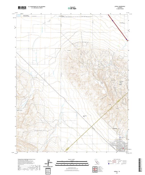 2021 Avenal2021 Print · USGSKings County's western edge comes into focus in this recent survey of the petroleum and agricultural lands surrounding the Kettleman Hills. Genealogists and historians can trace the streets of Avenal and navigate the natural drainages of Zapato Chino Canyon and Arroyo Ciervo.
 - 2021 Map of La Cima, 2021 Print
 2021 La Cima2021 Print · USGSKings County at the turn of the 2020s shows the stark meeting of industrial water infrastructure and the rugged Kettleman Hills. Researchers can trace the path of the California Aqueduct as it passes north of Avenal and Hydril Hill.
 - 2021 Map of Kettleman Plain, 2021 Print
 2021 Kettleman Plain2021 Print · USGSThe oil-rich ridges of Kings County come into focus during the early twenty-first century as industrial and natural landscapes intersect. Researchers can trace the unique topography of Kettleman Hills and locate specific landmarks like Reef Station and Drillers Ridge.
 - 2021 Map of Garza Peak, 2021 Print
 2021 Garza Peak2021 Print · USGSThe western fringes of the San Joaquin Valley meet the Diablo Range in this 2021 study. Researchers can trace remote landmarks and water sources like Garza Peak, The Turtle Hole, and Willow Spring along the Kings County border.
End of results
Showing maps 1-4 of 4
Top cities near Avenal
Frequently asked questions
- What are the different types of historical maps available for Avenal?
- What is the oldest map of Avenal?
- Where can I purchase historical maps of Avenal for my home or office?
- Where can I download high-res historical maps of Avenal?
- Are there historical topographic maps available for Avenal?
- Is there historical aerial imagery available for Avenal?
- Where are historical maps of Avenal sourced from?