
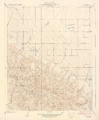
1934 Map of Reef Ridge
USGS Topo · Published 1934About this map
The boundary between Fresno Co and Kings Co bisects this 1934 survey, a region defined by the dramatic meeting of the Kettleman Plain and the sharp uplift of Reef Ridge. This topography dictated early settlement and industry, as seen in the presence of an Oil Pumping Station along the Coalinga-Bakersfield Road, marking the edge of the burgeoning California oil fields. Ranching life is documented through established sites like the Ernest Kreyenhagen Ranch and the Sagasar Ranch, while the Vones Ranch Adobe Ruins point to an even earlier era of habitation. In this arid landscape, the location of water was paramount for survival, noted by specific springs such as Wade Baxter Spr and Avenal Canyon Spring. Higher elevations leading toward Table Mtn and the Diablo Range provided grazing grounds, evidenced by Blacks Corral and isolated structures like the Rhodes Cabin.
Find a feature on this map
28 named features on this map. Tap any name to fly to it.
Don’t see what you’re looking for? This feature index may not catch every label — zoom into the map to look around manually.
Map Details
Editions of this 1934 Reef Ridge Map
This is the sole edition of this map. No revisions or reprints were ever made.
Other maps of this area

1912 · Coalinga
USGS Topo · 1:125,000

1914 · Cholame
USGS Topo · 1:125,000

1915 · Cholame
USGS Topo · 1:125,000

1917 · Cholame
USGS Topo · 1:125,000

1930 · Discovery Well
USGS Topo · 1:31,680

1930 · Canoas Creek
USGS Topo · 1:31,680

1930 · Kettleman Plain
USGS Topo · 1:31,680

1933 · Kettleman Plain
USGS Topo · 1:31,680

1934 · The Dark Hole
USGS Topo · 1:31,680
1934 · La Cima
USGS Topo · 1:31,680