Old Maps of Dinsmore, California for Hiking & Exploration
Hike through history with 10 historic maps of Dinsmore. Explore old trails, ghost towns, and forgotten backroads — perfect for outdoor adventurers and local explorers.
- Rediscover forgotten places: Map out old mining camps, roads, and footpaths that no longer exist on modern maps.
- Layer with modern tools: Combine with LiDAR or satellite views to plan hikes through historical terrain.
- Made for exploration: Popular among hikers, overlanders, and local history lovers.
Use these maps to find adventure and explore the hidden past of Dinsmore.
Dinsmore, CA maps
(10)- 1949 Map of Blocksburg, 1955 Print
 1949 Blocksburg1955 Print · USGSHumboldt County ranching and timberlands are captured here in the late 1940s, showing the remote canyon country before modern development. Genealogists and local historians can locate early family holdings like Cobb Ranch and the vanished Buck Mtn School.2 unique versions available
 - 1951 Map of Blocksburg
 1951 Blocksburg1951 Print · USGSHumboldt County ranching and timber country are captured here in the early fifties, spanning the divide between the Eel and Mad Rivers. Genealogists and historians can locate remote family holdings like Payton Ranch, the Buck Mtn School, and the Northwestern Pacific rail line at Eel Rock.2 unique versions available
 - 1958 Map of Redding
 1958 Redding1958 Print · USGSNorthern California's valley and mountain landscapes are captured in the late fifties, showing the region as new reservoirs reshaped the river systems. Genealogists and historians can trace rail-side towns like Cottonwood, the military presence at Red Bluff Air Force Station, and mountain outposts like Weaverville.5 unique versions available
 - 1977 Map of Dinsmore, 1978 Print
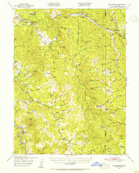
 1977 Dinsmore1978 Print · USGSThe Humboldt and Trinity county line meets in this 1970s survey of the mountain forests and river valleys. Researchers can trace the local infrastructure of Dinsmore, from the Southern Trinity High School to the Dinsmore-Humboldt County Airport.2 unique versions available
 - 1979 Map of Garberville, 1996 Print
 1979 Garberville1996 Print · USGSThe redwood forests and river canyons of Humboldt and Trinity counties are shown here in the late seventies. Genealogists and historians can trace rail-side life along the Northwestern Pacific RR or locate small settlements like Fort Seward, Alderpoint, and Zenia.
 - 1997 Map of Dinsmore, 2001 Print
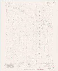
 1997 Dinsmore2001 Print · USGSThe mountain communities of the California coast range are documented here in the late nineties, centered on the river valleys of the Six Rivers National Forest. Researchers can trace the layout of Dinsmore and Mad River, including local landmarks like Southern Trinity High School and the Dinsmore-Humboldt County Airport.
 - 2012 Map of Dinsmore, 2012 Print
 2012 Dinsmore2012 Print · USGSCovers Dinsmore, including Van Duzen, Humboldt County, and other nearby areas
 - 2015 Map of Dinsmore, 2015 Print
 2015 Dinsmore2015 Print · USGSCovers Dinsmore, including Van Duzen, Humboldt County, and other nearby areas
 - 2018 Map of Dinsmore, 2018 Print
 2018 Dinsmore2018 Print · USGSCovers Dinsmore, including Van Duzen, Humboldt County, and other nearby areas
 - 2022 Map of Dinsmore, 2022 Print
 2022 Dinsmore2022 Print · USGSHumboldt County in the early twenty-first century remains a landscape of high ridges and timber lands managed under the Six Rivers National Forest. Genealogists and hikers can trace remote landmarks like Dinsmore, Low Gap, and the high peak of Buck Mountain.
End of results
Showing maps 1-10 of 10
Frequently asked questions
- What are the different types of historical maps available for Dinsmore?
- What is the oldest map of Dinsmore?
- Where can I purchase historical maps of Dinsmore for my home or office?
- Where can I download high-res historical maps of Dinsmore?
- Are there historical topographic maps available for Dinsmore?
- Is there historical aerial imagery available for Dinsmore?
- Where are historical maps of Dinsmore sourced from?