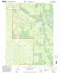
1997 Map of Dinsmore
USGS Topo · Published 2001About this map
Van Duzen River and the Mad River carve deep drainages through this mountainous portion of the Six Rivers National Forest during the late 1990s. The settlement of Dinsmore serves as a small hub along the northern reaches, supported by the Dinsmore-Humboldt County Airport and the nearby Van Duzen School. To the east, the community of Mad River clusters near the Mad River Ranger Station and Southern Trinity High School.
Find a feature on this map
49 named features on this map. Tap any name to fly to it.
Don’t see what you’re looking for? This feature index may not catch every label — zoom into the map to look around manually.
Map Details
Editions of this 1997 Dinsmore Map
This is the sole edition of this map. No revisions or reprints were ever made.
Other maps of this area

1909 · Big Bar
USGS Topo · 1:96,000

1914 · Pilot Creek
USGS Topo · 1:62,500

1915 · Big Bar and Vicinity
USGS Topo · 1:250,000

1918 · Anada
USGS Topo · 1:62,500

1931 · Hoaglin
USGS Topo · 1:96,000

1935 · Hoaglin
USGS Topo · 1:125,000

1949 · Blocksburg
USGS Topo · 1:62,500

1951 · Blocksburg
USGS Topo · 1:62,500

1951 · Pilot Creek
USGS Topo · 1:62,500

1951 · Hyampom
USGS Topo · 1:62,500