
1951 Map of Pilot Creek
USGS Topo · Published 1952About this map
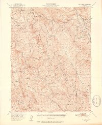
Ackley Ranch (Site of Fort Baker) sits along the southern reach of the Mad River, providing a significant historical marker in this section of the Six Rivers National Forest. This 1951 survey reveals a landscape of high ridges and deep drainages at the border of Humboldt and Trinity counties, where seasonal mountain life is marked by the presence of Cold Springs Lookout and remote dwellings like the Dan East Cabin and Ridge Cabin. The terrain is defined by massive formations such as Showers Mtn and Blake Mtn, which overlook the complex network of creeks feeding the South Fork Trinity River. Evidence of early stock raising and travel is found in the scattered Torrey Corrals, Deer Creek Ranch, and the Eightmile Trail winding through Soldiers Grove. This map preserves the mid-century layout of these public lands before modern fire management and road development altered the access patterns of the northern California back-country.
Find a feature on this map
102 named features on this map. Tap any name to fly to it.
Don’t see what you’re looking for? This feature index may not catch every label — zoom into the map to look around manually.
Map Details
Editions of this 1951 Pilot Creek Map
5 editions found
Other maps of this area

1909 · Big Bar
USGS Topo · 1:96,000

1914 · Pilot Creek
USGS Topo · 1:62,500

1915 · Big Bar and Vicinity
USGS Topo · 1:250,000

1918 · Anada
USGS Topo · 1:62,500

1921 · Dyerville
USGS Topo · 1:62,500

1922 · Korbel
USGS Topo · 1:62,500

1922 · China Flat
USGS Topo · 1:62,500

1922 · Kneeland
USGS Topo · 1:62,500

1931 · Hoaglin
USGS Topo · 1:96,000

1935 · Hoaglin
USGS Topo · 1:125,000