
1951 Map of Hyampom
USGS Topo · Published 1953About this map
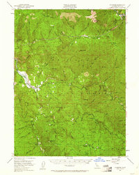
The South Fork Trinity River carves through the heart of this mountain landscape, meeting the Trinity River near Big Bar. In the early 1950s, the isolated valley community of Hyampom serves as a central hub, complete with a Landing Field and the Hyampom Guard Sta. The terrain is characterized by high ridges like Halfway Ridge and Pelletreau Ridge, separated by deep gulches and creek drainages. Significant human activity is evidenced by remote outposts and family-named holdings, including Grel Ranch, French Ranch, and specialized locations such as Camp Trinity and Camp Carter. Geologic and recreational interests are marked by the Butter Creek Caves and Big Slide Camp Ground, while the high-elevation Haypress Meadow suggests a history of seasonal grazing within the Six Rivers National Forest.
Find a feature on this map
76 named features on this map. Tap any name to fly to it.
Don’t see what you’re looking for? This feature index may not catch every label — zoom into the map to look around manually.
Map Details
Editions of this 1951 Hyampom Map
4 editions found
Other maps of this area

1909 · Big Bar
USGS Topo · 1:96,000

1914 · Pilot Creek
USGS Topo · 1:62,500

1915 · Big Bar and Vicinity
USGS Topo · 1:250,000

1918 · Anada
USGS Topo · 1:62,500

1922 · China Flat
USGS Topo · 1:62,500

1931 · Hoaglin
USGS Topo · 1:96,000

1935 · Hoaglin
USGS Topo · 1:125,000

1949 · Blocksburg
USGS Topo · 1:62,500

1951 · Blocksburg
USGS Topo · 1:62,500

1951 · Pilot Creek
USGS Topo · 1:62,500