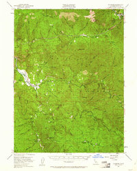
1951 Map of Hyampom
USGS Topo · Published 1961About this map
The confluence of the South Fork Trinity River and Hayfork Creek defines the remote settlement of Hyampom in the mid-twentieth century. This Trinity County landscape is a complex network of ridges and watercourses, including Indian Creek and Butter Creek, where topography dictated the placement of early infrastructure. The Landing Field at Hyampom and the Telephone Line cutting through the center of the sheet reflect the region's mid-century modernization within the Six Rivers National Forest.
Find a feature on this map
72 named features on this map. Tap any name to fly to it.
Don’t see what you’re looking for? This feature index may not catch every label — zoom into the map to look around manually.
Map Details
Editions of this 1951 Hyampom Map
4 editions found

Other maps of this area

1909 · Big Bar
USGS Topo · 1:96,000

1914 · Pilot Creek
USGS Topo · 1:62,500

1915 · Big Bar and Vicinity
USGS Topo · 1:250,000

1918 · Anada
USGS Topo · 1:62,500

1922 · China Flat
USGS Topo · 1:62,500

1931 · Hoaglin
USGS Topo · 1:96,000

1935 · Hoaglin
USGS Topo · 1:125,000

1949 · Blocksburg
USGS Topo · 1:62,500

1951 · Blocksburg
USGS Topo · 1:62,500

1951 · Pilot Creek
USGS Topo · 1:62,500