Old Maps of Janes Place, California for Academic Research
Study the evolution of Janes Place with 11 high-resolution historic maps. Whether you're teaching, researching, or modeling changes in land use, these maps provide essential visual documentation of urban, environmental, and geographic change.
- Analyze long-term change: Track patterns in development, transportation, and natural features.
- Ideal for environmental or urban studies: Support academic projects with primary historical map data.
- Use in the classroom or lab: Educators and researchers rely on these maps to bring historical context to life.
These maps are a powerful tool for teaching, research, and visualizing how Janes Place has changed over the decades.
Janes Place, CA maps
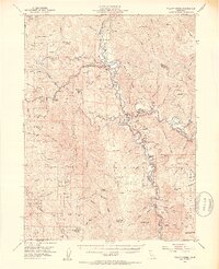
(11)- 1915 Map of Big Bar and Vicinity
 1915 Big Bar and Vicinity1915 Print · USGSThe Trinity River wilderness in the early twentieth century was a landscape of isolated mining outposts and river settlements. Genealogists and historians can trace the early footprints of Junction City, Helena, and Hyampom alongside remote landmarks like Keystone Cabin.5 unique versions available
 - 1922 Map of China Flat
 1922 China Flat1922 Print · USGSNorthwestern California at the dawn of the 1920s reveals a landscape of isolated river settlements and early forest service outposts. Genealogists and historians can trace the residents of Quinby and Uptons or locate the China Flat Post Office and Handy Horse Ranger Station.
 - 1952 Map of Willow Creek, 1954 Print
 1952 Willow Creek1954 Print · USGSThe Trinity River valley in the early fifties shows a mountain landscape of remote ranches and forest stations. Genealogists and historians can locate family landmarks like Russell Cabin, the Horse Mtn Mine, and the Cedar Grove Ranch.4 unique versions available
 - 1958 Map of Redding
 1958 Redding1958 Print · USGSNorthern California's valley and mountain landscapes are captured in the late fifties, showing the region as new reservoirs reshaped the river systems. Genealogists and historians can trace rail-side towns like Cottonwood, the military presence at Red Bluff Air Force Station, and mountain outposts like Weaverville.5 unique versions available
 - 1979 Map of Grouse Mtn
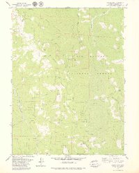 1979 Grouse Mtn1979 Print · USGSHumboldt County’s high country is captured here during the late 1970s, showing a landscape of national forest ridges and remote mountain outposts. Researchers can trace old mountain life through sites like Ammon Station, the Horse Mountain Mine, and Janes Place.2 unique versions available
 - 1982 Map of Hayfork, 1983 Print
 1982 Hayfork1983 Print · USGSTrinity and Humboldt counties appear here in the early eighties as a landscape of timber and mining. Researchers can trace remote river settlements like Hyampom and Burnt Ranch or locate old operations such as the Yellowstone Mine and Index Mine.
 - 1997 Map of Grouse Mountain, 2001 Print
 1997 Grouse Mountain2001 Print · USGSHumboldt County’s high country is captured here during the late nineties, showing the remote forest lands and isolated dwellings of the era. Genealogists and local historians can trace family-named sites like Bartlett Ranch, McMillion Cabin, and the high-elevation Grouse Mountain Lookout.
 - 2012 Map of Grouse Mountain, 2012 Print
 2012 Grouse Mountain2012 Print · USGSCovers Janes Place, including Humboldt County, United States, and other nearby areas
 - 2015 Map of Grouse Mountain, 2015 Print
 2015 Grouse Mountain2015 Print · USGSCovers Janes Place, including Humboldt County, United States, and other nearby areas
 - 2018 Map of Grouse Mountain, 2018 Print
 2018 Grouse Mountain2018 Print · USGSCovers Janes Place, including Humboldt County, United States, and other nearby areas
 - 2021 Map of Grouse Mountain, 2021 Print
 2021 Grouse Mountain2021 Print · USGSHumboldt County’s high timber country is shown here in the modern era within the Six Rivers National Forest. Researchers can trace the ridges and water sources that define this landscape, from Friday Ridge to White Rock Spring and Clear Lake.
End of results
Showing maps 1-11 of 11
Top cities near Janes Place
Frequently asked questions
- What are the different types of historical maps available for Janes Place?
- What is the oldest map of Janes Place?
- Where can I purchase historical maps of Janes Place for my home or office?
- Where can I download high-res historical maps of Janes Place?
- Are there historical topographic maps available for Janes Place?
- Is there historical aerial imagery available for Janes Place?
- Where are historical maps of Janes Place sourced from?