Old Maps of Whitethorn, California for Academic Research
Study the evolution of Whitethorn with 10 high-resolution historic maps. Whether you're teaching, researching, or modeling changes in land use, these maps provide essential visual documentation of urban, environmental, and geographic change.
- Analyze long-term change: Track patterns in development, transportation, and natural features.
- Ideal for environmental or urban studies: Support academic projects with primary historical map data.
- Use in the classroom or lab: Educators and researchers rely on these maps to bring historical context to life.
These maps are a powerful tool for teaching, research, and visualizing how Whitethorn has changed over the decades.
Whitethorn, CA maps
(10)- 1921 Map of Briceland
 1921 Briceland1921 Print · USGSHumboldt County ranching and river life are captured here during the first World War, showing the early infrastructure of the redwood region. Researchers can locate numerous family holdings like the Ben Stoddard Ranch and settlements at Briceland and Garberville.2 unique versions available
 - 1949 Map of Garberville, 1963 Print
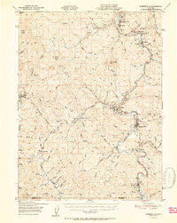
 1949 Garberville1963 Print · USGSThe South Fork Eel River canyon in the late 1940s was the heart of Humboldt's redwood country. Researchers can trace the mid-century development of Garberville, find the Oakdale Sch, and locate old settlements like Briceland and Ettersburg before modern growth.3 unique versions available
 - 1951 Map of Garberville
 1951 Garberville1951 Print · USGSSouthern Humboldt County is defined by the winding course of the river and the redwoods in the early fifties. Genealogists and historians can trace the development of river towns like Garberville or locate rural schools such as Oakdale Sch and South Fork Union H S.2 unique versions available
 - 1958 Map of Redding
 1958 Redding1958 Print · USGSNorthern California's valley and mountain landscapes are captured in the late fifties, showing the region as new reservoirs reshaped the river systems. Genealogists and historians can trace rail-side towns like Cottonwood, the military presence at Red Bluff Air Force Station, and mountain outposts like Weaverville.5 unique versions available
 - 1969 Map of Briceland, 1974 Print
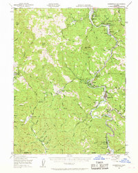
 1969 Briceland1974 Print · USGSHumboldt County’s southern timber and ranching country comes into focus in the late sixties, showcasing the remote headwaters of the Mattole River. Researchers can locate old community hubs like Briceland, trace family roots near Whitethorn Sch, or follow the trails along Gibson Ridge.4 unique versions available
 - 1979 Map of Garberville, 1996 Print
 1979 Garberville1996 Print · USGSThe redwood forests and river canyons of Humboldt and Trinity counties are shown here in the late seventies. Genealogists and historians can trace rail-side life along the Northwestern Pacific RR or locate small settlements like Fort Seward, Alderpoint, and Zenia.
 - 2012 Map of Briceland, 2012 Print
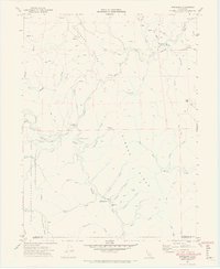
 2012 Briceland2012 Print · USGSCovers Whitethorn, including Briceland, Thorn Junction, and other nearby areas
 - 2015 Map of Briceland, 2015 Print
 2015 Briceland2015 Print · USGSCovers Whitethorn, including Briceland, Thorn Junction, and other nearby areas
 - 2018 Map of Briceland, 2018 Print
 2018 Briceland2018 Print · USGSCovers Whitethorn, including Briceland, Thorn Junction, and other nearby areas
 - 2021 Map of Briceland, 2021 Print
 2021 Briceland2021 Print · USGSCoastal Humboldt County and the Mendocino border are captured here in the early twenty-first century as they were shaped by the Mattole River and its deep gulches. Researchers can locate the historic Briceland Cem and trace the paths of old ranch roads near Whitethorn and Thorn Junction.
End of results
Showing maps 1-10 of 10
Frequently asked questions
- What are the different types of historical maps available for Whitethorn?
- What is the oldest map of Whitethorn?
- Where can I purchase historical maps of Whitethorn for my home or office?
- Where can I download high-res historical maps of Whitethorn?
- Are there historical topographic maps available for Whitethorn?
- Is there historical aerial imagery available for Whitethorn?
- Where are historical maps of Whitethorn sourced from?